
- Hikes in Arizona
- Phoenix Area and Central Arizona
- Wild Horse Trail (Lead Trail)
Wild Horse Trail (Lead Trail)

Location
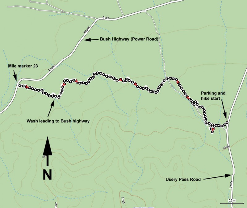
From the Phoenix area, take US-60 East to the Ellsworth Road Exit. Go North on Ellsworth Road. After passing McKellips Road, Ellsworth Road turns into Usery Pass Road. Follow this road 2.3 miles to the signed entrance of the Usery Mountain Recreation Area. Zero your odometer, stay on Usery Pass road, and drive another 2.4 miles to the parking area on your left. The parking area is not signed, so it is important to use the odometer to know where the trailhead start is.
Hike details
Season
- January
- February
- March
- November
- December
- July
- August
Solitude
Difficulty
Permits
Hike along the Wild Horse trail (also known as the Lead trail) near Phoenix, Arizona.
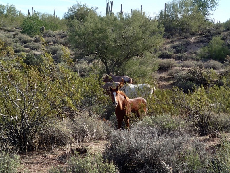
Surprises are a part of hiking. Especially when adventuring on a trail you haven't done before, the results can be unpredictable. Sometimes this surprise is unpleasant, for example when you find out that the trail you picked was exposed to a forest fire and is now choked with the thorny Mexican locus bush. But more uplifting is when the surprise is a pleasant one. Luckily for us, we were pleasantly surprised on this hike by some four legged friends.
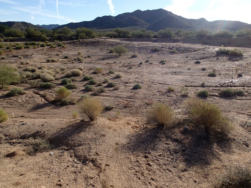
Starting at the pull off on your left (West side of Usery Pass road), start walking West through the obvious break in the barrier. This barrier was put in place to prevent vehicles from driving past this point. There is some route finding at the beginning of this trail, but if you follow these directions, as well as bring the map of this hike, you should be OK. The trail walks along side a barbed wire fence, quickly coming to the edge of a large pit. There are several trails in this area. You want to pick the trail that heads straight across this pit, which was clearly uses as a target shooting range (no longer, as the sign in the parking area states this is now prohibited). After walking across the pit, climb up the other side and continue walking in a Westerly direction until the trail heads North. The trail will resume it's Western orientation, but for now, follow the trail to the North and then to the North West. The trail from this point is well worn and easy to follow.
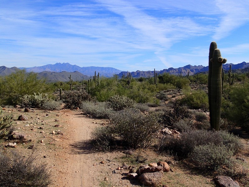
From the East to West direction, you enjoy ever larger views of Red Mountain directly in front of you. Many of the Sonoran cacti are here, including Saguaro, prickly pear, and barrel cactus. Although you're likely to be the only hikers on the trail, the mountain bikers also enjoy this trail. When we hiked this, the mountain bikers were all universally pleasant and courteous. Since we all have to share the trails, I'd advise returning this courtesy in the same manner.
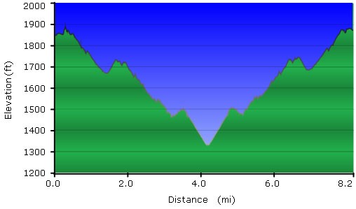
After 3 miles of hiking, you'll reach the walls of an obvious wash. Although the trail continues across the deep wash here, we decided to turn North and walk along the wash to see if this trail was possible to do as a one way shuttle hike. After 0.5 miles of hiking along this wash, it ended at a bridge along the Bush highway, near mile marker 23.
While the beginning and ends of this trail have seen some abuse (as the broken glass and shotgun shells prove - likely why this trail earns its other name "The Lead Trail"), the majority of this trail is in excellent shape and well worth hiking.
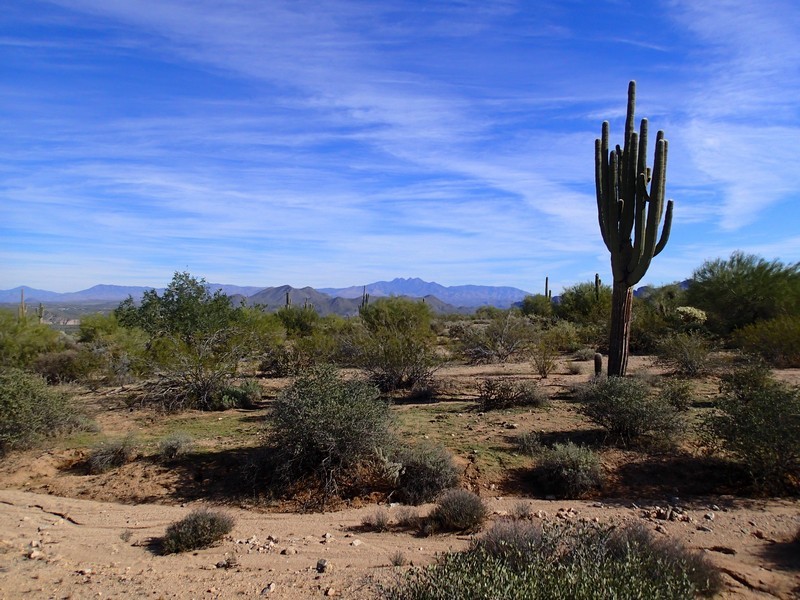
When ready, return the way you came. This time as you hike East, you get to enjoy the views of the four peaks wilderness off in the distance.
There is one more thing to keep any eye out for on this hike. This trail is called the "Wild Horse Trail" because of the possibility you may run across some of the wild horses of the area. We were lucky enough to spot them while hiking and they were kind enough to pose for some pictures. As a result of this wonderful surprise, we have a very fond memory of this hike. I hope you get to share in this good luck when you hike this trail.
