
- Hikes in Arizona
- Northern Arizona
- Taylor Cabin
Taylor Cabin
Location
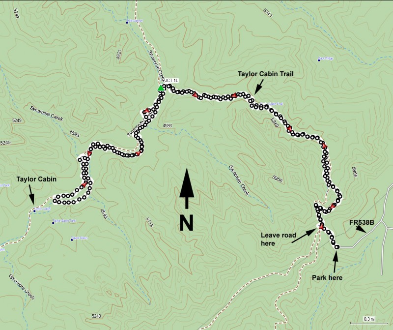
To get to the trailhead: from the Flagstaff area, take HWY-66 West out of town, turning South (left) onto Woody Mt Road (FR231). This road starts off as paved. Soon after it passes over I-40, the road turns into good graded dirt. Follow this road 14 miles to FR583. Make a right turn onto FR583 and take it 5.7 miles to the intersection with FR538E. Continue on FR538 (stay left at the junction) and go another 3.8 miles to the signed junction with FR538B. Turn right onto FR538B to a dirt road that gets progressively worse. Make sure you have high clearance for this road, as it is rocky and clearance can be an issue. Go 2.9 miles on this road. There are several forks on this road, when in doubt, pick the fork that will keep you under the power lines. After 2.9 miles, you'll reach a small clearing on your right. Even though the road continues, park here. The road is closed up ahead and there is no parking nor anyplace to turn around.
Hike details
Season
- March
- April
- September
- October
Solitude
Difficulty
Permits
Hike to remote Taylor canyon in the Sycamore Creek wilderness, Arizona.
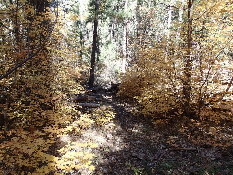
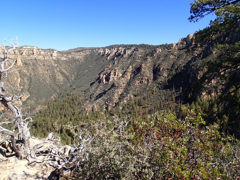
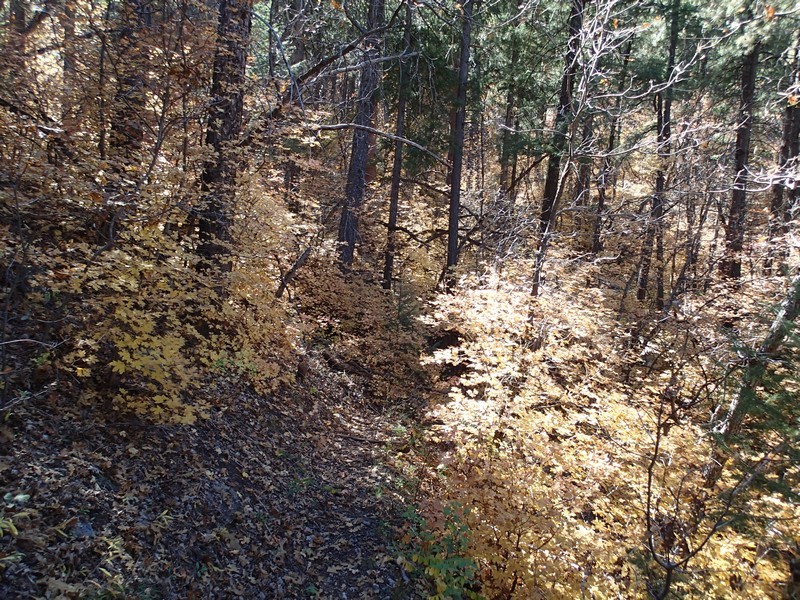
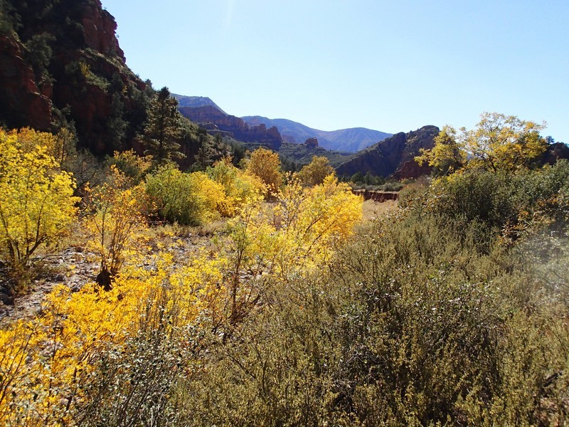
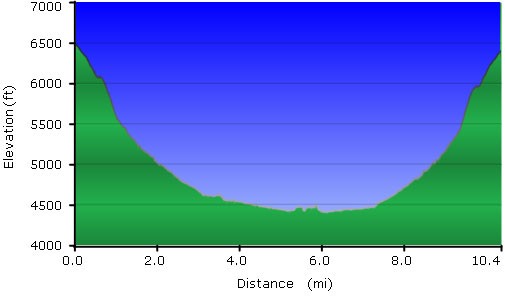
After successfully completing the tough drive in (don't worry if you have to walk or bike the last 0.5 miles, it's probably a good decision) walk along the dirt road a few hundred feet to the gate closing the road. Enjoy the views of the red rock of the Sedona area to your left. Continue past the gate a few hundred yards to a saddle, keeping your eyes on the right side of the road. There is a rusty sign marking the start of the Taylor Cabin trail #35. Leave the dirt road here walking past this sign and use the instructions that follow to get on the correct trail, as there are several false trails here. There is a barbed wire fence on your right. Once you reach the end of the barbed wire fence, look right to see a small wilderness sign. Follow that trail and make a left at the sign. From here, the trail is easier to follow, but there is much route finding ahead. As you walk, enjoy the views here of wide open Sycamore canyon. If you picked the fall to try this hike, you'll enjoy the colors of gold provided by the oak along the trail. You'll eventually reach a ridge where the trail drops off to the right canyon. Continue downhill as the trail switchbacks towards the canyon floor.
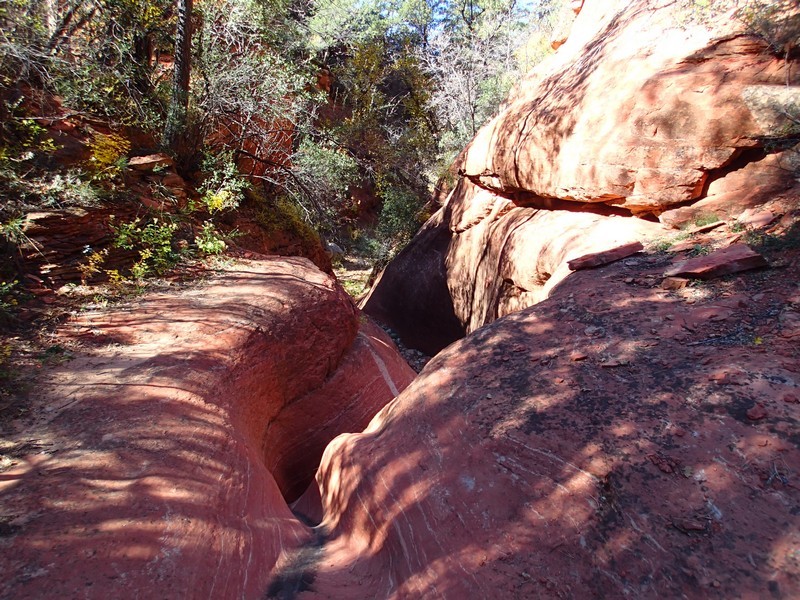
There is a good bit of dead-fall here, hiding the trail. Use those route finding skills. Unfortunately, this trail sees little use, so it is likely that the trail will be more and more difficult to find unless some trail maintenance is done. This is a nice forest area, so while you're route finding to stay on the trail, enjoy the shade and colors. Soon you'll reach a canyon and some of the red sandstone walls indicative of the Sedona area start to appear. It's a pretty canyon to walk through. Try to follow the carins here to get around a few pour offs. After 3.3 miles of hiking, you'll reach the junction with Sycamore canyon (JCT 1L on the map). You'll be greeted with giant sycamores enjoying the water that lies underneath the dry canyon. From here, head left and start the long boulder hopping trek to Taylor cabin. There used to be a trail on the opposite bank along this section, but it has been swallowed up by nature. The trail is now a horrible bushwhack (you can see on the map some of the sections where I tried to follow it) so my advise is to stick with the boulder hopping. After about 1.7 miles of boulder hopping down Sycamore canyon from the junction you'll see Taylor cabin.
Taylor cabin was made and used by the ranchers of the area. It uses native stone and makes a good destination for the turn around point of this hike. Unfortunately for me, I ran out of time on my hike and wasn't able to reach the cabin before I had to turn around. Hopefully you have better luck than I did! When you're finished enjoying the area, return the way you came.
