
- Hikes in Arizona
- Tucson Area and Southern Arizona
- Aspen Loop
Aspen Loop


Location
To get to the Trailhead: From the Tucson area, drive the Tanque Verde road east. Turn left onto the Catalina Highway. Take this paved and scenic road all the way to the top of Mount Lemmon. At the fork between the ski area and the town of Summerhaven, turn left to go into the town of Summerhaven. When in Summerhaven, continue on North Sabino Canyon Parkway. Continue a short drive on this road to it's end and try to find a place to park. This is a popular hike, so parking could be tricky. There is a restroom here.
Hike details
Season
- June
- August
- September
- January
- February
- December
Solitude
Difficulty
Permits
Hike the Aspen Loop trail on Mount Lemmon near Tucson, Arizona.
Mount Lemmon is a real treasure for the folks living in Tucson. For those looking for a short, easy loop hike through this picturesque area, the Aspen loop trail is a good choice.
This is a popular area, so hopefully you got an early start and were able to find a parking space near the trailhead. This is a loop trail, so it can be hiked in either direction. We arbitrarily chose the counter-clockwise direction, so the write up reflects this.
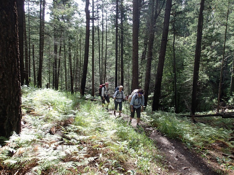
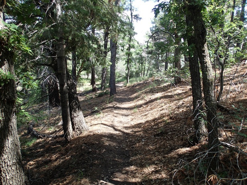
From the Arizona trail sign just to the right of the restrooms, start hiking along the easy to follow Marshall Gulch trail. This trail starts above a lovely creek, shaded by the forest with ferns underneath. It's a great stretch of trail so be sure to enjoy it. The creek stays with you for a while and you'll have to cross it a few times, but it is easy to keep your feet dry.
After only about 0.3 miles of hiking, you'll reach an unsigned trail junction (JCT 1ST on the map). To your left and back is a trail that parallels the creek and heads back to the parking area. Instead, continue straight here (heading northwest). Continue to enjoy the shade of the maple and pine trees in this section.
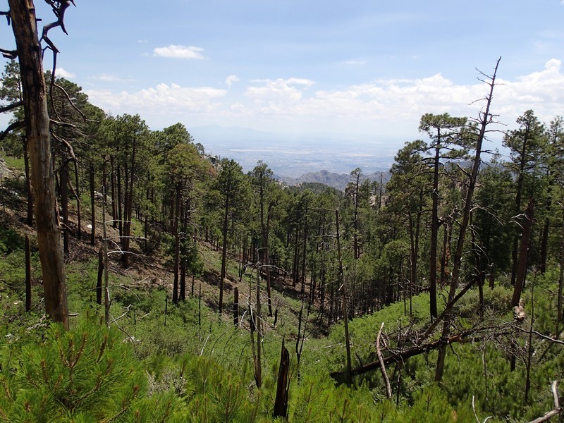
Soon you will leave the creek and forest behind and begin hiking through a section of the forest recovering from a 2003 fire that wiped out the town. You'll notice the forest is slowly recovering. Fortunately, for the hiker that means plenty of ferns and flowers, but at the cost of leaving the shady trees behind.
After about 1.2 miles of hiking from the start, you'll reach a junction (JCT 2L on the map) with several of the area trails, including the Aspen trail, the Mint Spring trail, and the Wilderness of rock trail. This junction is signed, but can be a bit confusing. Turn left here onto the signed and easy to follow Aspen trail.
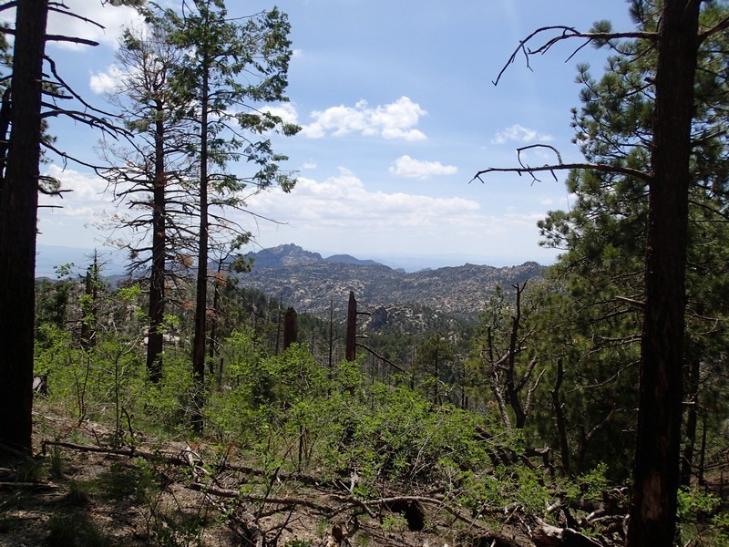
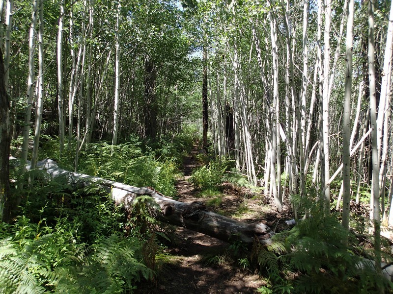
The trail starts to climb again here as you stay in the formerly burned area. There are some spectacular views of the Tucson area in this section. Eventually you'll leave the burned trees behind and enjoy a descent into the stream area through wild grape vines, ferns, and Aspen.
From the previous trail junction, it's about 2.4 miles back to the Marshall Gulch trailhead.
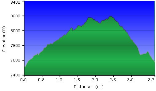
Just a heads up, there is a detailed map at the trailhead, but the lengths of the trail don't match up with my GPS tracks, so I'm going to go out on a limb here and say that the distances on the map are wrong. The map would have you believe that it's a 4.4 mile loop when it's much closer to a 3.7 mile loop.
Enjoy this great summer hike!
