
- Hikes in Arizona
- Mogollon Rim
- Willow Springs Lake Bike Trail #535
Willow Springs Lake Bike Trail #535


Location
To get to the trailhead: from the Phoenix area, take HWY-87 North toward Payson. Once in Payson, take HWY-260 East towards Heber. Between mile markers 284 and 285 you'll see the small parking area and signed trailhead on your left (just after you pass the turnoff to the road to Young on your right).
Hike details
Season
- May
- June
- July
- August
- September
- January
- February
- December
Solitude
Difficulty
Permits
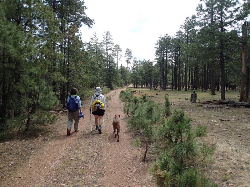
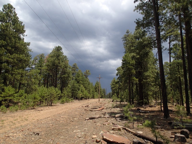
Hiking along the Willow Springs Lake bike trail on the Mogollon Rim in Arizona.
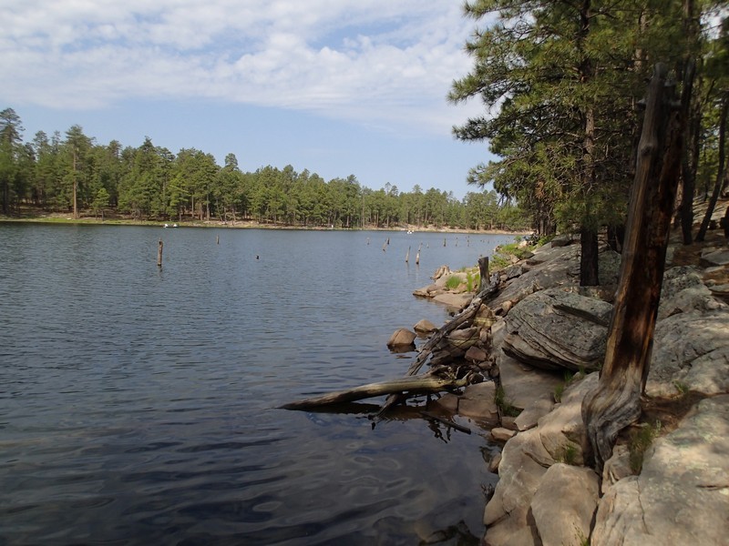
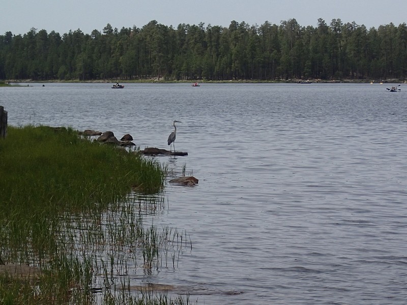
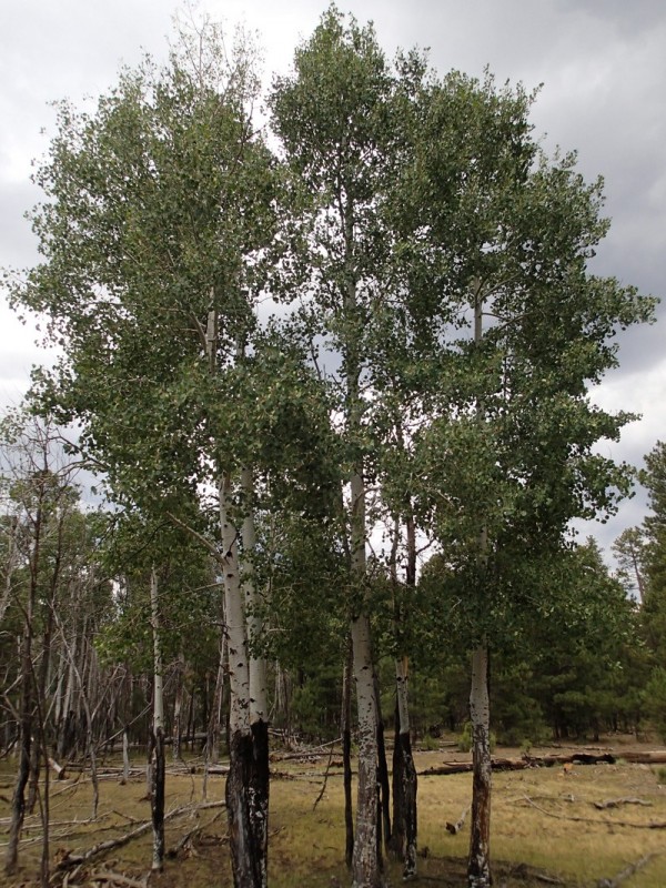
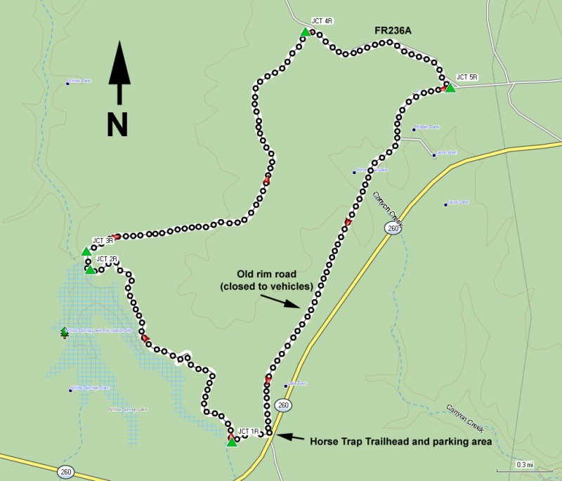
The Willow Springs Lake is one several very popular fishing lakes along the Mogollon rim. There are several trails in this area, including one that loops completely around the lake. This trail spends some of the time hiking on closed roads and some of the time hiking along the eastern edge of the lake. The trail was made for mountain bikes, but it is a nice trail for hikers too. There are several access points to this trail. We used the easily accessed Horse Trap Trailhead and the write up reflects this choice.
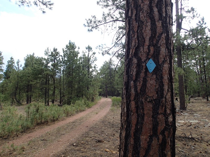
From the Horse trap trailhead, Start walking along the easily followed trail about 100 yards to a signed trail junction. You can go either direction for this loop and we chose the clockwise direction. The loop trail is marked by blue diamonds in the trees to help you stay on trail, so if you are concerned about which way to go, look for them.
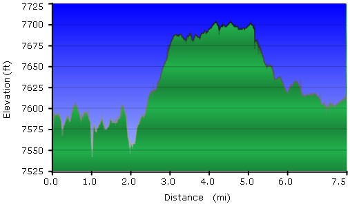
It's a short 0.2 miles of hiking along the old rim road (closed to motor vehicles) and beneath power lines to the first views of Willow Springs lake. Turn right here (JCT 1R on the map) and follow the trail as it heads generally North along the Eastern edge of the lake. This section of the trail is very pleasant and generally shaded as you walk through a pine forest. You'll get some nice views of the lake in a bit, but first you need to use those route finding skills. There are a few closed roads in this area, so keep an eye out for cairns and the blue diamonds in the trees to stay on the correct trail. After 1.7 miles of total hiking, you'll reach a nice view of the lake and a T trail junction (JCT 2R on the map). Turn right here and then after another 0.1 miles of hiking you'll see the dam on your left and two dirt roads, one straight ahead and one to the right (JCT 3R on map). Turn onto the right most dirt road and begin hiking.
From this point, you'll be walking along a closed road, so it is very easy to follow. You'll hike along this section of the trail for about 2 miles until you reach the next trail junction (JCT 4R on map). Turn right onto FR236A, which is now closed to motor vehicles. This section is also an old road and easy to follow. After about a mile on this section of the trail, you'll reach the final trail junction (JCT 5R on the map) and you'll turn right onto the old rim road, also closed to vehicles. Follow this easy to follow closed road 2.2 miles back to the Horse trap trailhead.
