
- Hikes in Arizona
- Sedona
- Wilson Mountain South
Wilson Mountain South


Location
Hike details
Season
- April
- May
- October
- November
- January
- February
- December
Solitude
Difficulty
Permits
Hike up Wilson Mountain near Sedona and Oak Creek Canyon, Arizona
Sedona has recently instituted a "Red Rock Pass", which is a fancy way of saying you need to pay to play. As of May, 2013, the fee is $5 per day per vehicle. There are plenty of places in and around Sedona to pay this fee and get the receipt, which you need to put on your vehicle rear view mirror to keep from being towed.
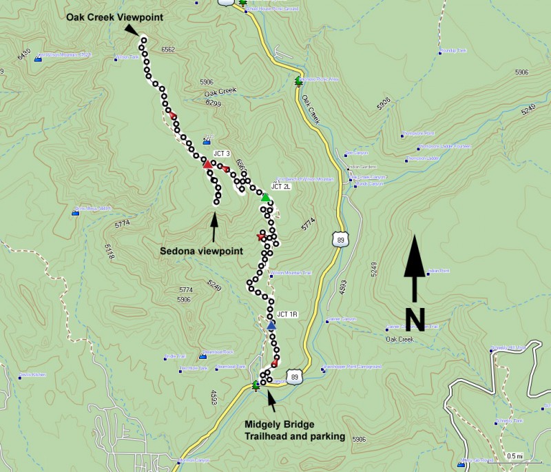
There's actually two routes to get to the top of Wilson Mountain. This hike details the Southern most route, which is a better choice in the colder months. There is more sun on this trail than the alternate.
The signed trailhead starts at the small Midgely Bridge parking area. This parking area is nearly always crowded, however, many people who stop there just snap a few pictures of the bridge and then leave. So if you wait a few moments a parking spot usually opens up.
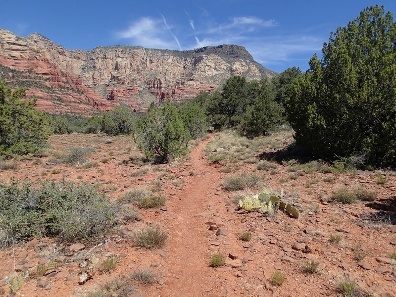
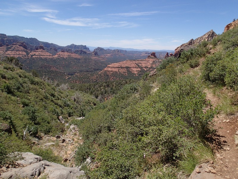
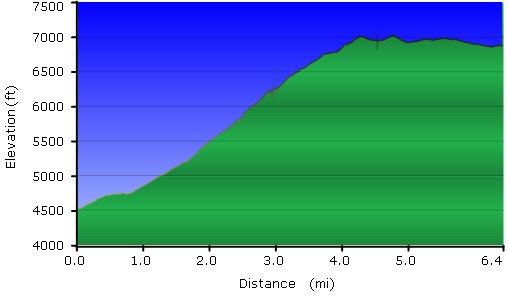
This well worn and easy to follow trail starts on the red rock of Sedona and climbs steadily to the first bench of Wilson Mountain. After 0.6 miles of hiking, stay right at the signed trail junction with the Wilson canyon trail (JCT 1R on the map) to stay on the Wilson Mountain trail. There are good views of Steamboat Rock and the Sedona area during the next 2.4 miles of climbing along this section of the trail.
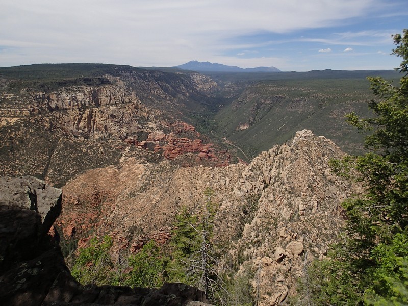
Once you've reached the bench, you'll see a sign pointing out the Wilson mountain trail and the Northern Wilson mountain trail. Take a left at the trail junction (JCT 2L on the map) (the right fork follows the Norther route and ends up at the Encinoso Picnic area) and continue another 0.7 miles up more switchbacks. At the top, there's another signed fork (JCT 3 on the map). The left fork goes 0.4 miles to a great view of the Sedona area. The right fork goes 1.5 miles to a great view of the Oak Creek Canyon. You win either way. I recommend doing them both, after all, you've already paid the price in elevation, you might as well enjoy the rewards of your hard work.
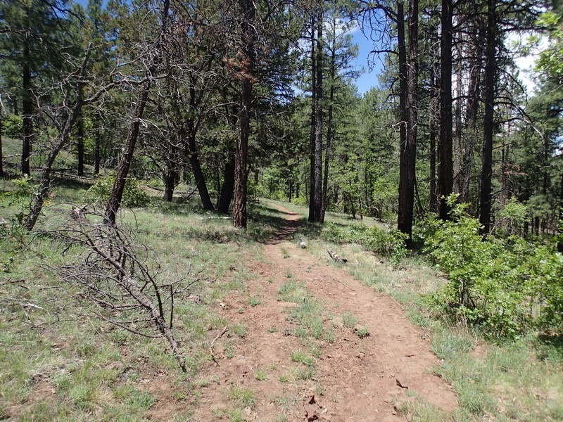
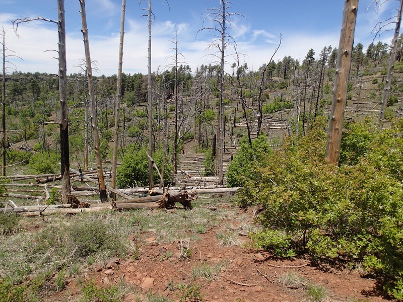
The top of Wilson Mountain used to be heavily forested and this section of the trail would be an explosion of color in the fall. Unfortunately, the Brins fire of 2006 destroyed much of the beauty of this area. As a result, the 0.7 mile section of the trail from the first bench to the second bench is overgrown and brushy with some pricker bushes. Long pants are recommended on this hike for this reason. Additionally, on the top of Wilson Mountain, there are downed trees blocking sections of the trail, especially on the beginning of the spur trail to the Sedona viewpoint. It is easy to lose the trail in this section, so use those route finding skills.
You gain a good bit of elevation on this hike. If you see black clouds roll in or hear thunder or see lightning, head back down.
This is a long hike, so bring plenty of food and water.
