
- Hikes in Arizona
- Superstition and Mazatzal Wilderness
- Circlestone (From Reavis Ranch)
Circlestone (From Reavis Ranch)
Location
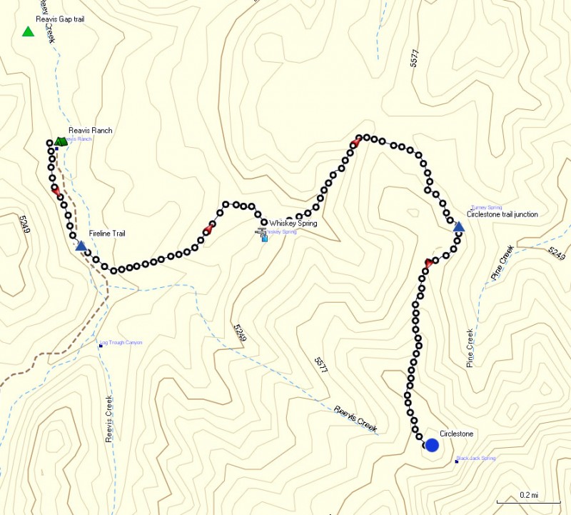
This hike is accessed from either the Rogers trough trailhead or the Reavis trailhead.
Hike details
Season
- March
- April
- October
- November
Solitude
Difficulty
Permits
Hike to Circlestone from Reavis Ranch in the Superstition Wilderness, Arizona.
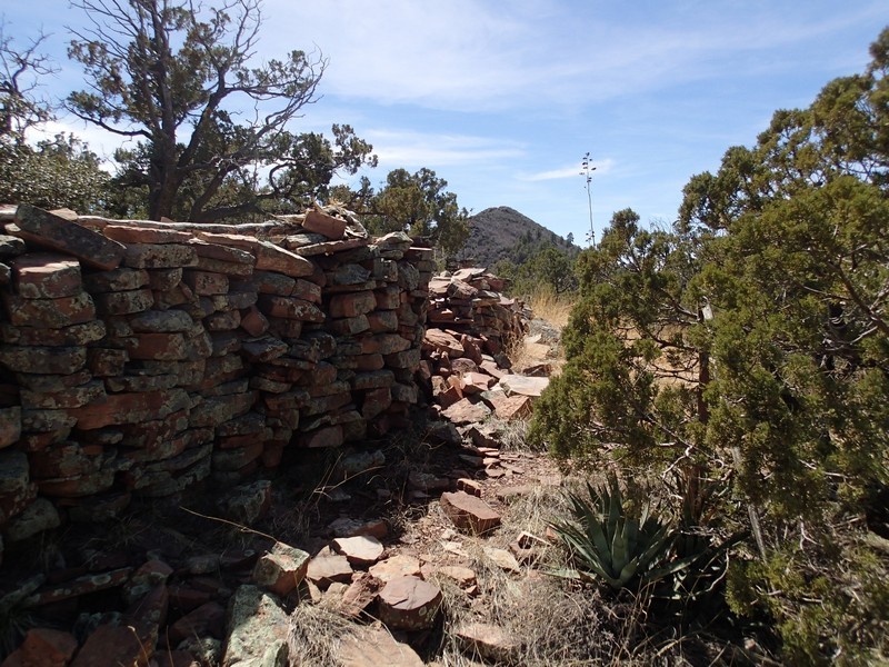
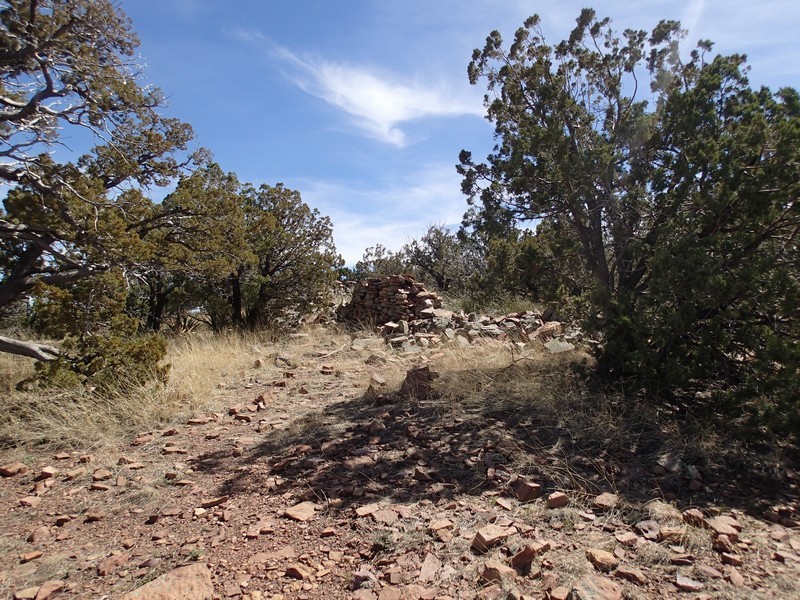
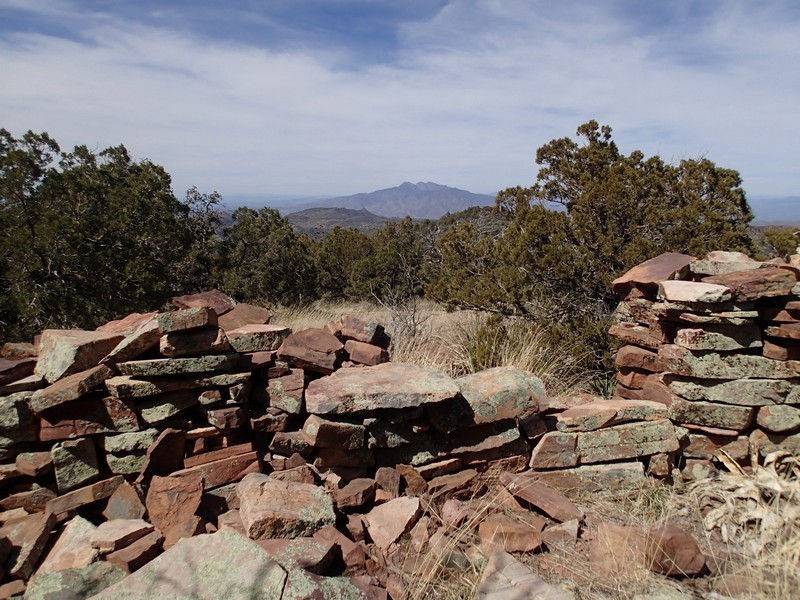
One of the real mysteries of the Superstition wilderness is Circlestone. This native American ruin is a bit of a mystery, as it appears to be an ancient Celestial calendar, but no one is sure who was responsible for it. The walls themselves have been ravaged by time, but many of them are still standing and the views alone are worth the trip. This write up starts from Reavis Ranch, assuming you've arrived here by hiking from the Rogers trough trailhead or Reavis trailhead and set up camp nearby.
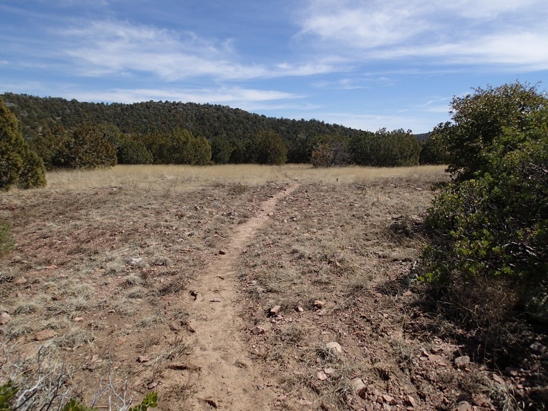
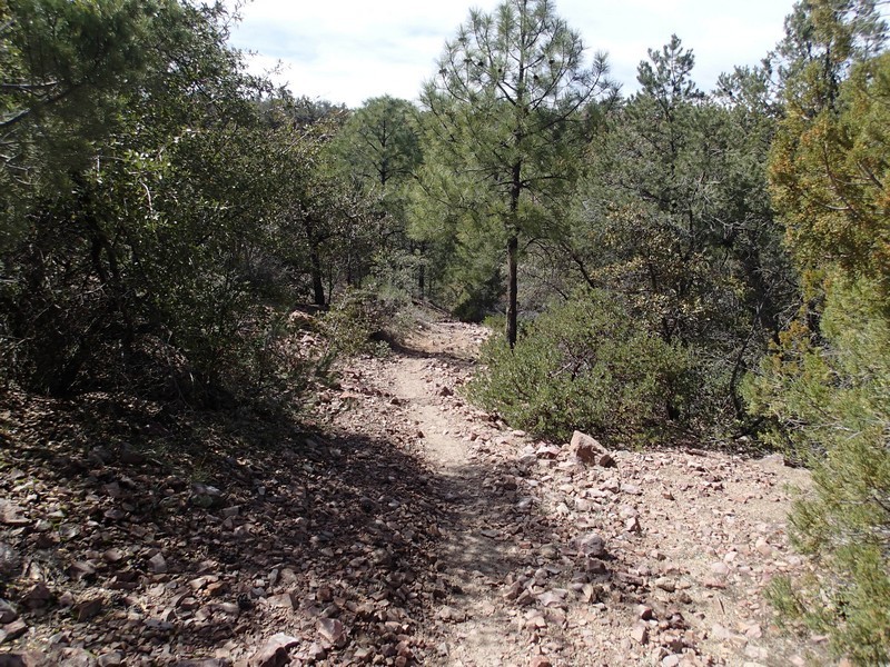
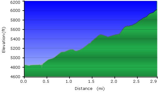
From Reavis Ranch, head South along the Reavis trail. After a short 0.3 miles, the trail crosses the creek. There are several trails in the area, so you'll need to use those route finding skills. Shortly after crossing the creek, you'll see the signed trail junction for the Fireline trail. This trail was created from a bulldozer fighting a wildfire in the Superstitions back in 1966. This East heading trail becomes more rocky as it climbs up towards Whiskey spring (which you reach after about 0.8 miles of hiking). The trail is also a bit difficult to follow in spots here, so use those route finding skills and watch for helpful cairns. You'll continue to climb until after 1.4 miles of hiking you reach a saddle. The trail starts to bend South from here. After 1.7 miles of total hiking (about 0.3 miles from the saddle) you'll see a spur trail that heads off to the right (marked on the map). When we did this hike, there was a good cairn here marking the trail. Follow this trail as it quickly heads up the nearby mountain through Gambel Oak trees. The trail is relatively easy to follow, but rocky and a little bit overgrown. From the trail junction, it's another 0.8 miles of hiking to the easily spotted Circlestone ruin. Plan on spending some time here to explore all the ruined walls and enjoy all the views from the area. The highest point in the Superstition wilderness is seen to the South West (Mound Mountain at 6266 ft). You'll also have some good views of the Four peaks and the whole of the Eastern Superstition Wilderness range. While exploring the ruins, we also noted some pottery shards. Please leave everything in this area exactly how you found it.
When finished, return the way you came.
