
- Hikes in Arizona
- Superstition and Mazatzal Wilderness
- Reavis Ranch (From Reavis trailhead)
Reavis Ranch (From Reavis trailhead)


Location
From the Phoenix area, take HWY 88 North East out of Apache Junction towards Apache Lake. Eventually, HWY 88 turns into dirt. This road is OK for cars if you drive slowly, but it is slow going in spots, with some definite elevation. After the road turns to dirt, drive an additional 7.2 miles to the dirt road turn to signed Reavis Trail (right turn). There are a couple of dirt roads leading right in this area, so make sure you look for the Reavis Trail sign. From this point, it's 3 miles on a good dirt road to the trailhead.
Hike details
- Water
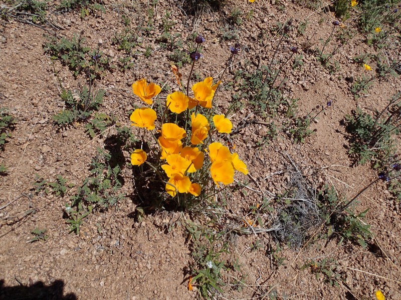
- Wild Flowers
Season
- March
- April
- October
- November
Solitude
Difficulty
Permits
Hike to Reavis Ranch along the Reavis trail in the Superstition Wilderness, Arizona.
This is a long backpack, but well worth the effort. Camping along Reavis creek is a real treat, and there are some wonderful day hiking opportunities. There are several ways to get to Reavis Ranch. This hike describes the route from Reavis trailhead. For the route from Rogers trough, click here.
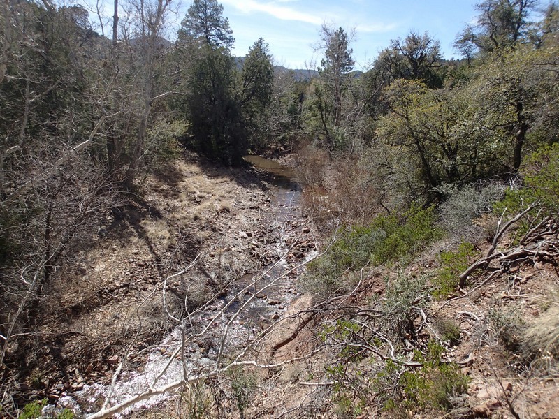
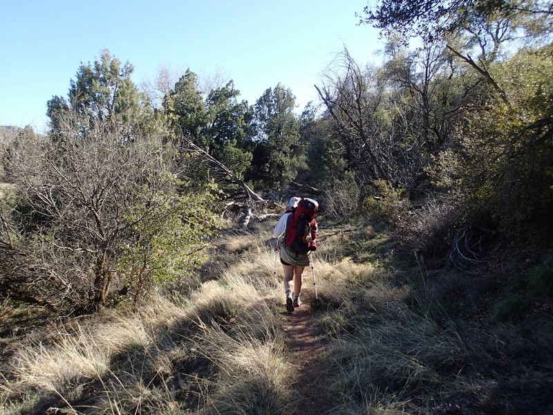
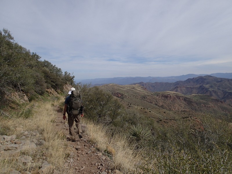
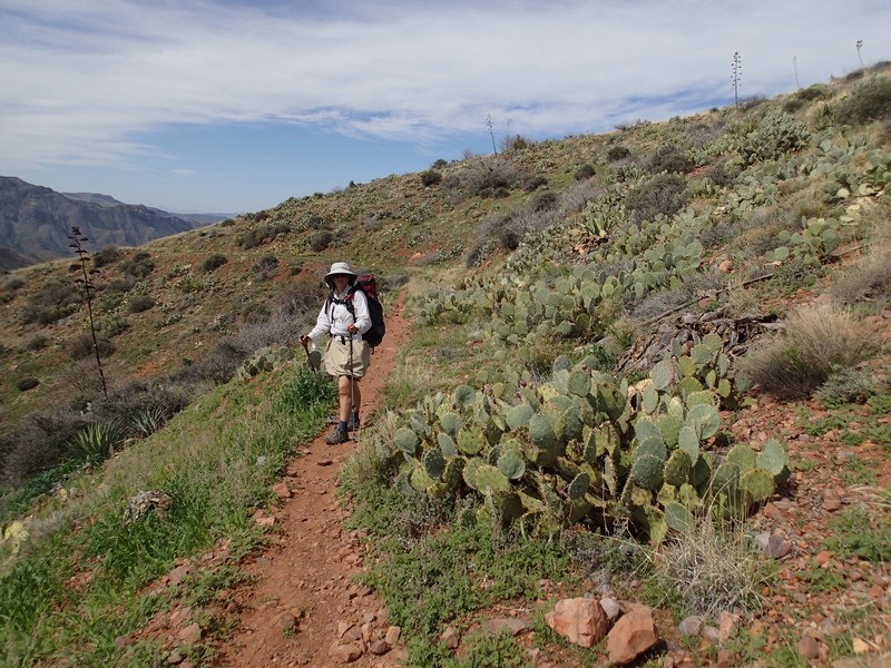
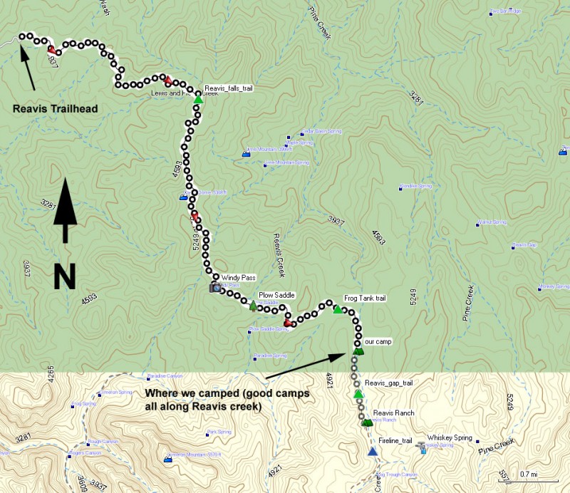
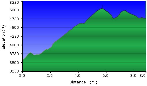
From the Reavis Trailhead, follow along the old dirt road that once lead to the Reavis ranch. The views here of Apache lake and the Superstitions are worth the effort themselves. After about 3.5 miles of hiking, you'll see a spur trail that heads to your left up a hill. This was signed as Reavis Waterfall when we were last here. Stay right and continue on the main trail. The trail continues it's gentle climb up to an unnamed saddle. The trail then flattens out for a bit, then resumes climbing until you reach Windy Pass after about 5.2 miles of total hiking. To the left, the whole of the Reavis creek drainage opens up and the views of the Eastern Superstition wilderness abound. After 5.7 miles of hiking you'll reach a signed trail junction for Plow Saddle. Continue on the main trail which now gently drops in elevation. After 7.5 miles of hiking, you'll reach the signed trail junction with Frog tanks trail. Continue on the Reavis trail, which is a bit overgrown (but not bad at all). After another 0.2 miles of hiking, the trail heads South as it parallels Reavis creek. This seasonal creek provides critical water for the pine trees and juniper trees in the area. There are an abundance of excellent and remote campsites along Reavis creek. Please consider using an already created campsite before making another. We camped near the creek at 8.2 miles of hiking (actually about 0.7 miles from the site of Reavis ranch). Since you are backpacking as well, keep an eye on the creek to find a good campsite. You will likely need to leave the trail to explore a bit, as the best sites are not seen from the trail. After about 9 miles of hiking, you'll see the ruins of Reavis ranch.
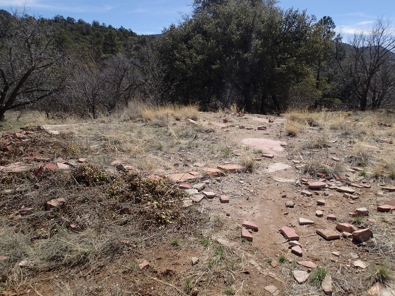
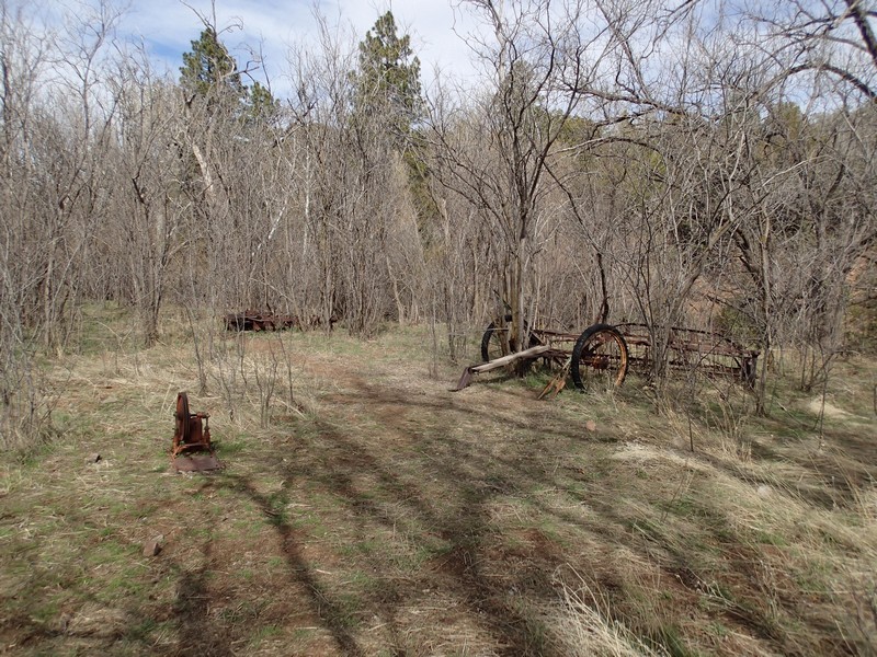
Unfortunately, the old ranch house was burned down by careless campers. However, there are still a good number of reminders of this working ranch scattered about the area. It's an interesting place to explore, just please leave everything where you found it.
In the unfortunate event that Reavis creek is dry when you arrive, you can find water at Whiskey Spring, just up the Fireline trail (on the map). When we did this hike in mid March, the creek was flowing strongly and we were lulled to sleep by the sounds of creek song at night.
If you're looking for a good day hike in this area, I'd recommend heading to Circlestone.
