
- Hikes outside of Arizona
- United States - National Parks
- White Rock Loop
White Rock Loop


Location
From the town of Las Vegas, take HWY 215 to the West Charleston Blvd exit. Head West on this road, which turns into HWY159. Turn right on the well signed Red Rocks Drive in the Red Rocks National Conservation Area. Pay to play (as of March 2011, the fee was $7 per car). Drive along this one way road until you see the signed turn off for the Willow Springs Picnic area. Turn right and drive to the end of the paved road. Park here. There are restrooms here but no water, so bring what you need.
Hike details
Season
- February
- March
- October
- November
- June
- July
Solitude
Difficulty
Permits
Hike the White Rock loop near Las Vegas, Nevada.
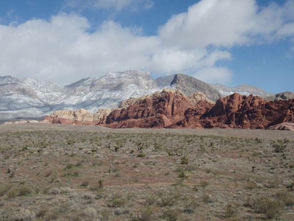
Many people head to Las Vegas for the casinos, the hotels, the entertainment, the shows, or even the shopping. However, not many people are aware that the Red Rocks National Conservation area is a short 25 minute drive from downtown Las Vegas, featuring world class rock climbing and hiking. If you are in the area and are itching for some outdoor fun, Red Rocks is well worth the drive.
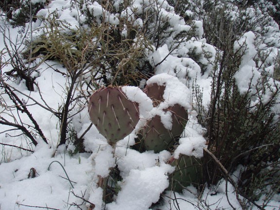
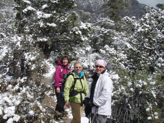
We were actually in this area for rock climbing. Unfortunately for us, the weather wouldn't cooperate, so we decided to take an inclement weather hike instead. We decided on the White Rock Loop trail. Hiking in a light snow made for an interesting and enjoyable hike. We were well prepared for the weather, so you should be as well, regardless if it is hot or cold. Although there are several places you can start this loop hike, we chose the Willow Springs picnic area. We took this hike in a clockwise direction, so the write-up will reflect this.
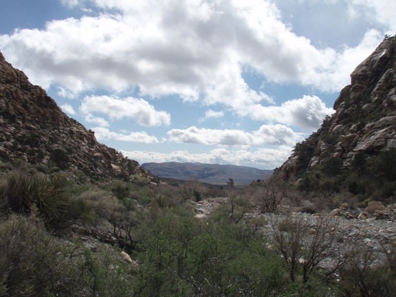
From the Willow Springs conservation area, follow the wide dirt road into the mountains of Red Rocks. One nice thing about this loop is that the trail is easy to follow it's entire length and all junctions are well signed. The first trail junction will leave the dirt road as the trail narrows and you follow the sign towards White Rock Springs. This section of the hike leads you through a gentle climb up a narrow valley framed on both sides by the Red Rocks. Hiking through here it's easy to forget that the bustling metropolis of Las Vegas is a short 25 minute drive away.
Continue on this trail until you reach the White Rock Springs parking area. Continue to follow the trail, this time following the arrows towards Willow Springs. This section of the trail is a gentle downhill and is as easy to follow as the previous section. Continue to follow the trail until you reach the Willow Springs picnic area and your car. Before you get there, you'll pass some signed petroglyphs. Even though they are signed, I sure couldn't see them. I hope you have better luck and that you enjoy this hike as much as we did.
