
- Hikes outside of Arizona
- Asia
- Mount Fuji
Mount Fuji


Location
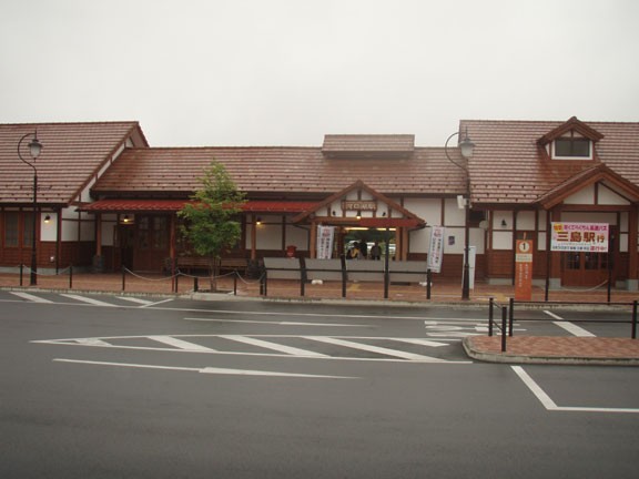
From Tokyo, there are two main ways to get to Kawaguchiko. You can either take a bus from Shinjuku or take the Chuo Line from Shinjuku, then take a local train from Otsuki to Kawaguchiko station. This is a good place for your hotel, as there are many in the area and the Kagaguchiko lake is very pretty. To get to the trailhead, take one of the shuttle busses from the Kawaguchiko station to the Kawaguchiko 5th station.
Hike details
Season
- January
- February
- December
Solitude
Difficulty
Permits
Hike up Mount Fuji in Japan
For information on how to get to the start of the hiking trail, Japan guide has pretty good instructions.
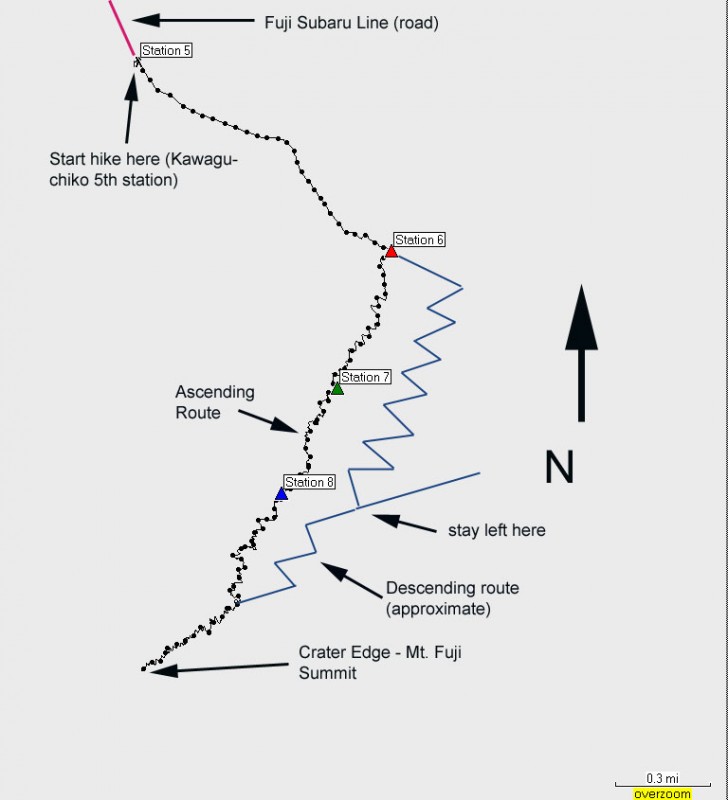
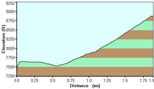
Mount Fuji is a dormant volcano that is a cultural icon in Japan. We have all seen the perfect volcanic profile picture with the snow capped peak that represents the quintessential pose of Mount Fuji. Thousands of people gather in July and August to try to ascend this 3776 meter (12,400 ft) peak and experience the magic of this mountain. There are four routes to the highest point in Japan, but this write up details the most popular route which is the Yoshidaguchi climbing trail that starts at Kawaguchiko 5th station (north side of the mountain). Hiking overnight and reaching the summit to watch the sunrise is also a Japanese tradition, however the weather was really poor when we did this hike, so we chose to hike during the daytime.
This is not a trivial hike. Although the toughest part may be navigating in a strange country with a unique culture, a 5500 ft elevation gain is also pretty strenuous! Route finding is not too much of a problem, but the weather can be very severe. When we took our hike in mid August, we experienced 60 mph wind gusts, heavy rain, and 7 °C (45 °F) temperatures near the top. Being prepared is critical, otherwise this could be a very dangerous situation. Rain gear is a must (jacket and pants). Wear polypro layers underneath (no cotton!) and wear sturdy hiking boots (the volcanic rock is quite sharp). Hiking sticks are recommended for the descent and gloves are helpful both for the scrambling and to warm your hands near the top.
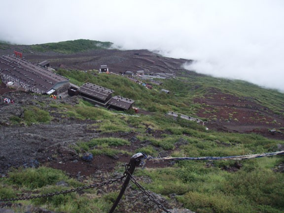
After the bus drops you off at the Kawaguchiko 5th station, follow the throngs of humanity past the shops and restaurants to the trail. There are 10 stations on this trail, starting at 1 on the bottom and up to 10 at the top. The trail from the 5th station climbs for a bit, then descends for a while. This may confuse you into thinking you are on the wrong trail, but rest assured the trail will start to ascend again and won't stop until you reach the summit. The trail is forested here, but soon leaves the tree line and starts climbing up volcanic rock. The 6th station is the start of the many mountain huts on this trail. You can buy food and water at these locations, but it is a bit pricy. From the 6th station, there are two trails. To the left is the 'descent' trail. We'll come back to that later. For the ascent, stay to the right following the trail that leads you through the mountain huts. Many of them have seats to stop and rest.
There are restrooms at most of the mountain huts (100 Yen donation is requested) but no trash containers. Please take all your trash with you.
This pattern of switch backing up from mountain hut to mountain hut holds until the 9th station. Here you will leave the huts behind and finish the hike to the summit without any further safety net. The trail is never difficult to follow.
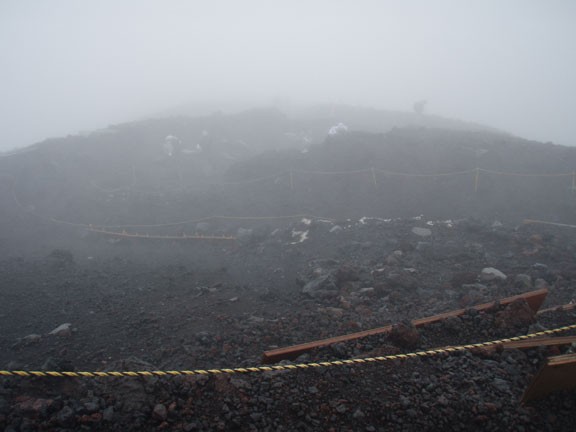
Unfortunately, I don't have any superlatives to describe the views from the summit because when we did this hike we reached the top in a driving rain with high winds and fog. We didn't see anything at all except for the trail. I can only imagine the spectacular views on a clear day.
Due to the lousy weather, we descended quickly, taking the 'descent' trail around station 9. The descent trail goes to the right and soon reaches a fork. If you go to the right at this fork, you could end up at a different hiking trailhead so make sure you go left (towards Yoshidaguchi or Kawaguchiko). The sign is in both Japanese and English. The descent trail is on soft volcanic sand and is easy on the knees. Using a hiking stick for balance is very useful here.
After lots of hard work, you will reach the the 6th station again (pay attention to the signs so you don't hike past the left fork) and walk the remaining distance to the 5th station trailhead. Congratulate yourself on your hard work by getting some food at the 5th station while waiting for your bus to return you to your hotel.
