
- Hikes outside of Arizona
- United States - National Parks
- Virgin River Narrows (Zion National Park)
Virgin River Narrows (Zion National Park)

Location
To the upper trailhead (Chamberlain's Ranch): take HWY-9 East from the East entrance of the park. Drive 2.5 miles to a road going North, signed as North Fork. Turn left onto this road and take this road 18 miles. This road is well signed, but turns to a dirt road about 1/3 of the way. This road may be difficult when wet. After driving 18 miles, you will reach the Virgin River. Take the bridge across the river and turn left. After 0.25 miles, you will reach a gate, go through the gate (close the gate behind you) and drive another 0.5 miles to the trailhead. Keep in mind that Chamberlain's Ranch is private property, so treat it well so we can continue to have access to this incredible hike.
To the lower trailhead: Park at the visitor center and take the free shuttle to the Temple of Sinawava stop.
Hike details
Season
- August
- September
- January
- February
- December
Solitude
Difficulty
For a less strenuous hike with children, start from the lower trailhead and hike into the narrows area about 2 miles. No permit is required if hiking from the bottom and not going past Big Spring.
Permits
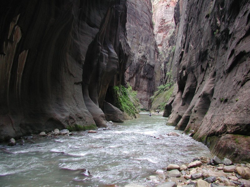
Hike, wade, and swim through the Virgin River Narrows in Zion National park
This hike takes some planning, as the National Park service requires a permit to hike the complete length of the Virgin River Narrows from Chamberlain Ranch to the Temple of Sinawava trailhead. Go to the NPS website at www.nps.gov/zion for more information. Permits can be reserved on their website and some of the spaces are reserved for walk up hikers. Permits must be received the day before your hike and cost $5 per person.
Pay particular attention to the weather, as there is flash flood potential in this hike. The backcountry office in Zion where you get your permit has flash flood warning ratings and weather reports.
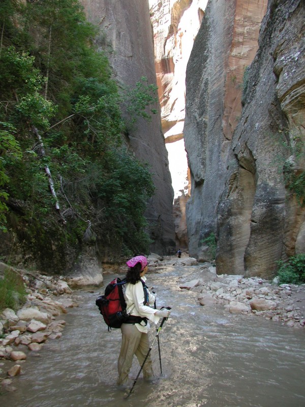
We arranged for a shuttle from one of the local private companies offering this service (recommended). We used Zion Adventure Company (www.zionadventures.com) although there are a number of outfitters offering this service. Zion Adventures rents equipment for this hike, and we rented canyoneering shoes (consisting of neoprene socks and self draining rubber soled shoes - also recommended) for the day. Although we were worried about wearing shoes that had not been broken in, these shoes worked very well and neither of us had blisters. They also keep your feet warmer in the cold Virgin river. Bring a hiking stick (I used an old ski pole), as the river can be pretty stiff. I would not want to try hiking this canyon without one. Make sure the items in your backpack can get wet, as there is at least one mandatory swim (and falling into the water at least once is likely).
Try to arrange for a shuttle that gets you to the Chamberlain Ranch trailhead as early as possible. Due to the length of this hike, you may be fighting daylight depending on your hiking speed. Be sure to bring a headlamp along in case darkness falls before you can make it out of the canyon.
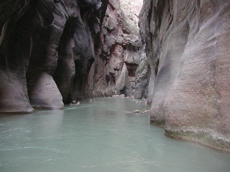
From the Chamberlain Ranch trailhead, cross the river and walk along the dirt road for about 3 miles. You will pass by a ruined cabin (Bulloch's Cabin) which precedes the end of this dirt road. From this point you will be walking in the canyon and making your way through it by any means necessary. There are some trails in this area made by hikers, but there is no official trail. Progress through the canyon can sometimes only occur by walking through the river. There is no escaping that you will get wet! Of course, that is one of the things that makes this hike so much fun.
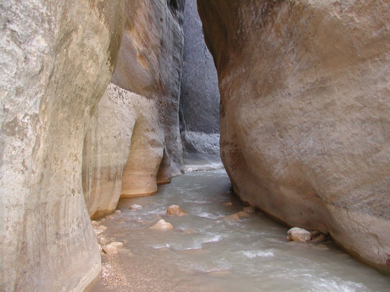
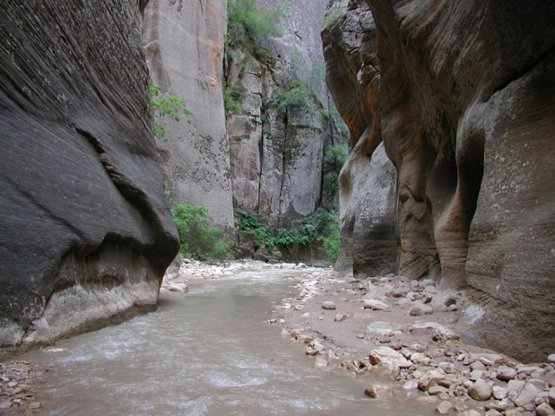
About 5.7 miles of hiking will get you to the start of the narrows. Here the river cuts through the sandstone cliffs, some as deep as 2000 ft. The scenery is world class and as we hiked through this area, we were quite thankful we could hike so many miles through this canyon, as neither of us wanted it to end.
Some key landmarks:
Mile Landmark
1.5 miles Bulloch cabin
5.0 miles Simon Gulch (enters from right)
6.5 miles 12 foot waterfall (bypassed on left)
8.0 miles Deep creek (enters from right)
9.5 miles Kolob creek (enters from right)
10.75 miles Goose creek (enters from right)
11.5 miles Big Spring
13.5 miles Orderville Gulch (enters from left)
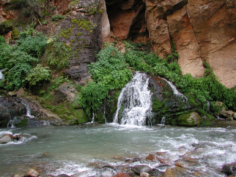
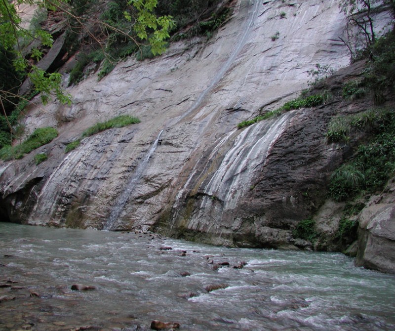
14.75 miles Mystery falls (on left)
16.0 miles Temple of Sinagava shuttle bus stop and trailhead
The deepest narrows are in the Orderville Gulch area, which is well worth exploring a bit, as it is even more narrow than the Virgin river (and quite scenic). After the confluence with Orderville Gulch, you'll likely see more and more tourists hiking from the bottom up. After 15 miles of hiking, you'll reach a paved trail and it's a quick 1 mile to the end of the trail and the shuttle bus stop.
