
- Hikes in Arizona
- Mogollon Rim
- Donahue Trail
Donahue Trail


Location
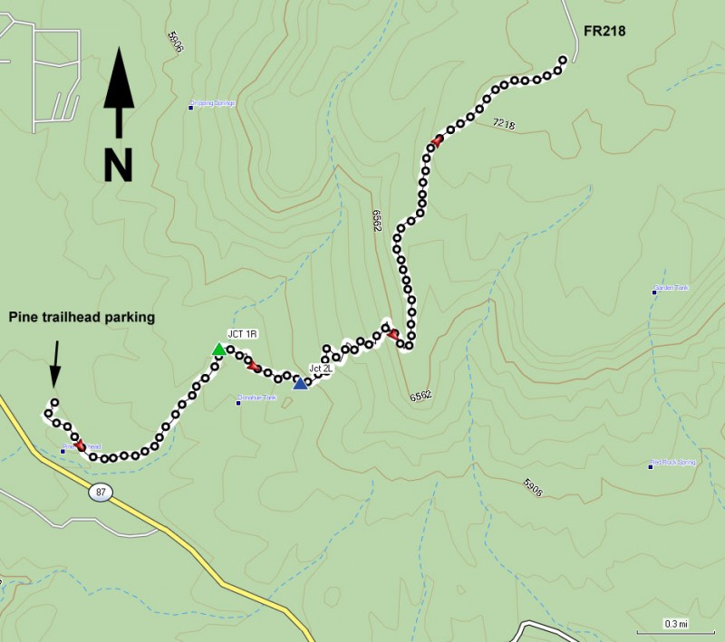
To get to the trailhead: from the Phoenix area, take HWY-87 North toward Payson. Stay on HWY -87 as you head towards the town of Pine.
Just after mile marker 267, turn right and follow the sign for the Pine Trailhead.
Hike details
Season
- May
- June
- August
- September
- January
- February
- December
Solitude
Difficulty
Permits
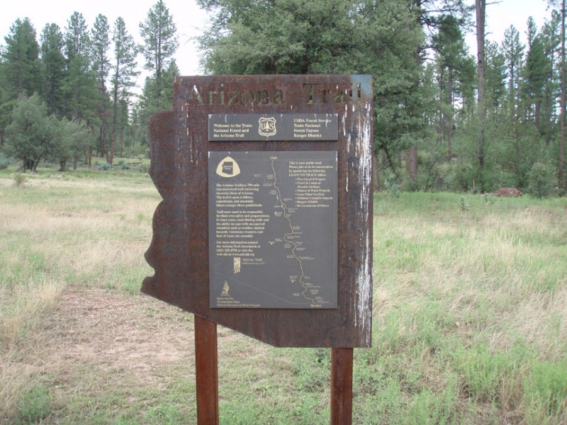
Hike the Donahue trail up the Mogollon rim in Arizona.
The Donahue Trail is a good and somewhat less traveled route to get to the top of the Mogollon rim. The Pine Canyon hike also leaves from this trailhead and is a more popular hike so this trailhead parking may be well populated. Don't worry too much, it's likely they aren't hiking on the Donahue trail.
From the parking area there are two signed trailheads leaving the area. The one more North is the trail up Pine Canyon. The signed trail to the East (with the big Arizona Trail sign) is the trail we want called the Highline trail.
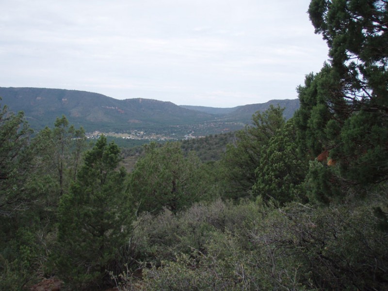
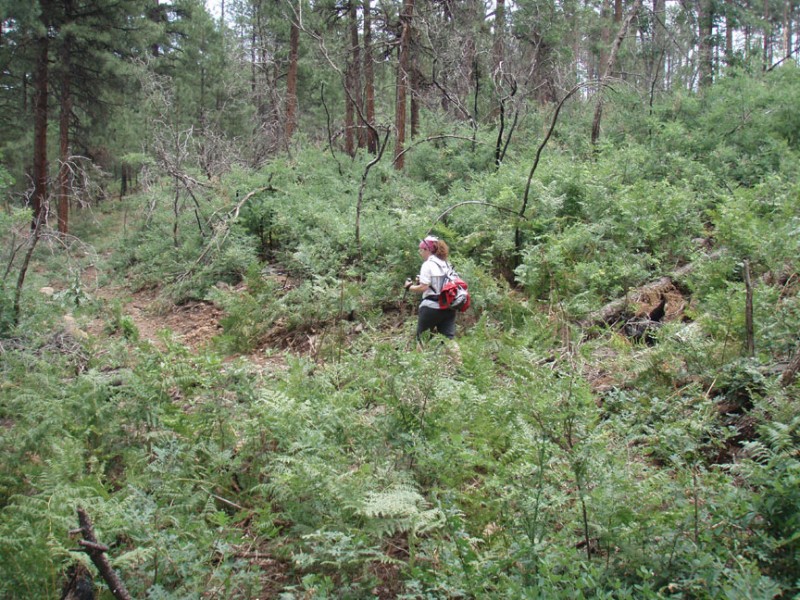
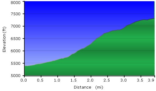
The Highline trail in this section is easy to follow and heads generally East through a low density pine forest before turning North at a signed trail junction. Continue following this trail for about 0.9 miles where you will reach a signed junction (Jct 1R on the map). Turn right here to continue on the Highline trail towards the Donahue trail. The trail here has less shade but the tradeoff is the views of the surrounding forest are much more expansive. After 1.3 miles of total hiking, you'll reach the signed trail junction with the Donahue trail (Jct 2L on the map). Note the distance is incorrect on this sign. Turn left here and start the climb up the Mogollon rim. As you climb, you'll be treated to ever more impressive views of the surrounding forest and the small town of Pine. This section of trail switches back up the rim at a good elevation with little shade. It's a bit brushy here, but nothing too bad.
After reaching the top of the rim, enjoy the expansive views and continue on through the forest. The trail is still easy to follow and the forest is much more dense with some welcome shade. There are even some ferns to keep you company. The trail stays near the rim for a while, then turns deeper into the forest. You'll be walking on a wide dirt road path for some sections of this trail, but keep your eyes out for the easy to spot trail signs to get back on the single track section of the hike. This part of the hike is really worthwhile as the forest feels very secluded and it would not be unusual to spot wildlife here. We noticed plentiful deer tracks along the trail. After 3.9 miles of total hiking, you'll reach FR218 and the clear turn around point of this hike.
When ready, return the way you came.
