
- Hikes in Arizona
- Prescott Area
- Coleman Trail #108
Coleman Trail #108

Location
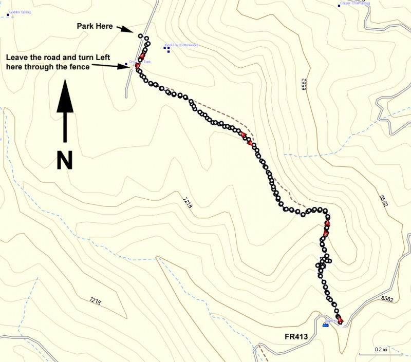
To get to the trailhead: from the Phoenix area, take I-17 North toward Flagstaff. At Cordes Junction, take HWY-69 towards Prescott. To short cut the distance, take Fain Road North to bypass Prescott and head directly to HWY-89A. Take HWY-89A East towards Jerome. At the summit of Mingus mountain, turn right on the signed junction for the Methodist Camp (FR104). Take the well graded dirt road FR104 for 2 mile, following the signs that lead to the Methodist camp. After passing the camp, continue towards the signed Mingus campground. Once you reach the campground, turn right and continue through the campground, following the signs for trail #108 and trail #9037 (about 0.7 miles from the entrance to the campground). There will be a spur road to your right that will be very near the big radio towers. Keep an eye out for the trail marker for TR108 on your right and park here.
Hike details
Season
- May
- June
- July
- August
- January
- February
- December
Solitude
Difficulty
Permits
Hike the Colman Trail near Prescott, Arizona.
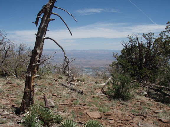
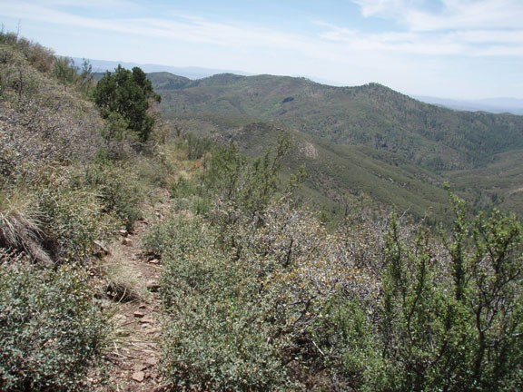
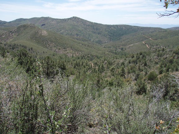
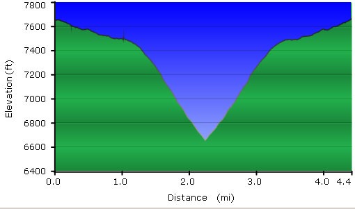
From the signed trailhead, head along the closed dirt road. About 0.1 miles from the trailhead, the trail leaves this road and makes an abrupt left turn through an open fence. From here, the road begins to gradually narrow into a trail, as well as begin a gradual descent. The pine forest is not too thick here, allowing distant glimpses of potential viewpoints to come. Continue along the easy to follow trail for about 1.2 miles, where you will see the forest begin to open up and views of Cottonwood and Sedona begin to appear on your left. Soon, the forest disappears and you have great views of the surrounding area. The trail begins a more serious and rocky descent here. Although the trail is easy to follow, it switches back and forth a few times as it descends down to FR413. The trail also gets a bit overgrown here, so expect some mild bushwhacking. Eventually you'll reach FR413 after about 2.2 miles of hiking. This road marks the turn around point. Return the way you came.
