
- Hikes in Arizona
- Prescott Area
- Miller Creek Trail
Miller Creek Trail

Location
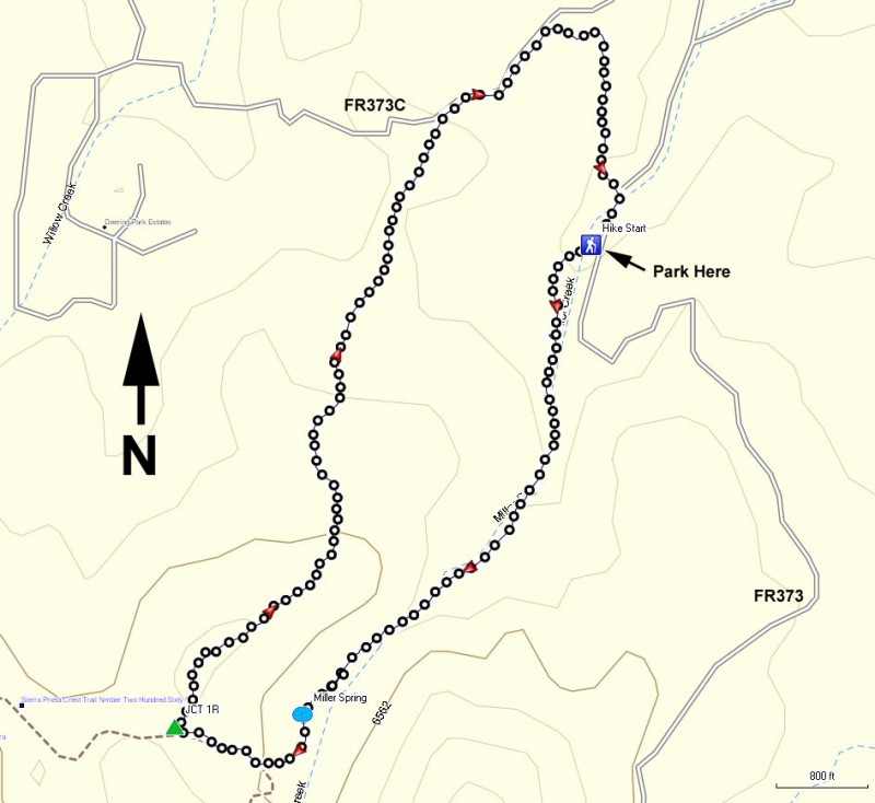
To the Trailhead: From the Phoenix area, take I-17 to the junction of HWY-69. Turn left onto HWY-69 towards Prescott. At the intersection between HWY-89 and HWY-69 towards the town of Prescott, turn left (HWY-69) and head towards the town of Prescott on Gurley Street. After passing through the downtown Prescott area, soon Gurley street turns into Thumb Butte Road. After the road changes to Thumb Butte road, the Thumb Butte day use parking area appears on the right after about 1.5 miles. Continue past the Thumb Butte day use area for another 1.7 miles to a signed junction with a blue sign. Turn left here towards Copper Basin Viewpoint. From this junction, drive another 0.6 miles and park in the clearing on the right that marks two camp sites (#5 and #6 I think). The unsigned trail starts on the other side of a rock and earth berm on the south side of this clearing. There was a trail sign there but someone decided to blast it to bits.
Hike details
Season
- May
- June
- July
- August
- January
- February
- December
Solitude
Difficulty
Permits
Hike the Miller creek trail near Prescott, Arizona
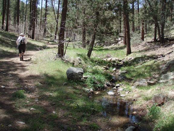
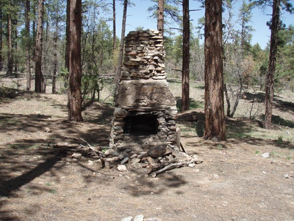
The solitude we found on this hike was a pleasant surprise. It winds through a pine forest along a babbling creek, which just added to the charm. There is some tricky route finding on this trail, but if you follow the directions here, you'll be OK. From the parking area, look to the South (up road). On the South side of the parking area there is a dirt and rock berm that blocks automobile access to the road on the other side. This closed road (now called Miller Creek Trail) will be your trail for the first half of this hike. After 0.1 miles along this trail, you'll see a stone chimney on your right, clearly the remains of an old homestead which is now no longer to be found. For the next mile, you may see faint trails come in from one side of the road or another. Stay along the creek for the first mile of hiking and you'll stay on the trail. The trail itself follows Miller Creek for a while, heading generally Southwest. When we did this hike in late April, it was running. The trail gains gradual elevation through the pine forest while crossing the creek a few times. The crossing is never too difficult and you can keep your feet dry.
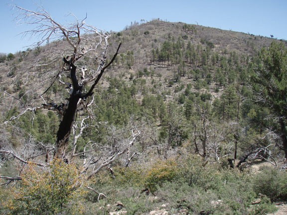
About a mile from the parking area is a wide clearing known as the source for Miller creek called Miller Spring. Continue along the dirt road past the remains of a rusting vehicle of some sort on your right. The trail turns West away from the creek now and you'll continue on the closed road, which increases in elevation more steeply. You may notice rocks and branches placed across the road. This is to prevent vehicles from using the road and not meant to block hiker traffic. This confused us at first because sometimes this method is used to block out of use hiking trails as well. Continue a total of 1.6 miles from the parking area where you'll reach a T intersection and be on an open rim. There are nice views to be found here in several directions. You'll want to stay right here at the junction (JCT 1R on the map). Continue generally Northeast on the now closed forest road FR9401E. You'll notice many more branches, rocks, and dirt blocking the road to prevent vehicle traffic.
After 3.2 miles of hiking, you'll reach the paved road FR323C. Turn right at the paved road and walk along the pavement for about 0.2 miles to another dirt road on your right. This dirt road has clearly been blocked from vehicle traffic by more rocks and logs. This closed dirt road will take you back to the start of the hike. You'll need to use your route finding here, as following this closed dirt road is tricky. Since the vehicle traffic has been blocked, the forest has done a good job trying to reclaim this dirt road, making it hard to follow. Luckily there are helpful cairns placed strategically along the closed road to help you navigate. Keep a sharp eye out for them to stay on the road. This final dirt road descends gradually about 0.5 miles to the FR323 road, reaching the road a few hundred yards away from the start of the hike and the parking area.
