
- Hikes in Arizona
- Phoenix Area and Central Arizona
- Black Mountain
Black Mountain


Location
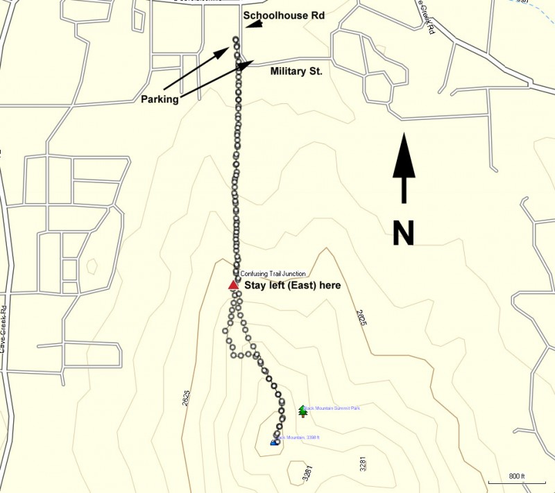
To get to the trailhead: from the Phoenix/Mesa area, take I-17 North to the Carefree Hwy exit. Take the Carefree Highway East about 8.5 miles to Cave Creek Road. Turn left onto Cave Creek Road and drive to the four way intersection with Schoolhouse Road (four way stop sign). Turn south on Schoolhouse Road, drive for a few hundred yards, and look for a legal place to park. There is some parking on the North side of Military street or the West side of Schoolhouse Road. Do not park further south from this point, as this is a no parking area and we don't want to make the local land owners unhappy so we can continue to enjoy access to this hike.
Hike details
Season
- January
- February
- March
- April
- October
- November
- December
- July
- August
Solitude
Difficulty
Permits
Hike the Black mountain trail near Phoenix, Arizona.
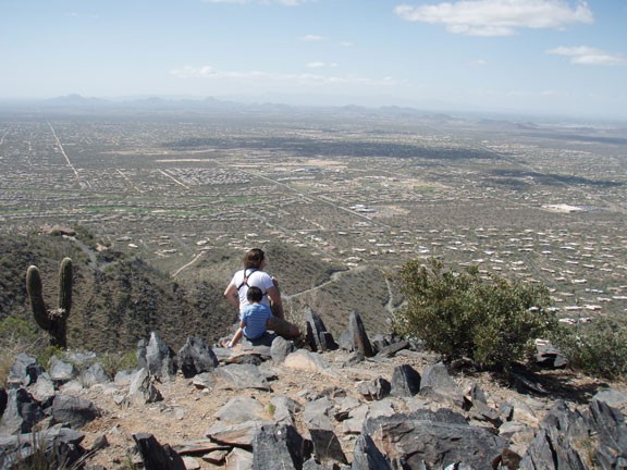
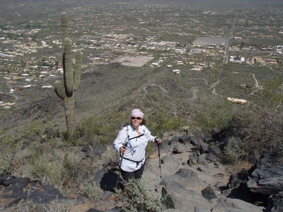
Black mountain stands as a 4000 ft high peak overlooking the town of Cave Creek in the North Phoenix area. It's a wonderful choice if you enjoy Camelback mountain and Piestewa peak and are looking for something similar. Parking is a bit chaotic here. Look for a place to park on the West side of Schoolhouse Road or the North side of Military Road. Please don't park any further South than Military Road so we don't upset the private home owners of this area. This is very important so we can continue to have access to this trailhead. From the intersection of Schoolhouse Road and Military Road, hike South along Schoolhouse Road towards the obvious Black Mountain. You'll hike on Schoolhouse Road for a few hundred yards until you see the brown trailhead sign on your left. Leave the road here and start walking along the easy to follow trail.
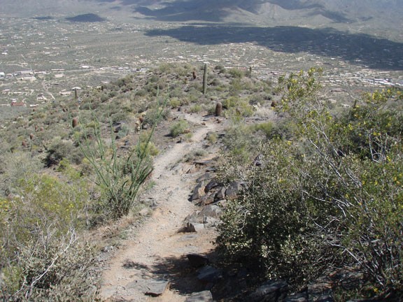
Here the trail parallels the dirt road and you get some increasingly pretty views of Cave Creek as you continue to climb. The trail is rocky, but easy to follow with the exception of one point you reach after 0.6 miles from the start. There are a series of trails that meet here. One is currently marked by cairns and is the wrong way. You want to stay on the more well traveled trail that goes to your left up the spine of the mountain. We ended up following the cairns and were hiking on a trail that cross cut the mountain, eventually petering out. We then bushwhacked up to the main trail. So stay left at this junction to avoid our mistake.
Continue the climbing, but be sure to look around once in a while to enjoy the ever more impressive views of the area. From the top, you'll get good views of the Spur Cross Conservation area to the North and Pinnacle Peak, along with the McDowell Mountain Range, to the South.
After enjoying the views, return the way you came.
