
- Hikes in Arizona
- Sedona
- Vultee Arch
Vultee Arch


Location
From the Phoenix area, take I-17 North to exit 298 to HWY 179 West into Sedona. At the junction with HWY-89A, follow the signs to 89A West. About 3.2 miles from the junction of HWY-179 and HWY-89A, turn right onto signed Dry Creek Road. Follow this paved road for 2.0 miles. Turn right at the signed intersection with FR152 (Dry Creek Road). Drive 4.4 miles to the end of this road and the parking for the Vultee Arch trailhead. This road is rocky and rough. A high clearance vehicle is required. A red rock parking pass is no longer required at this trailhead (as of March 2014).
Hike details
Season
- April
- May
- October
- November
Solitude
Difficulty
Permits
Hike to Vultee Arch near Sedona, Arizona.
After surviving the rough drive along FR152 (Dry Creek Road, high clearance required!), you'll be ready to stretch your legs. From the East end of the parking area, the start of the Vultee Arch trail is signed and easy to find. The trail itself is also easy to follow to the views of Vultee Arch.
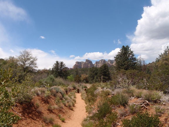
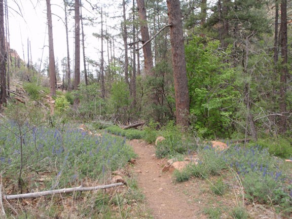
This trail starts in the dusty sand typical of this area of Sedona. As you hike further up Sterling Canyon, you'll be surrounded by the red rocks mountains of this area. The trail increases in elevation gradually, eventually gaining more shade from a pine forest. The canyon walls will also begin to close in around you.
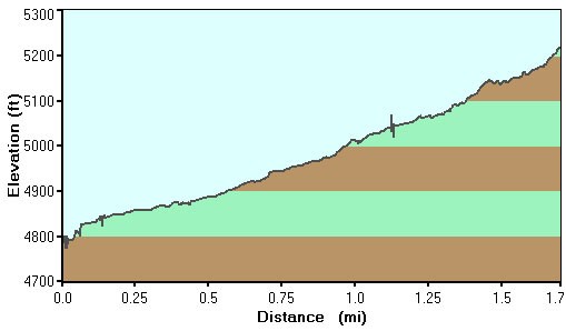
After 1.6 miles of hiking, you'll reach the signed junction with the Sterling Pass trail. If you look to your left (North wall of the canyon) you'll see Vultee Arch. Stay left at the junction and hike a few hundred more yards to a good place to rest and enjoy views of the arch. There is also a plaque here to mark the passing of Gerald and Sylvia Vultee, who died in a plane crash near this spot.
If you would like, there is a scramble route to the top of the arch from this point.
When ready, return the way you came.
