
- Hikes in Arizona
- Grand Canyon / Marble Canyon
- Widforss Trail
Widforss Trail


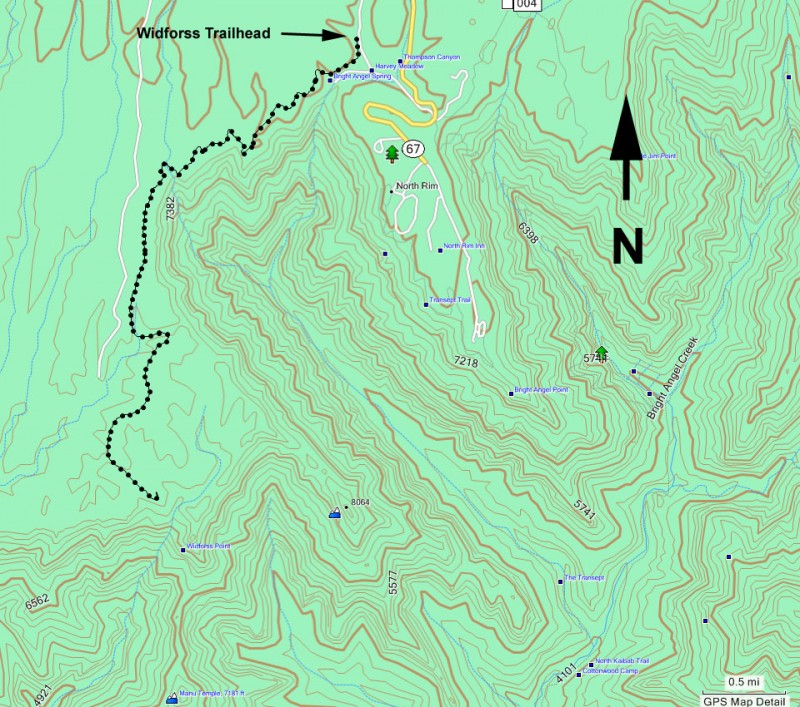
Location
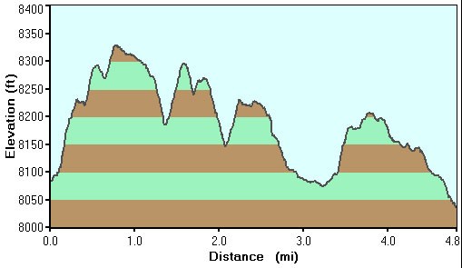
Hike details
Season
- May
- June
- July
- January
- February
- March
- December
Solitude
Difficulty
30 yr old Recommendation: This is a great hike that alternates between North rim views and a lovely forest. This is a Moderate difficulty hike.
Permits
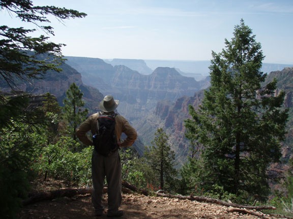
Hike the Widforss trail on the North Rim of Grand Canyon National park, Arizona.
The Widforss trail is named after Gunnar Widforss, who painted watercolor paintings of the Grand Canyon. Additional information about this area can be found on a free handout at the beginning of the trail. The information lines up with numbered posts along the first part of this trail.
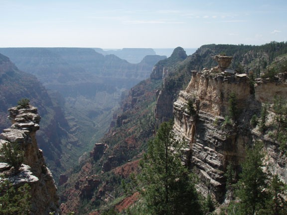
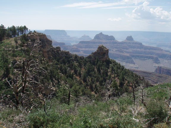
The trail is easy to follow and for the first section spends much of the time along the rim overlooking The Transept, which is a dramatic canyon that drains into Bright Angel creek. The rest of the trail goes through a lovely forest of Ponderosa Pine and Aspen before reaching the reward... magnificent views of the Grand Canyon from Widforss point.
From the point, you can see views of Angels gate, Brahma temple, Zoraster temple, as well as a multitude of other prominent South rim landmarks like Yaki and Mather points. Plan on spending some time here to enjoy the views. It's also a great place for lunch before the return hike.
When ready, return the way you came.
