
- Hikes in Arizona
- Mogollon Rim
- Telephone Ridge Trail #203
Telephone Ridge Trail #203
Location
To get to the trailhead: from the Phoenix area, take HWY-87 North toward Payson. Once in Payson, take HWY-260 East towards Heber. Turn left at the signed junction for the Rim Road (FR300, signed as the turnoff for Woods Canyon Lake). FR300 will eventually turn into a well graded dirt road. Take FR300 8.4 miles and turn left on signed FR169. Take FR169 7.6 miles and turn right onto signed FR119 (sign points towards Telephone Ridge trail). Take this road 1.5 miles to a fork, turning left at the signed fork (stay towards the Telephone Ridge trail) and then make a quick right. From this point, the road gets rocky, so you should have a high clearance vehicle. The trailhead parking is at the signed end of FR119, after about another 2 miles from the fork.
Hike details
Season
- May
- June
- July
- August
- September
- January
- February
- December
Solitude
Difficulty
Permits
Hike the Telephone Ridge trail in Arizona.
There are several routes that enter into beautiful Chevelon canyon. This is a quick route that provides just enough exercise to feel you earned the rest along the creek.
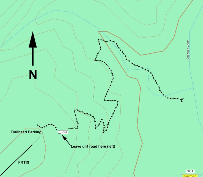
The only tricky part about this hike is the start. There are two dirt roads and several faint trails that leave the parking area. Although there is a hiking sign with an arrow, the arrow is not clear in pointing you in the correct direction. Facing the hiking sign, you should take the dirt road about 30 yards to it's left. Do not take the road that is next to the 'End FR119' sign. The latter is a trail to a campsite, which goes to a lookout of Chevelon canyon, but not much else.
From the true trail, the route finding is not done yet. About 250 ft down the trail, look to your left where a single track trail marked by cairns appears. This is easy to miss, but the dirt road quickly disappears if you miss this turnoff (marked 004 on the map). Simply backtrack to the trail, which heads towards the canyon wall.
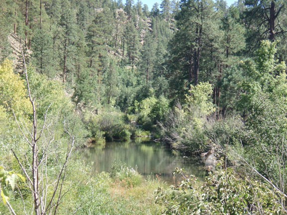
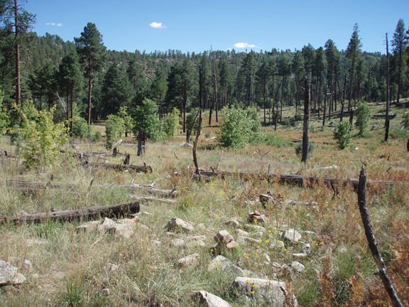
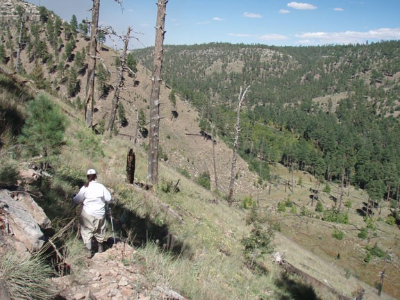
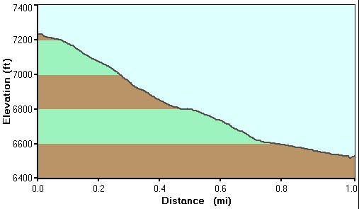
From here, the trail is easy to follow all the way down to Chevelon creek. The trail switchbacks along a burned ridgeline, providing easy views of the canyon, but not much shade. After a mile of total hiking, you'll reach the bottom of the canyon. Your reward is a picture perfect campsite and peaceful Chevelon creek.
When ready, return the way you came.
