
- Hikes in Arizona
- Tucson Area and Southern Arizona
- Wilderness of Rock (via the Mint Spring trail)
Wilderness of Rock (via the Mint Spring trail)

Location
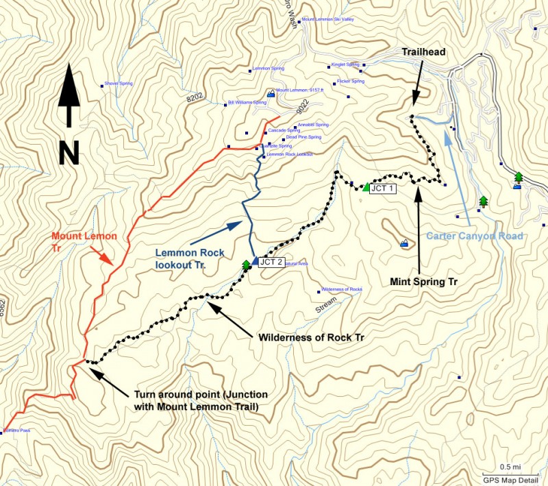
To get to the Trailhead: From the Tucson area, drive the Tanque Verde road east. Turn left onto the Catalina Highway. After paying the $5 parking fee, take this road all the way to the top of Mount Lemmon. At the fork between the ski area and the town of Summerhaven, turn left to go into the town of Summerhaven. When in Summerhaven, turn right onto signed Carter Canyon Drive. Take this road 0.5 miles to it's end at a private driveway and park in the clearing on the right side of the road. The trailhead is signed, but it is not easy to see.
Hike details
Season
- May
- June
- August
- September
- January
- February
- December
Solitude
Difficulty
Permits
Hike the Wilderness of rock via the Mint Spring trail on Mount Lemmon near Tuscon, Arizona.
I'm jealous of the folks living in Tucson.
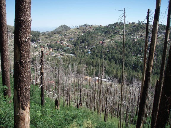
For those of us living in the Phoenix area, the summertime means we need to take the 1.5+ hour drive north to cooler hiking areas like Prescott, Payson, or Flagstaff. Just recently, I took my first trip to Mount Lemmon, located just north of the Tucson area. At 9300 ft, Mount Lemmon holds many enjoyable hikes a relatively short drive from the Tucson area. One such hike takes you into the Wilderness of Rock area.
From the parking area, start walking down the road toward the private property sign. Look on your left across the creek (before reaching the sign) to see the signed Mint Springs trail. It is not easy to see, as this area is very overgrown. If you reach the private property sign, turn around, as you have gone too far.
Start along this overgrown trail as it climbs out of the small canyon. This section of the trail is through a section of the forest recovering from a 2003 fire that wiped out the town. You'll notice the town and forest are both recovering. Fortunately, for the hiker that means plenty of ferns, flowers, and unobstructed views. Unfortunately, it also means the trail is a bit overgrown with sticker bushes, so wear long pants. The bees are also quite enamored with the flowers. They were completely ignoring us as we walked through this area, but if you are allergic to bees, plan accordingly.
After about 1.7 miles, you'll reach a junction with several of the area trails, including the Aspen trail, the Marshal Gulch trail, and the Wilderness of rock trail. This junction is signed, so you will be going generally straight onto the Wilderness of rock trail (see JCT 1 on the map). From this point, the hike changes, and not for the last time.
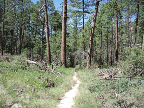
The forest in this area provides some shade and the smell of pine trees is strong. Soon a vibrant creek is your companion as you follow the bottom of Lemmon Canyon. You will cross the creek several times, but the creek is low enough to boulder hop across without any danger of getting wet.
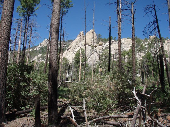
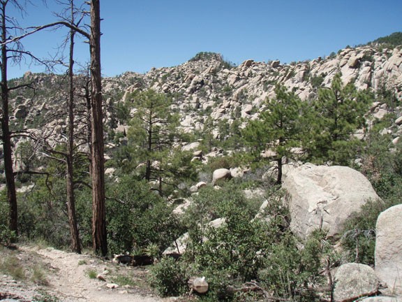
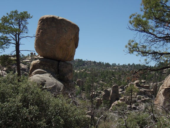
After 3.2 miles of hiking, you'll reach the entrance to the Wilderness of Rock. You'll know it when you see it, as the area strongly resembles the Chiricahua National Monument area. To say there are rocks everywhere sells this place short. Boulders abound, guarded over by soaring exposed rock peaks more remnant of the Yosemite area. There is some route finding needed in this area, as the trail goes across some of the rock. There are rock cairns at strategic points to help you find your way.
After about 5.5 miles of hiking, you'll reach the signed junction with the Mount Lemmon trail. By turning right and following this trail up to the top of Mount Lemmon, you can make a very nice shuttle hike (make sure you have a second car or are comfortable hitch hiking). However, for this hike and a straightforward way back to your car, turn around here.
