
- Hikes in Arizona
- Prescott Area
- Mingus Mountain Loop hike
Mingus Mountain Loop hike


Location
To get to the trailhead: from the Phoenix area, take I-17 North toward Flagstaff. At Cordes Junction, take HWY-69 towards Prescott. To short cut the distance, take Fain Road North to bypass Prescott and head directly to HWY-89A. Take HWY-89A East towards Jerome. At the summit of Mingus mountain, turn right on the signed junction for the Methodist Camp (FR104). Take the well graded dirt road FR104 for 2.6 miles into the Mingus Mountain campground. At the first stop sign, go straight and park at the trailhead.
Hike details
Season
- May
- June
- July
- August
- September
- October
Solitude
Difficulty
Permits
Hike through the pine forests of Mingus Mountain near Prescott, Arizona.
We were attempting to escape the hot July summer weather in the Phoenix area and decided to try a loop hike atop the 7000 ft Mingus mountain. After completing this loop hike, we were very glad we did. The hike we decided on was a loop, made up of the View point trail 106 and the North Mingus trail 105.
We had a tricky time finding the trailhead to the View Point Trail 106 (no surprise, considering my challenges in route finding for Yeager Canyon and Gaddes Spring, which are also in this area). The trailhead is signed and there is a day use parking area next to it. After paying the $5 fee, start heading down the View Point Trail.
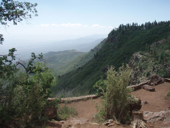
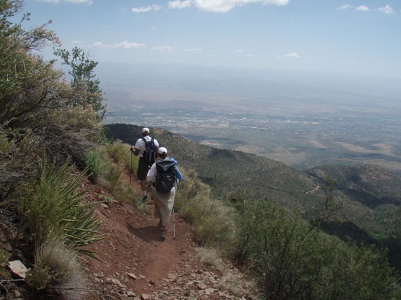
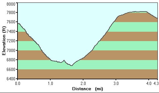
The trail is easy to follow and you are quickly treated to views of the Verde Valley, with the town of Cottonwood and Sedona in the distance. Unfortunately for us, it was a hazy day, due to wildfires in the Flagstaff area. The trail switchbacks down Mingus mountain for about 900 ft. Luckily, there is some shade to start, but eventually the pine trees thin out and are replaced by chaparral. After about a quarter of a mile, the trail grade levels out, although it always goes down. The trail hugs the side of Mingus mountain, providing constant and enjoyable views of the Verde valley.
After about 1.5 miles of hiking on the View Point trail, you'll reach a signed trail junction with the 105A connector trail. If you stay on trail 106, you'll reach FR413 in about 0.6 miles. To do the loop hike, turn left at this junction (marked as Jct 1A on the map) to hike on the 105A connector trail. The connector trail continues to hug the contour of Mingus mountain, providing better views of Jerome and the Sedona canyons in the distance.
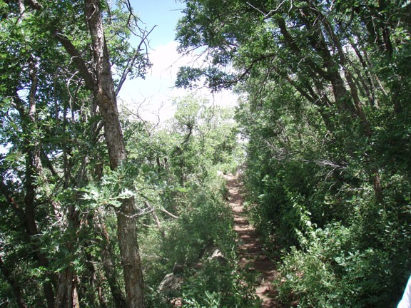
After 0.4 miles on this connector trail, you'll reach the signed junction with North Mingus trail #105 (marked as Jct 2A on the map). Turn left here and start climbing back up Mingus mountain. The climbing is steady, but not overly steep. You'll know you are near the top when the pine trees come back to shade you and you pass a few small groves of Aspen trees. From the junction to the top is about 0.8 miles.
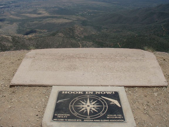
At the top, the trail flattens out and heads back towards the campground. You'll hike about 0.3 flat miles when you reach a hang gliding launch area. It's an interesting place and is certain to start daydreams about hang gliding. There is also a series of TV and radio towers here. Follow the dirt road 0.7 miles back to your car.
