
- Hikes in Arizona
- Superstition and Mazatzal Wilderness
- Reavis Falls
Reavis Falls

Location
From the Phoenix area, take HWY 88 North East out of Apache Junction towards Apache Lake. Eventually, HWY 88 turns into dirt. This road is OK for cars if you drive slowly, but it is slow going in spots, with some definite elevation. After the road turns to dirt, drive an additional 7.2 miles to the dirt road turn to signed Reavis Trail (right turn). There are a couple of dirt roads leading right in this area, so make sure you look for the Reavis Trail sign. From this point, it's 3 miles on a good dirt road to the trailhead.
Hike details
Season
- January
- February
- March
- April
- October
- November
- December
Solitude
Difficulty
Permits
Hike to Reavis Falls in the Superstition Wilderness, Arizona.
Reavis Falls is one of those hikes that seems more like an urban legend than reality. A 200 ft waterfall in the middle of the dry Superstition Wilderness? Sounds mysterious, but it's true! Like all things rare and wonderful, there is a great deal of work to be done to see it, but it does exist... that is as long as you take this hike in the Spring or after a good rainfall. Don't take this hike after a prolonged dry spell or Reavis falls will indeed remain hidden.
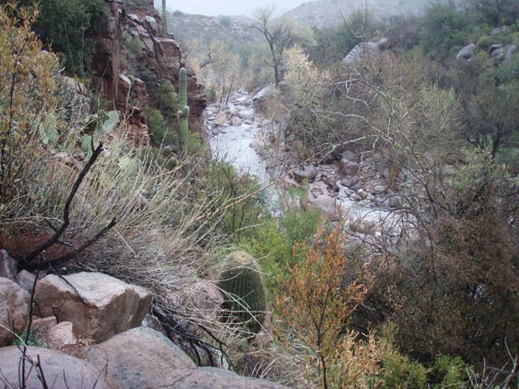
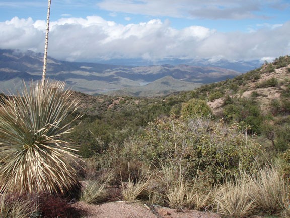
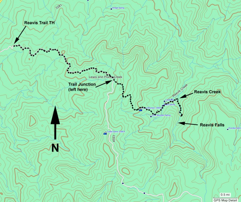
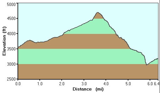
From the Reavis Trailhead, follow along the old dirt road that once lead to the Reavis ranch. The views here of Apache lake and the Superstitions are worth the effort themselves. After about 3.5 miles of hiking, you'll see a spur trail that heads to your left up a hill. Make a left here. You'll know you're on the right trail if you soon go through a break in a barb wire fence. At the top of the hill, you'll see the canyon that is formed by Reavis creek and it is quite a sight. Now comes the work part. It's about a 2700 ft drop to get down to Reavis Creek.
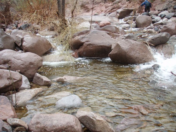
Once you reach Reavis creek, head up creek (right) and try to follow whatever cairns are available. If you can't find any, boulder hop as best you can up the creek. Under normal circumstances, you should be able to keep your feet dry during this section. About 0.5 miles of slow travel will get you to the waterfall.
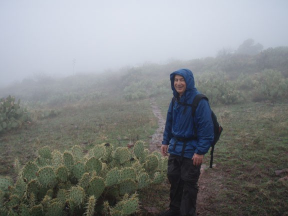
You may notice that I don't have any pictures of this waterfall below. That's because, true to the elusive nature of this waterfall, the most recent time I took this hike was a very rainy day at the end of a rainy weekend. The water levels in Reavis creek were high enough that we couldn't quite make it to the waterfall before we had to turn back (or swim!). Since it was February, swimming wasn't an option. I have been there before when the waterfall was running, so I swear it exists. I just didn't have a camera back then. Someday, I'll have to repeat this hike to get that magic Reavis falls picture.
Hopefully, you'll have better luck than we did and you'll get to enjoy the views of the waterfall for a while before heading back. You'll quickly realize that views of the waterfall extract a heavy price as you carry yourself 2700 ft back out of the canyon.
