
- Hikes in Arizona
- Phoenix Area and Central Arizona
- Pueblo la Plata (Silver Creek Ruins)
Pueblo la Plata (Silver Creek Ruins)

Location
From the Phoenix area, take I-17 North to the Bloody Basin exit (#259). This road (FR269) is a good graded dirt road. Bloody Basin road crosses the Agua Fria river, but the river is either low or dry most of the year and the crossing is paved. Drive 8.7 miles along this road and make a left at the signed junction for route 9023. You'll pass double tank on your left (a couple of large cow dirt water ponds) and after 0.5 miles, you'll stay left at the signed 9023 junction. At this point, the BLM calls this road a 'route'. You'll probably need a high clearance vehicle to make it to the parking area, which you'll reach after another 0.7 miles of driving. You can also park and walk it if you like. There's a trail register here, with information about the ruins.
Hike details
Season
- January
- February
- March
- April
- September
- October
- November
- December
Solitude
Difficulty
Permits
Hike to the ruins at Pueblo la Plata, also known as the Silver Creek Ruins in Arizona.
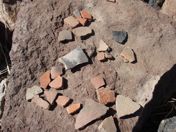
Although the ruins here are not nearly as impressive as those of Cooper Forks or Pueblo Canyon, the hike is certainly much easier. These ruins still have much to interest the curious, especially if you enjoy hunting for pottery shards.
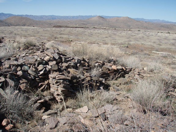
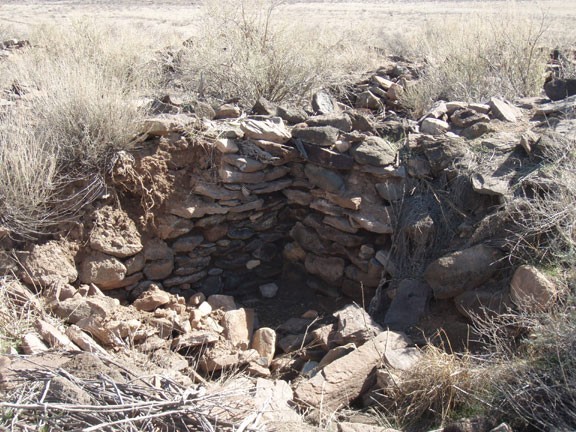
From the parking area, head through the gate and follow the old dirt road towards the mound in the distance. It's only about 0.5 miles flat walking to the main ruins. It is estimated there were between 120 to 160 rooms at this site during it's occupation seven hundred years ago. The walls of the rooms have seen better days, but much of the original stonework is still holding up in places. It is also the easiest place I've found to discover pottery shards... they're everywhere. So careful where you step!
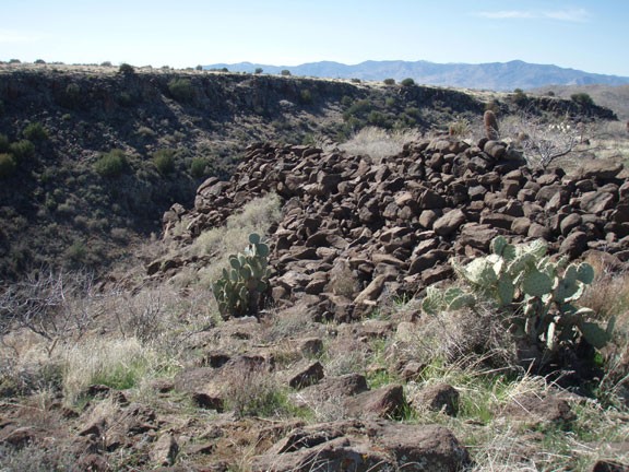
When you've finished exploring the main ruins, turn West and start a flat cross country walk to "the Fort" (no defined trail). After about a half mile (see the map) you'll reach the obvious wall between the two canyons out on a point. The route finding isn't too difficult, as both sides are bordered by the canyons. The wall is impressive, as it is clearly obvious they spent a great deal of effort building it. This is a good spot for lunch, as you can enjoy the ruins as well as the views.
When you're ready, return the way you came.
