
- Hikes in Arizona
- Phoenix Area and Central Arizona
- Thompson Peak
Thompson Peak


Location
From the Phoenix area, take state HWY-87 towards Payson. Turn left onto Shea Blvd into Fountain Hills. From Shea Blvd turn right onto Palisades Blvd. Then take a left onto Golden Eagle Blvd. Take Golden Eagle Blvd to the end of the road and a parking area.
Hike details
Season
- January
- February
- March
- April
- October
- November
- December
Solitude
Difficulty
Permits
Hike to the top of Thompson peak near Scottsdale, Arizona.
From the parking area, you need to walk about 10 minutes through a subdivision under construction to get to the actual trail. There is a map at the parking area and they've put helpful trail markers at each intersection. As you enter the subdivision, turn right onto the third right street (follow the trail marker signs). The wide and well traveled trail is down the hill on the left side of the road. There is a spot to pay the $2 entry fee into the park here (Trailhead marked on Map). Although this housing development is not completed yet, once it is, hikers will have to be very respectful of private property to continue to enjoy access to this trailhead. Please be a model hiker and respect private property here!
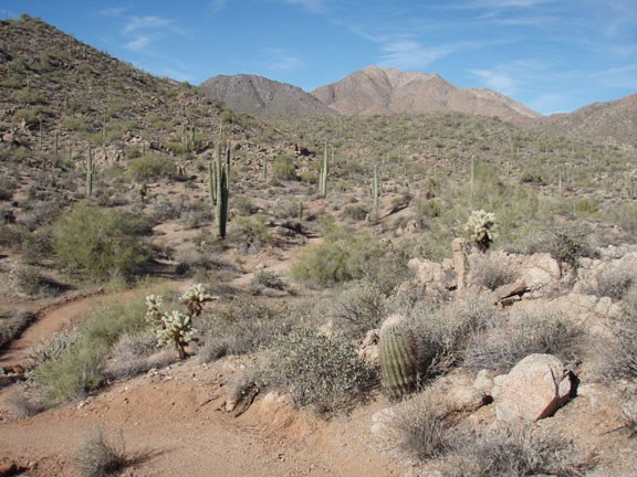
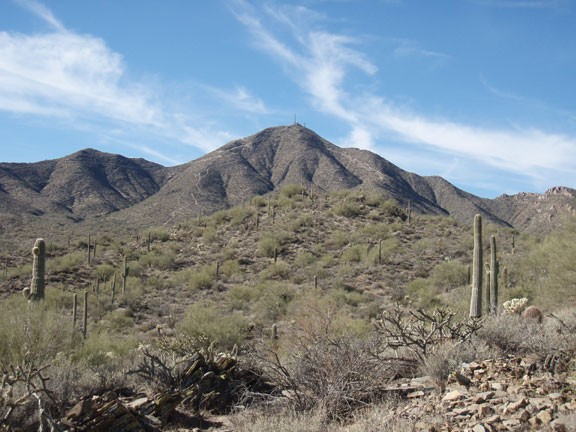
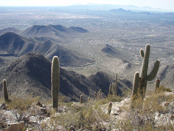
The well marked trail heads through the desert. There are plenty of Saguaro and Palo Verde here. The trail has some up and down, but generally heads up. Views behind you of the Superstitions and in front of you of the McDowell Mountains open up as you hike. Be sure to stop and look around once in a while. After 2.5 miles of hiking, you will reach a dirt road (closed to motor vehicles). You can see the tailings of the Dixie mine directly in front of you, along with some large cottonwood trees in a wash. If you go right onto this road, you can check out the old Dixie mine, long since closed. We'll turn left here (Jct 2L on map) to continue up the dirt road to Thompson Peak. After a bit you'll see some cairns on the road and a more narrow trail (The Prospector Trail) to your right (Jct 3L on map) that leads off to Bell Pass. Stay on the road (left) here and continue following this wide road as it gets steeper and steeper.
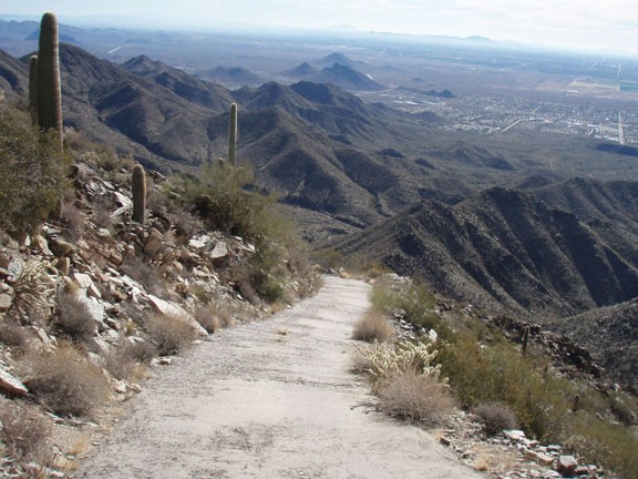
As you climb in earnest, you'll notice sections of this road is paved. The road is so steep, I doubt that you could descend in a car safely without the road being paved. This road services the wireless towers at the top of the mountain... just imagine trying to drive up or down this road!
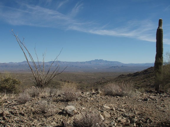
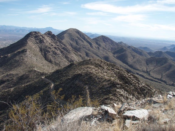
The steep road gets your heart going, but the views all around will take your breath away. On a clear day you can see the Four Peaks, Weavers Needle, Camelback Mountain, Scottsdale, and the whole of the McDowell Mountain ridgeline. Its a great reward for your hard climbing.
After enjoying your triumphant views (and snapping a few pictures) return the way you came.
