
- Hikes in Arizona
- Superstition and Mazatzal Wilderness
- Carney Springs
Carney Springs

Location
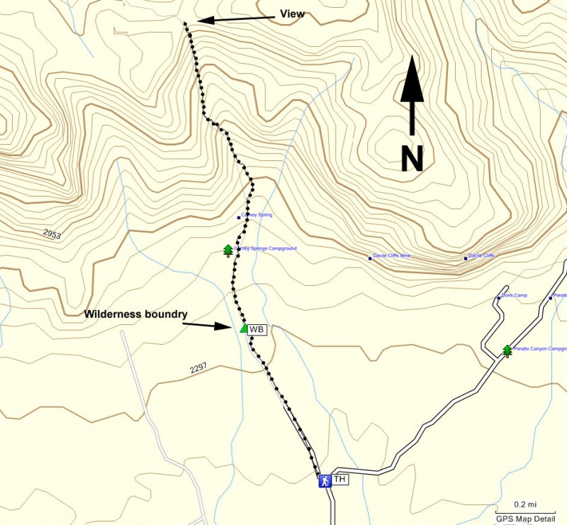
From the Phoenix area, take US-60 East, leaving the city limits. After leaving Apache Junction, continue about 8.5 miles, turning left onto signed Peralta Road (FR 77). After starting out as a paved road, this quickly turns into a maintained dirt road. After 5.6 miles, you'll stay left at the signed junction that heads towards the Peralta Trailhead. Go another 0.6 miles and park at the unsigned parking area and trail on your left. If you reach the obvious Peralta Trailhead, you've gone too far.
Hike details
Season
- January
- February
- March
- October
- November
- December
Solitude
Difficulty
Permits
Hike up Carney Springs trail in the Superstition Wilderness, Arizona.
One way to escape the crowds at the beautiful, but popular Peralta Trail hike is to stop short of that trailhead and hike up the Carney Springs trail. This trail is not nearly as easy to follow as the Peralta Trail, but it does have significantly fewer people on it.
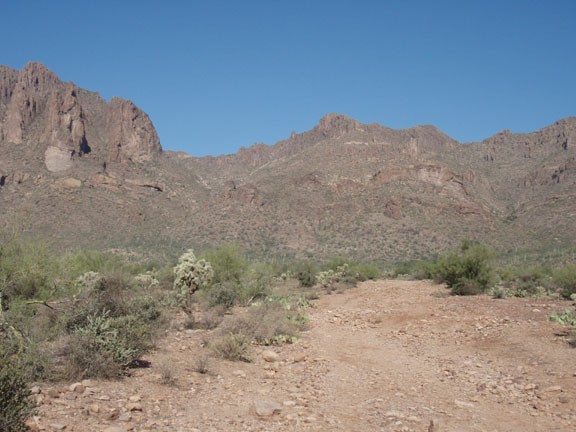
From the parking area, follow along the wide, closed dirt road heading towards the Superstition Wilderness. This old road used to lead to the Carney Springs campground, but has since been closed to cars. You'll soon arrive at the site of the old campground and a fence marking the wilderness area (marked WB on the map). On the other side of the fence, the road goes away and you'll follow a faint and rocky trail for the remainder of the hike.
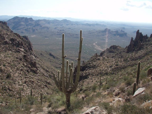
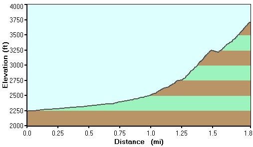
From this point, the climbing starts in earnest. Since the grade is so steep, there are a number of sections where it could be easy to loose the trail. There are cairns to mark the trail in these sections, so keep an eye out for them and use those route finding abilities. There are some minor scrambling sections as you climb as well. Make sure you turn around once in a while to enjoy the views as you go up.
After about 1.8 miles of hiking, you'll reach the ridgeline. The trail continues along the ridgeline and goes all the way to the Flat Iron. However, for this hike, this ridge makes a nice place to rest and enjoy the views.
When ready, return the way you came.
