
- Hikes in Arizona
- Superstition and Mazatzal Wilderness
- Thicket spring mine (squaw flat)
Thicket spring mine (squaw flat)

Location
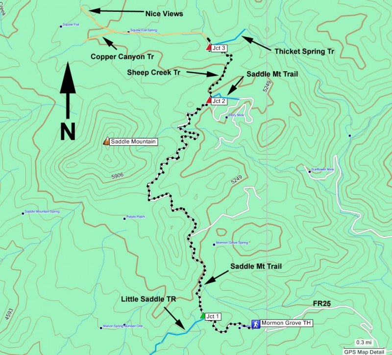
To get to the trailhead: From the Phoenix area, take HWY87 North, leaving the city limits. After passing the Sunflower turnoff, look for the Sycamore Creek Road turnoff. Take this paved road 1.2 miles and turn right onto dirt FR201 (crossing a cattle guard). Take FR201 for 1.2 miles to a second cattle guard, after which the road splits, turn left onto FR25. Take FR25 for 2.6 miles to a split on the road. Turn left to stay on FR25 and drive this section 2.2 miles to the Mormon Grove Trailhead. The trailhead is not signed, but the trail starts where the road dead ends at an old corral.
Hike details
Season
- January
- February
- March
- October
- November
- December
Solitude
Difficulty
Permits
Hike the Thicket spring trail in the rugged Mazatzal wilderness, Arizona.
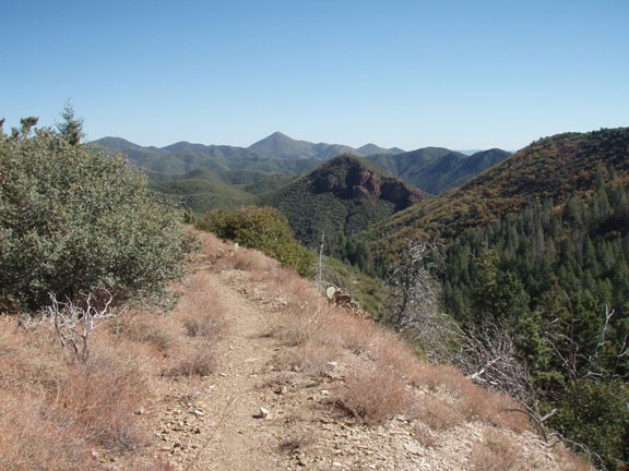
Taking this trail system to the old mine at Thicket Spring is a pleasant way to day hike in the Mazatzal wilderness without backpacking or gaining too much elevation. The mine is just an arbitrary destination. The actual joy of this hike is in the views you enjoy along its length.
From the corral at the Mormon Grove trailhead, follow the easily spotted trail from the small parking area. After a brief walk, you'll reach the wilderness boundary. The trail is an old road and easy to follow. After only about 0.5 miles, you'll reach the junction with the Saddle mountain trail and the Little saddle trail (Jct 1 on the map). Turn right here to hike on the Saddle mountain trail.
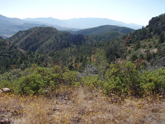
From the Saddle mountain trail, you'll enjoy wide ranging views of the Mazatzal wilderness, with Saddle mountain dominating your views on the left. It's an enjoyable stretch of the trail. We managed to surprise a large group of Javelinas here.
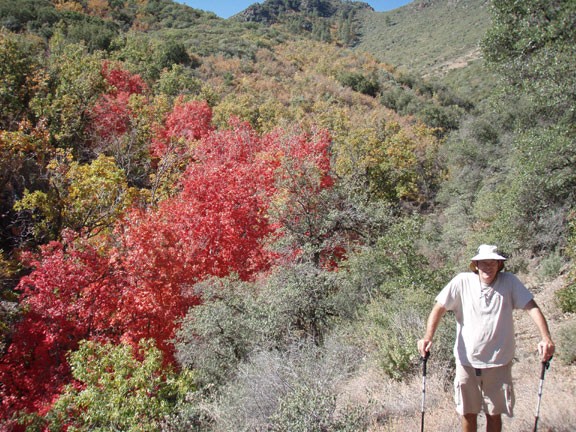
The next major trail junction you reach is with the Sheep creek trail. You'll turn left onto the Sheep creek trail at this point (Jct 2 on the map). From here, the trail gets a bit overgrown, so hopefully you're wearing long hiking pants to make this section more enjoyable to hike. One benefit of this section is the vegetation makes for colorful eye candy if you're taking this hike in the glory of fall. One tricky navigating note here. The trail will briefly enter a wash. After 20 yards or so, the trail will leave the wash to the left. It would be very easy to zone out and continue to follow the wash.
Soon the trail begins a descent into McFarland Canyon. This section switches back somewhat steeply, but there is obvious water under the surface here, as the oaks, sycamores, and Manzanita suggest. Finally you'll reach the clearing that marks the junction between the Thicket spring trail and the Sheep creek trail (Jct 3 on the map). This is a nice place to enjoy lunch and relax in the shade. Take some time to explore the mine entrance which is easily seen by walking just a short bit along the Thicket spring trail. A quick warning about exploring inside the mine, there may be bees inside... at least there were when we did this hike. If you're up for additional adventure from this point, you can continue along the Sheep spring another 0.5 miles to Squaw flat spring (seasonal), which is a cement trough with a pipe out of it in the middle of an old corral. If you walk another 0.25 miles along this trail, you'll be treated to some great views of the southern Mazatzal range.
When you've finished exploring, return the way you came.
