
- Hikes in Arizona
- Mogollon Rim
- Houston Brothers Trail #171
Houston Brothers Trail #171

Location
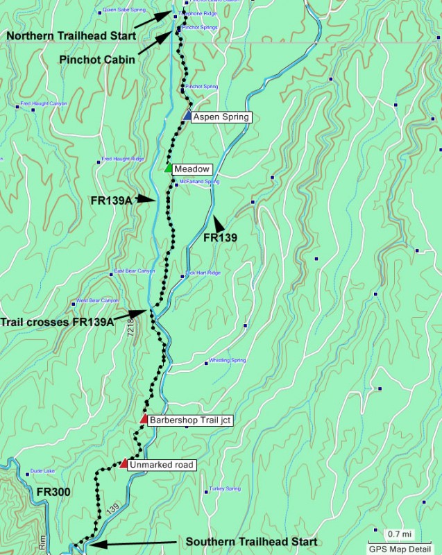
To get to the trailhead: from the Phoenix area, take HWY-87 Northeast through Payson, Pine, and Strawberry towards Winslow, AZ. After passing Lake Mary Road (FH3), drive an additional 9.4 miles, turn right onto FR 95 (just before mile marker 300). Drive on well graded dirt road FR 95 for 8.7 miles, to the intersection of FR 95 and FR 139.
For the Northern Trailhead:
Continue on FR95 for an additional 2.0 miles to the intersection with FR139A. Turn left to take FR139A and drive 0.2 miles to the signed Fred Haught Trail. There is good parking here. From this parking area, there is a small sign pointing the way to the Pinchot Cabin. Follow this trail 0.2 miles to the Pinchot Cabin and the start of the Houston Brothers Trail #171. All the dirt roads are in good shape for cars.
For the Southern Trailhead:
From the intersection of FR95 and FR139, turn left onto FR139. Drive on FR139 for 9 miles to the intersection with FR300 (also known as the Rim Road). Turn right onto FR300 and drive 0.1 miles to the signed trail start for the Houston Brothers Trail #171. All the dirt roads are in good shape for cars.
Hike details
Season
- June
- July
- August
- January
- February
- December
Solitude
Difficulty
Permits
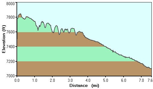
Hike along the Houston Brothers trail on the Mogollon rim in Arizona.
It was 114F in the Phoenix area, but only 81F up here, which is reason enough to enjoy this area in the middle of an Arizona summer. There is a nice variety of attractions on this hike which really adds to it's attractiveness. From the pine, aspen, oak forest, with occasional ferns underneath, to the perennial streams and springs, to some old historic cabins, this hike really provides a smorgasbord of enjoyment.
Depending on your mood, you can start at either the Northern or Southern trailheads. If you want to hike generally downhill and finish the hike at the Pinchot Cabin, then start at the Southern Trailhead. If you want to enjoy the best part of the hike early and finish the hike with great views off the Mogollon rim, then start at the Northern Trailhead. We chose the Southern trailhead and the write up reflects this.
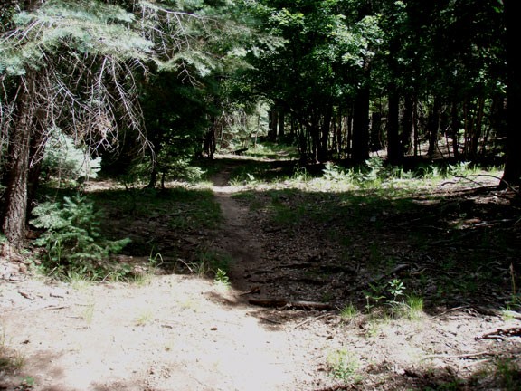
Before starting, be sure to enjoy the views from the Mogollon Rim to the floor below. From the Houston Brothers trail sign, walk along the easily followed trail into the woods. Very quickly, you'll cross an unmarked dirt road. Resist the urge to follow the road, instead crossing the road to continue on the faint trail on the other side. There are a few road crossings on this trail, but this trail always continues on the opposite side of the road. There are strategically placed cairns to help you navigate.
The hiking in this area alternates between a pine forest into heavy shade with aspen above and ferns beneath. After 1.3 miles of hiking, you'll cross another unmarked road, the trail resumes on the other side. Hiking 0.6 miles from this point will get you to the marked trail junction with the Barbershop trail #91 (marked on the map). Stay left to remain on the Houston Brothers trail. From this trail junction it is 1.3 miles of walking to where the trail crosses FR139A.
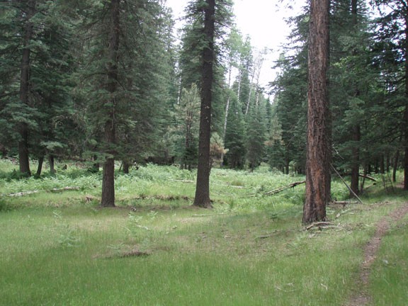
Up until this point, there have been several valleys and hills to travel through and over. From FR139A, the trail flattens out and becomes a very gentle downhill stroll. The scenery also begins to change, as the forest thins out and the trail follows an open meadow after about 1.7 miles. This meadow starts to bring a creek along side the trail. The trail temporarily disappears in this meadow, but use your route finding skills to find the trail on the other side of the meadow (marked on the map).
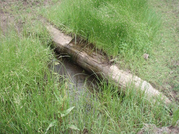
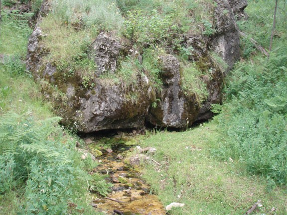
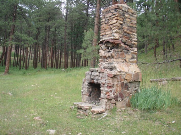
Now the trail skirts alongside a fenced meadow and creek. During one extended section, you will be walking through an enjoyable fern forest. After 0.6 miles, you'll find yourself at Aspen springs. To your right is a spring feeding the creek and the remains of an old cabin. It's worth spending a few minutes exploring this interesting area.
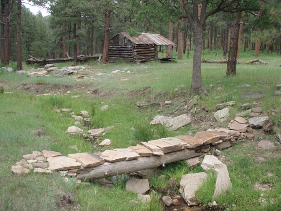
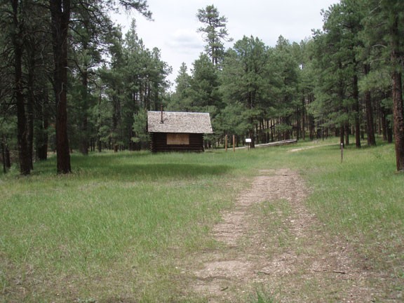
From this point, it's a short mile to Pinchot cabin. This cabin has an interpretive sign, describing the origins of this area and cabin. This area was once the summer camp of the Houston Brothers ranch. The only remaining cabin was built in the early 1930's and named after the first chief of the forest service, Gifford Pinchot.
From this area, there are two routes out. There is a very wide and easily spotted dirt road on the right side of the creek. This is not the route to the Northern Trailhead. To get to the Northern trailhead and FR139A, stay on the left side of the creek and take the less noticeable dirt road 0.2 miles to FR139A.
This hike is best done as a one way hike with a shuttle back to your car. I'd recommend dropping your bike at one end of the trail to use as a shuttle. The bike ride along FR139 is an easy and convenient way to get to your car and the distance is pretty short.
