
- Hikes in Arizona
- White Mountains and Eastern Arizona
- Thompson Trail #629
Thompson Trail #629


Location
To the Trailhead: From the Show Low area, go East on HWY260. Turn right onto the well graded dirt road HWY-273 and drive for about 14.5 miles to the junction with FR-116. Turn right on FR-116 and go 1.5 miles to the signed parking area on the left. The trail starts about 100 yards up the road on the left. All the dirt roads heading to this hike are well graded.
Hike details
Season
- June
- July
- August
- January
- February
- December
Solitude
Difficulty
Permits
Hike the Thompson trail in Eastern Arizona.
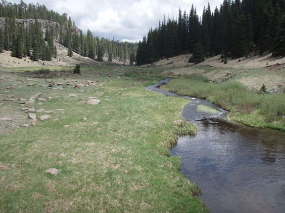
From the signed trailhead, walk downstream along the West Fork of the Black River. There are actually two trails here. The hiking trail stays close to the river and can sometimes be tricky to find. If you loose the trail your best bet is to search near the river to pick it up again. Depending on the flow of the river and recent rains, it may be a bit marshy in spots during this hike. The other trail is for mountain bikes and horses and follows an old dirt road.
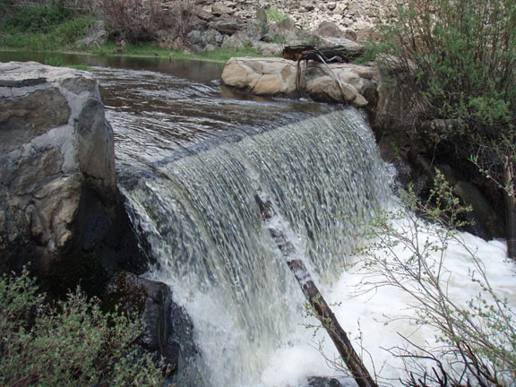
The walk along the river is very enjoyable, as this year round river accompanies you for the entire hike length. During the hike you will pass a few man made waterfalls along the river. The purpose of these falls are to protect the native Apache Trout in the river. In this section, fishing is prohibited. However, you will likely see fishermen along other parts of the creek.
We hiked this trail to the point at which the West Fork trail comes in from the left and a creek comes in from the right. This makes for a good turn around point.
If you like, you can take the old dirt road back to the trailhead. It is further away from the creek, but has some unique views.
