
- Hikes in Arizona
- Prescott Area
- Gaddes Spring Trail #110
Gaddes Spring Trail #110


Location
To get to the trailhead: from the Phoenix area, take I-17 North toward Flagstaff. At Cordes Junction, take HWY-69 towards Prescott. To short cut the distance, take Fain Road North to bypass Prescott and head directly to HWY-89A. Take HWY-89A East towards Jerome. At the summit of Mingus mountain, turn right on the signed junction for the Methodist Camp (FR104).
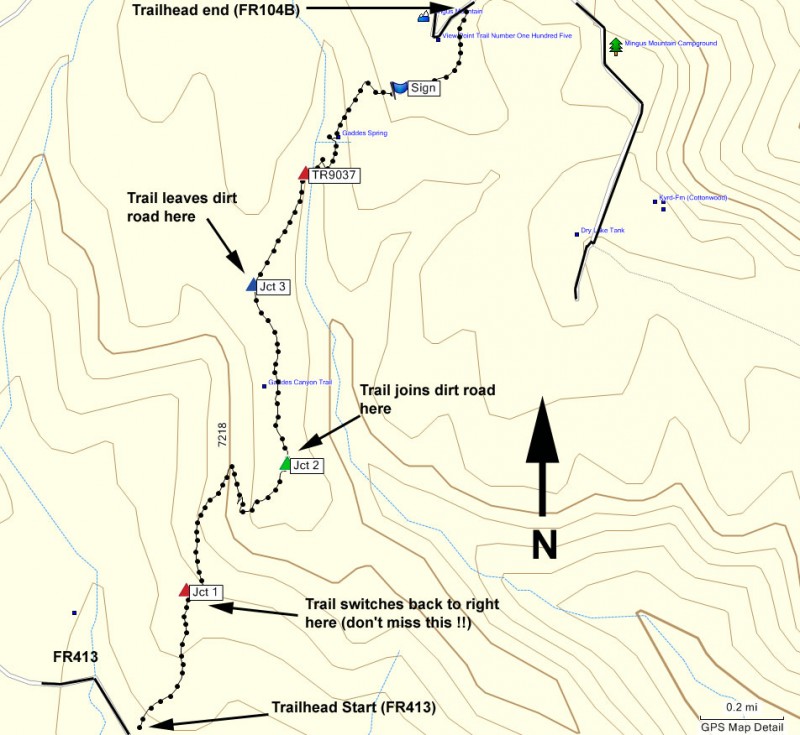
LOWER TRAILHEAD: Take the well graded dirt road FR104 for 1.3 miles. Turn right onto FR413 (sometimes signed as Allen Springs Road). This road is rougher and rutted, so a high clearance vehicle is recommended. Take this road 3.0 miles to the signed trailhead on your left.
UPPER TRAILHEAD: Take the well graded dirt road FR104 for 2 mile, following the signs that lead to the Methodist camp. Turn right on the signed junction with FR104B. After driving 0.2 miles, you'll see the signed trailhead on your left.
Hike details
Season
- May
- June
- July
- August
- January
- February
- December
Solitude
Difficulty
Permits
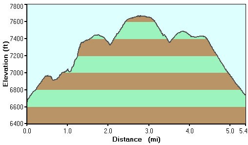
Hike up Gaddes Spring trail near Prescott, Arizona.
Mingus Mountain has been a real curse for my route finding abilities. After stumbling around to find the trailhead on Yeager Canyon, I managed to get good and lost on this hike as well. Acutally, I should never say I was lost. The correct phrase (according to the instructor that taught me orienteering) is that I was "Temporarily off map". Luckily, we were hiking this as an out and back, so I had a second chance to find the true trail.
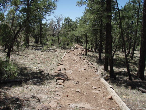
From the signed lower trailhead for Gaddes Spring #110, start hiking up the well defined old jeep road. There is a variety of shade provided by pine trees on this hike which makes for a pleasant walk. One issue with this trail is that it doesn't appear to get much maintenance, as there was a significant amount of deadfall on it. The problem for us was there is a critical trail junction we missed after 0.4 miles of hiking (Marked as JCT 1 on the map). There was so much deadfall here that we missed the trail jogging to the right and heading uphill. There was even a sign here, but since it was the same wood color as the trees, we missed that too. After much bushwhacking, GPS route finding, and a bit of swearing, we were able to get back on trail, but it wasn't nearly as enjoyable. My advice: Don't miss this turn. If the trail becomes difficult to follow, you will know you are off trail.
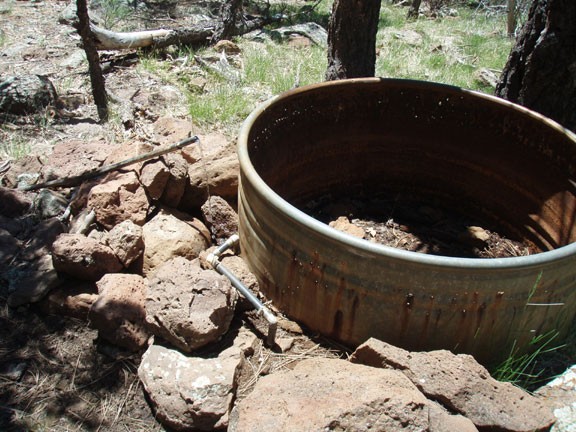
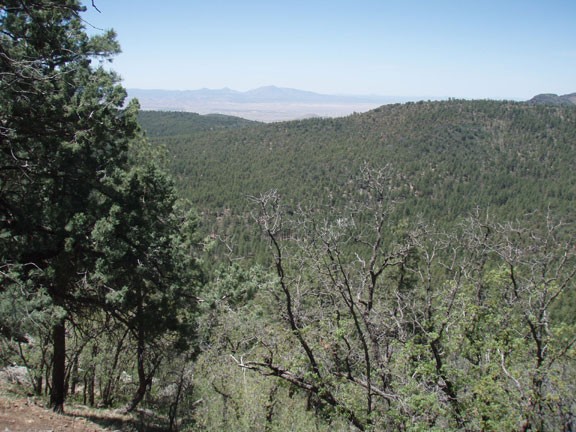
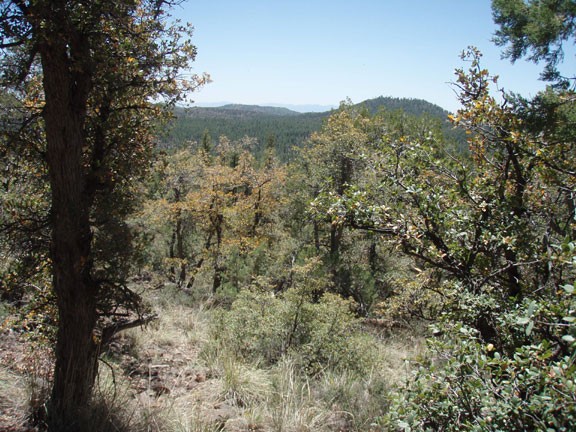
From the first junction, the trail switchbacks up Mingus mountain, once in a while providing nice views of the surrounding area. After the climb, you're rewarded by emerging onto a flat mesa, eventually joining an old road (JCT 2 on the map). This junction is signed. You'll walk another 0.4 miles along this old road until you leave the road again on a narrower signed trail junction (JCT 3 on the map). From this point on, this section of the trail is the most enjoyable, with large pine trees providing shade. You'll soon reach Gaddes Canyon, which may be running or dry depending on the rainfall and time of year. Climbing up out of the canyon, you'll see Gaddes Spring on your right. It is surrounded by barbed wire fence and looks unimpressive. However, look closely on the ground from this area across the trail and downhill. If you look downhill from here, you will see the actual spring, feeding an old rusted tank.
From the spring, it is a short 0.5 miles to the upper end of the trailhead at FR104B. We turned around here.
Some advise on the route finding. All the trail junctions are marked, so follow the arrows pointing towards Trail 110. In retrospect, it would have been easier to stay on trail if we had done it from the upper trailhead to the lower trailhead. If you desire, it is also easy to do this hike as a shuttle.
