
- Hikes in Arizona
- Northern Arizona
- Red Butte
Red Butte

Location
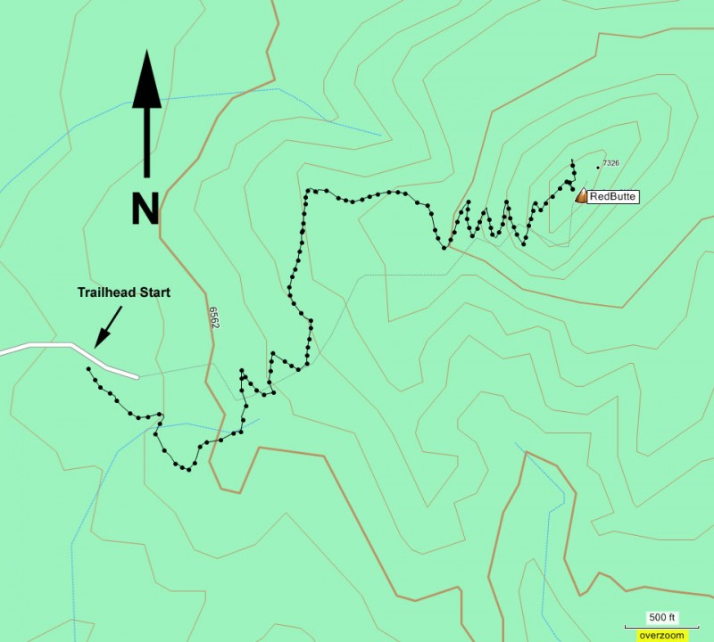
To the Trailhead start: From the Flagstaff area, take HWY 180 North West towards the south rim of the Grand Canyon. From the junction with HWY-64, turn North (staying on HWY 180) for another 10.4 miles. At the signed road junction for FR320, turn right (FR320 is also about 13.5 miles South of the Grand Canyon south entrance gate). Go about 1.5 miles on this well graded dirt road and turn left onto FR340. After 0.8 miles, turn right onto FR340A and head for the signed Red Mountain trailhead. You will reach the trailhead parking area after 0.3 miles.
Hike details
Season
- June
- July
- August
- September
Solitude
Difficulty
Permits
Hike up Red Butte in Northern Arizona.
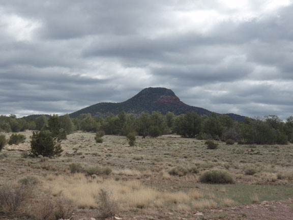
On the drive to the South Rim of the Grand Canyon, you'll notice a lone mountain keeping a solitary watch over the area. This mountain is known as Red Butte and there is a very pleasant trail up to the top of it. The Havasupai tribe consider this a sacred mountain, so please treat it accordingly.
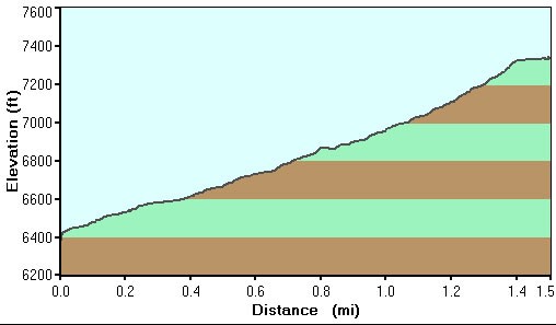
From the well marked trailhead, simply follow the trail as it heads up. The elevation grade is consistent and the trail is easy to follow. As you climb, you're treated to increasingly enjoyable views of the surrounding area. Since Red Butte is all alone in this area, it makes for a unique perspective.
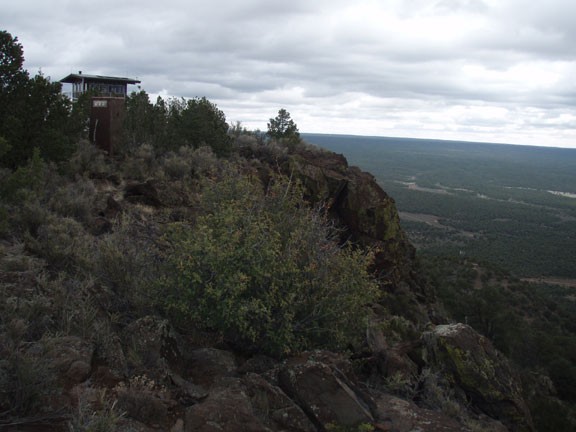
At the top there is a fire lookout, along with an outhouse and lots of great views. The San Francisco peaks are easily visible. Be sure to walk around the different sides of the butte to enjoy all of the different views.
When you've finished enjoying the top of Red Butte, return the way you came.
