
- Hikes in Arizona
- Superstition and Mazatzal Wilderness
- Millsite Canyon
Millsite Canyon

Location
To get to the trailhead: from the Phoenix area, take US-60 East from Apache Junction about 16 miles to Florence Junction. Another 1.5 miles on US-60 gets you to the unsigned junction with Queen Valley Road. Turn left and follow Queen Valley road for 1.8 miles to FR357 (Hewlett Station Road). Turn right on FR357 and go 3 miles. Make a left onto FR172 and drive 9.2 miles. At the signed junction, turn left onto FR172B (towards Woodbury Trailhead) and drive 0.2 miles. Park at the unsigned junction between FR172B and FR192B. From FR357 to the trailhead, you will need a high clearance vehicle for sections of the drive.
Hike details
Season
- January
- February
- March
- April
- October
- November
- December
Solitude
Difficulty
Permits
Hike Millsite Canyon in Superstition Wilderness, Arizona.
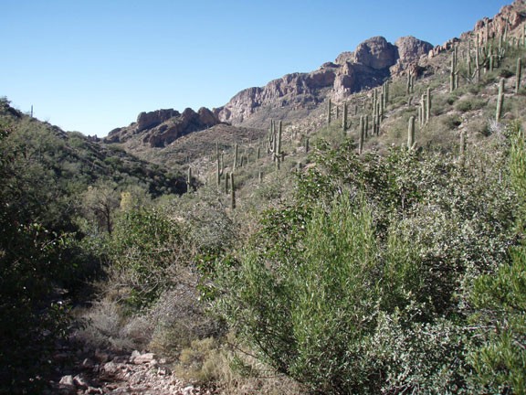
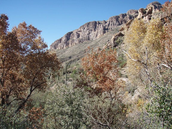
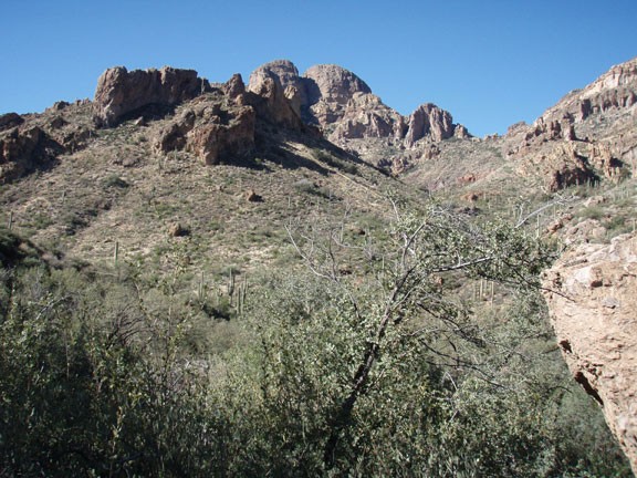
This trail follows a tough 4WD road and an old jeep trail through Milllsite canyon. The canyon itself is very scenic and this area of the Superstition is less heavily visited when compared to the Western trail access areas. In theory, this should be a less traveled trail. However, due to the trail's previous life as a jeep trail, ATV folks like to use it, even though the forest service has closed vehicle access to the trail.
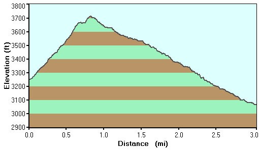
You could drive FR192B 1.1 miles to where the old jeep road starts, but it's a serious 4WD road, so it's better to walk it. From the junction of FR172B and FR192B, start walking up the road. The gravel is a bit crumbly here, which is not a problem climbing, but coming down can be a bit tricky. After 0.9 mile, you'll reach a gate (labeled as such on the map). Go ahead through the gate, closing it behind you. At 1.1 miles, you'll reach a junction (Jct 1 on the map). Turn left here and follow the more narrow jeep road through the start of the canyon. This is the section of the canyon that is closed to motor vehicles, but this is currently being ignored. The attraction of this area to both hikers and ATVs is easy to see. This desert canyon is quite scenic, with seasonal water running through the wash that adds to the ambiance. Since you're walking on old roads, the trail is easy to follow.
This old jeep road loops back up with trail 1900, but the Maverick Camp is a good place to turn around. You'll know you're at the camp because you'll see a stand of cottonwoods and colorful water loving trees surrounded by desert. Rattlesnake spring is here, along with water in the normally dry wash. It's a lovely place to explore for a bit and have some lunch.
When you're ready, return the way you came.
