
- Hikes in Arizona
- Prescott Area
- Hyde Mountain
Hyde Mountain


Location
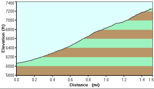
To the Trailhead: From the Phoenix area, take I-17 to the junction of HWY-69. Turn left onto HWY-69 towards Prescott. At the intersection between HWY-89 and HWY-69 towards the town of Prescott, turn left (HWY-69) and head towards downtown Prescott on Gurley Street. From downtown Prescott, turn right on Montezuma St. This turns into Iron Springs Road. When you reach Williamson Valley Road, turn right (North). Williamson Valley Road is also known as county road 5 and is a really enjoyable drive through grasslands, remote ranches, and mountains. You'll take this road about 22 miles to the signed turn for Camp Wood (turn left). This is FR 21, which you will follow for 15.2 miles to the signed junction with FR 95. Turn right onto FR 95 and drive 0.3 miles to the small trail marker sign for FR 95C (turn right onto this road). This area is kind of wide open with the road difficult to find. So look carefully for the FR 95C marker. Once you find FR 95C, follow this rocky road (high clearance vehicles required) about 2.0 miles to the signed start of trail #6. Park here where available.
Hike details
Season
- April
- May
- June
- July
- August
- September
- January
- February
- December
Solitude
Difficulty
Permits
Hike up Hyde Mountain in Prescott, Arizona.
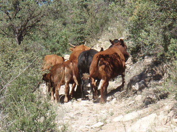
To start this hike, look for the brown trail marker labeled #6. Technically, this section of the trail is OK for ATV use, but it is not well suited for that... it's much better for hiking. We had an interesting encounter with a group of cattle. They were hanging out on the trail, but when we hiked to them, they wanted nothing to do with us. Unfortunately for all concerned, the direction they chose to run was up the trail. So we followed the cattle for the first 15 minutes of the hike before they finally figured out that they should probably leave the trail to avoid us. Leaving plenty of cow pies, they did wander off into the brush. There seem to be a healthy number of cattle in the area, so stay alert and don't mess with the angry bulls (the ones with big, pointy horns!). After about 1 mile, you'll reach a green gate that marks the end of the ATV allowed section of the trail (marked as 'gate' on themap). Go through the gate (closing it behind you). After passing through this gate, there is an unsigned fork in the trail. From what I've read, you can go either way and it meets up with the main trail. We went left and didn't see where it rejoined the trail. Best to be safe and take the left fork as well.
Another 0.25 miles up the trail is a signed junction with the Brown spring trail #5 (marked as 'WP1' on the map). Stay right here to stay on the Hyde Mountain trail #6. There are a couple of other signs you'll pass on the way up to the lookout. The trail can fade a bit, as it seems it does not get too much use, but the path is still relatively straight forward to follow.
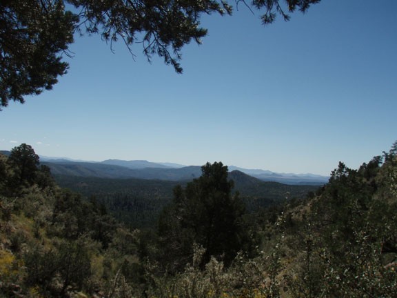
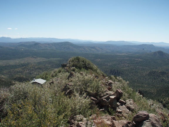
Soon the trail cuts across the southern face of Hyde Mountain, opening up impressive views to the South. After a few switchbacks, you'll see the fire lookout at the top. The reward for your climbing are the great views of the surrounding area as well as exploring around the fire lookout. This historic building is still in use as a fire lookout during the May-July timeframe.
After you've thoroughly enjoyed the different views and photographed the fire lookout from every unique angle, follow the same route back to your car.
