
- Hikes in Arizona
- Prescott Area
- Juniper Spring
Juniper Spring

Location
To the Trailhead: From the Phoenix area, take I-17 to the junction of HWY-69. Turn left onto HWY-69 towards Prescott. At the intersection between HWY-89 and HWY-69 towards the town of Prescott, turn left (HWY-69) and head towards downtown Prescott on Gurley Street. From downtown Prescott, turn right on Montezuma St. This turns into Iron Springs Road. When you reach Williamson Valley Road, turn right (North). Williamson Valley Road is also known as county road 5 and is a really enjoyable drive through grasslands, remote ranches, and mountains. You'll take this road about 36 miles (after 22 miles it turns to a dirt road in great shape). Soon after crossing an old metal bridge across Walnut Creek, you'll see a sign marking the turn for County road 125. This road is also in excellent shape. Turn left and follow this road for 1.5 miles to the signed parking for the Juniper Spring trailhead.
Hike details
Season
- May
- June
- July
- August
- September
- January
- February
- December
Solitude
Difficulty
Permits
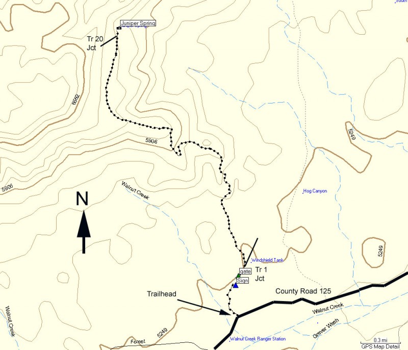
Hike to Juniper Spring in Prescott, Arizona.
From the parking area, bring out those route finding skills. There is a maze of dirt roads here, but the one you want is marked by a hiking marker labeled TR #1. Even though the trail you want is TR #2, follow this hiking marker on this relatively faint trail towards the right side of Juniper Mesa. There are some cairns to help you find your way. After 0.2 miles, you will see a sign for Juniper Spring trail 3.5 miles (labeled SIGN on the map). After 0.3 miles, you will cross through a gate in the fence (close it behind you) and a few steps after that is the junction between Trail #1 (to the right) and Trail #2 (to the left). This is shown on the map as GATE. The Juniper Spring trail is #2, so we will take the left fork.
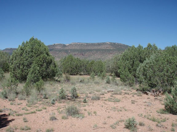
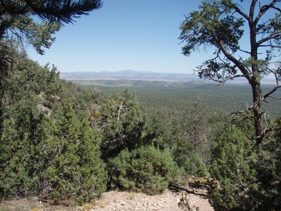
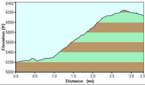
From this point, you can relax your route finding skills for a while, as the trail becomes much more defined and easy to follow. You will gain elevation gradually through a Juniper forest that are spaced well enough for impressive views of the area. This is a quiet and thoughtful place. Hopefully you will have the same solitude as us, so it's best to relax and enjoy the walk.
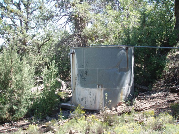
Eventually the climb will peak out at about 6200 ft, where the trail starts to descend again. You may need to do some route finding again here, as the trail gets a bit more faint. You'll know you've reached Juniper Spring when you see the large metal water tank and a wooden building used to feed livestock. Depending on the time of the year and the rainfall, the spring may or may not be flowing, but the water tank should have water in it. This is an interesting area to explore for a bit, have lunch, and enjoy the wind blowing through the trees. Trail #20 is also here, leading up to the rim of Juniper Mesa.
When you're ready to leave the peacefulness of this area and return to civilization, follow the same route back to your car.
