
- Hikes in Arizona
- Prescott Area
- Maverick Mountain
Maverick Mountain
Location
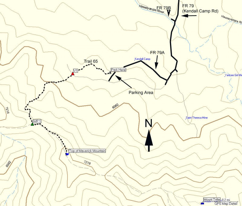
To the Trailhead: From the Phoenix area, take I-17 to the junction of HWY-69. Turn left onto HWY-69 towards Prescott. At the intersection between HWY-89 and HWY-69 towards the town of Prescott, turn left (HWY-69) and head towards the town of Prescott on Gurley Street. Not long after this turn-off, you will turn left (South) on Mount Vernon Street. From this point, it is 6.7 miles on a paved road (Known as the Senator Highway and FR-52)to the end of the pavement. From the end of the pavement, go another 0.3 miles and turned right at FR79, which is signed as Whispering Pines Camp. After 1.8 miles you will pass the turn for FR79B (stay left) and cross the Hassayampa River (really more of a creek). After 0.4 miles, turn right at a clear fork (but unsigned). In 0.2 miles, turn right at the sign for the Kendall Camp Trail 65. This last sign has seen some abuse from firearm enthusiasts so it may not be readable when you take this hike. Go another 0.7 miles on this increasingly rocky road (high clearance recommended) until you see a wood fence on your right. The parking area is just ahead where the road forks. You could continue on (right) to the actual trailhead (about 0.2 miles away), but unless you're on a ATV I wouldn't bother.
Hike details
Season
- May
- June
- July
- August
- January
- February
- December
Solitude
Difficulty
Permits
Hike up Maverick Mountain in Prescott, Arizona.
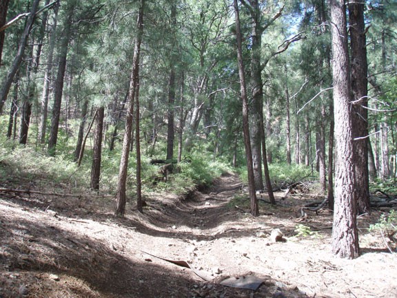
Navigating to the trailhead is the trickiest part of this hike. Hopefully the directions above guided you sufficiently to where you are standing next to the orchard that marks the remains of Kendall Camp. Follow the signs that mark Trail 65. The first part of this hike is along the quickly narrowing dirt road to the section of trail closed to motor vehicles. It's only about 10 minutes walking away (marked as V1 on the map).
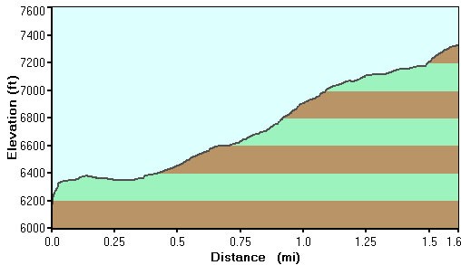
Trail 65 has a few junctions, but each is marked with trail markers so it is easy to follow. The narrow road becomes a trail and starts the 900 ft climb to the top of Maverick Ridgeline. The trail is shaded with pine and Oak trees, which makes the walk quite pleasant.
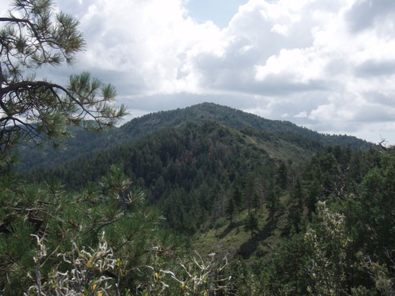
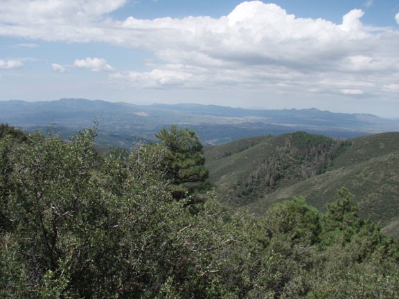
After about 1.3 miles of hiking you reach a ridgeline and a dirt road that has been closed to vehicle traffic. Turn left here (WP1 on the map) and follow the trail to the highest point on the Maverick ridgeline. Your climb is rewarded with views of Mount Tritle, Prescott, and the surrounding Bradshaw mountain range. After enjoying the views for a bit, turn around here and return the way you came.
