
- Hikes in Arizona
- Prescott Area
- Thumb Butte Trail
Thumb Butte Trail

Location
To the Trailhead: From the Phoenix area, take I-17 to the junction of HWY-69. Turn left onto HWY-69 towards Prescott. At the intersection between HWY-89 and HWY-69 towards the town of Prescott, turn left (HWY-69) and head towards the town of Prescott on Gurley Street. After passing through the downtown Prescott area, soon Gurley street turns into Thumb Butte Road. After the road changes to Thumb Butte road, the Thumb Butte day use parking area appears on the right after about 1.5 miles. There are toilets and water at this spacious trailhead.
Hike details
Season
- June
- July
- August
- January
- February
- December
Solitude
Difficulty
Permits
Hike the Thumb Butte trail in Prescott, Arizona.
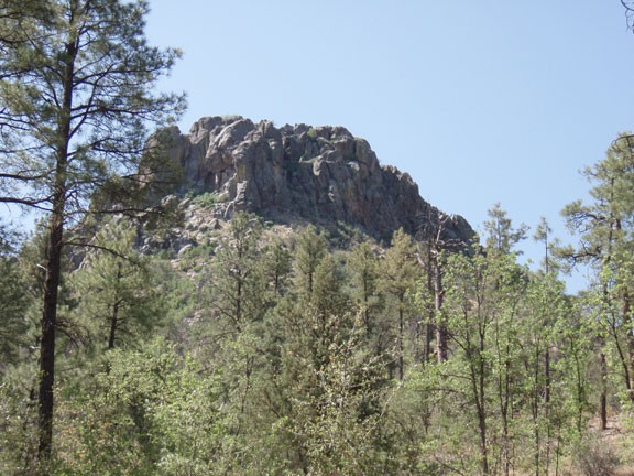
Thumb Butte stands as a sentry over the sprawling town that Prescott is becoming. East to see from nearly everywhere in town, there is also a nice and short climb to *almost* the top of this landmark.
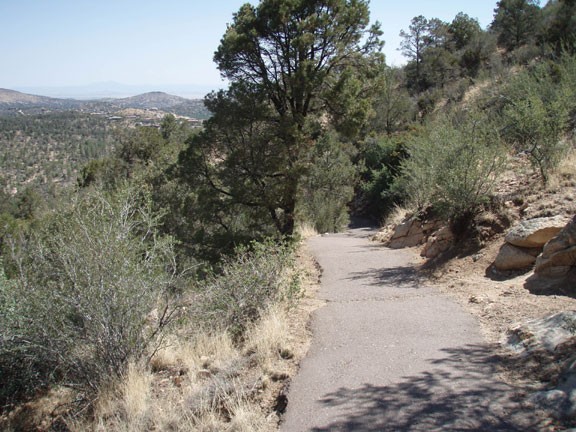
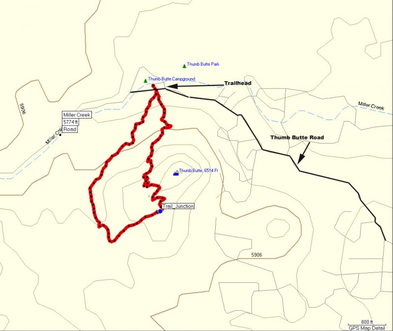
From the parking area, cross to the other (South) side of Thumb Butte Road and follow the paved trail for trail #33. The trail splits here, to the left the trail is paved all the way to the top via steep switch backs. To the left, the trail is more gradual dirt to the top. Pick which ever direction suits you. This hike describes the clockwise loop.
Turn left at the trail junction and follow the paved switch backs up the side of Thumb Butte. As you climb, you will quickly leave the pine shaded trailhead and will hike through the more sun exposed Pinyon-Juniper forest. One nice thing about this trail is you will get good views with just a little climbing effort. Views on this side of the trail include the city of Prescott, little granite mountain, granite mountain, and Bill Williams mountain.
After reaching the high point of this hike, views open up to the south, where you can enjoy views of the Bradshaw mountains and the Sierra Prieta range. On the return path, the trail turns to dirt. Stay right at any trail junction to stay on trail #33 back to the parking area.
