
- Hikes in Arizona
- Prescott Area
- Grapevine trail
Grapevine trail

Location
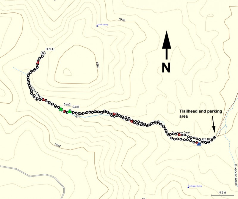
To the Trailhead: From the Phoenix area, take I-17 to the junction of HWY-69. Turn left onto HWY-69 towards Prescott. After about 12.2 miles, make a left turn at mile marker 274 (the road is not signed). Take this well graded dirt road for 2 miles. There are a number of forks on this road but if you stay on the main road (or what appears to be the most traveled road) you will be OK. After about 2 miles on this road, the road becomes very rocky and only high clearance vehicles can continue. This is not a road you want to be on when it is wet. Drive 0.7 miles to a green gate. Hopefully the gate is unlocked and you can drive through it (closing it behind you) and drive another 0.7 miles to the trailhead and parking area.
Hike details
Season
- May
- September
- October
- January
- February
- December
Solitude
Difficulty
Permits
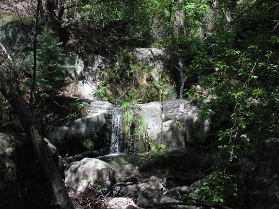
Hike along the Grapevine trail near Prescott, Arizona.
Driving to the trailhead, you would never know that soon you will be walking among tall pine trees, walnut trees, oak trees, ferns and plenty of squirrels and such inhabit this unique area. You may be wondering why this is called the Grapevine Trail. Keep your eye out for the grapevines later in the hike.
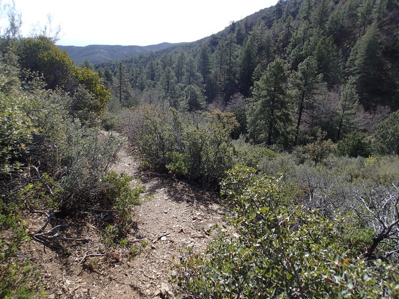
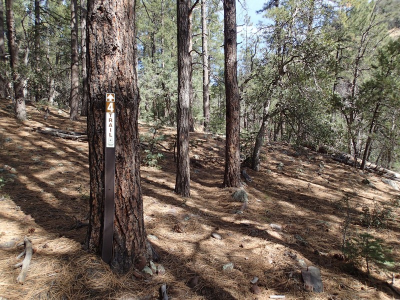
From the parking area, you will quickly reach the trail junction for trail #9434 (signed) heading left across the creek and trail #4 (signed) (JCT 1R on the map). Stay right to stay on Trail #4. The trail will cross the creek a few times. Depending on the time of year, there should be a bubbling creek to serenade you on this section. After about 0.5 miles of hiking, the trail will climb out of the creek area and provides some good views. The foliage is significantly different along this section, more desert scrub and cactus. In addition, there is no shade on this section.
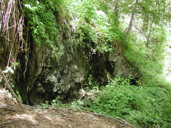
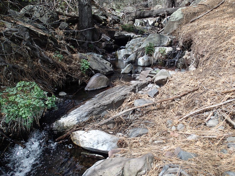
The trail returns to the creek near a gate to a fenced off section of the forest. Go through the gate (close it behind you - GATE1 on the map) and enjoy walking along the creek again under the shade of pine trees. The last time we did this hike (2006), there was a lush forest and ferns at our feet. Seems there was a flash flood recently that caused nature to reset itself in this area. As the years go by, this thick foliage is sure to return. You'll soon exit from a second gate, so close that one behind you as well (GATE2 on the map).
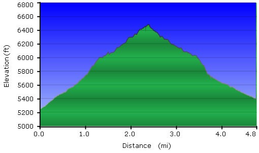
After about 1.7 miles of hiking, you will reach the spring that feeds this creek. On the right is an obvious rock seep and on the left is a spring. In previous years, the forest had been quite dense here. Now it is more open and lighted for pictures, but as a result is not as scenic. The hike continues to climb, eventually parting from the creek up to a saddle. There is another fence here and the trail continues for a bit, but we found this was a good place to stop, have some lunch, and enjoy the area.
When ready, return the way you came.
