
- Hikes in Arizona
- Prescott Area
- Granite Mountain
Granite Mountain

Location
To get to the trailhead: from the Phoenix area, take I-17 North to Cordes Junction. Take HWY-69 towards Prescott here. Traveling into Prescott from this route, the main street becomes Gurley St. Once you get to downtown, turn right (North) on Montezuma. This road soon becomes Whipple St., then it becomes Iron Springs Road. Keep an eye out for Granite Basin Road and make a right on this road. Take this paved road 3.9 miles to the signed parking for the Metate trailhead. As of May 2014, there is a $5 day use fee for this area. This trailhead has both restrooms and water.
Hike details
Season
- May
- June
- July
- August
- September
- January
- November
- December
Solitude
Difficulty
Permits
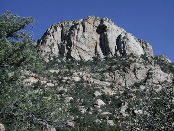
Hike up to the top of Granite Mountain near Prescott, Arizona.
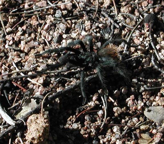
We took this hike a few days after a healthy rain. The snow at the top gave Granite Mountain an added level of charm. The day was warm enough to melt the snow, so the trail was a little muddy and wet. Still, we really enjoyed this hike.
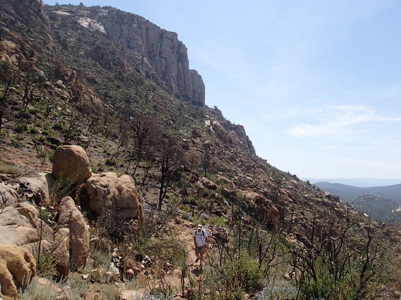
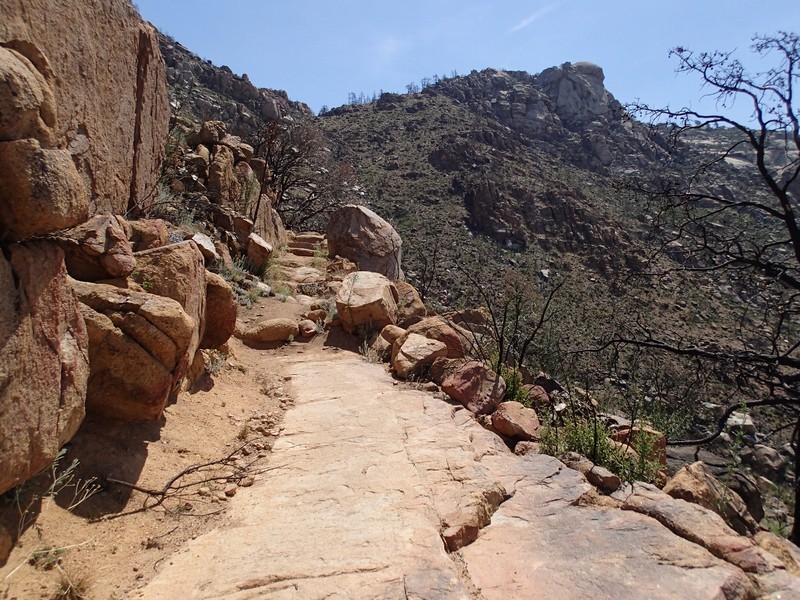
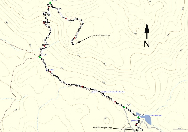
From the well marked parking area, pay your $5 like a good citizen and cross the road to find the Granite Mountain trail (TR# 261). The trail crosses a normally dry creek (which had water in it during our hike) and stays flat for a little while. This trail is well signed, so stay on TR#261 for the duration of this hike. Stay right at the signed trail junction (JCT_1R on the map) and again at the unsigned trail junction with the dirt road (JCT_2R on the map).
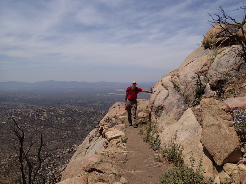
After 1.8 miles you reach the signed trail junction at Blair Pass (JCT_3R). There is a gate here that leads to two other trails. Don't go through this gate, instead turning right and following the trail as it heads towards Granite Mountain. Continue to follow this trail as you pass by the climbers trying their luck on the excellent climbing rock of Granite Mountain. Watch the skies for a glimpse of the endangered Peregrine falcons that like to nest in this area.
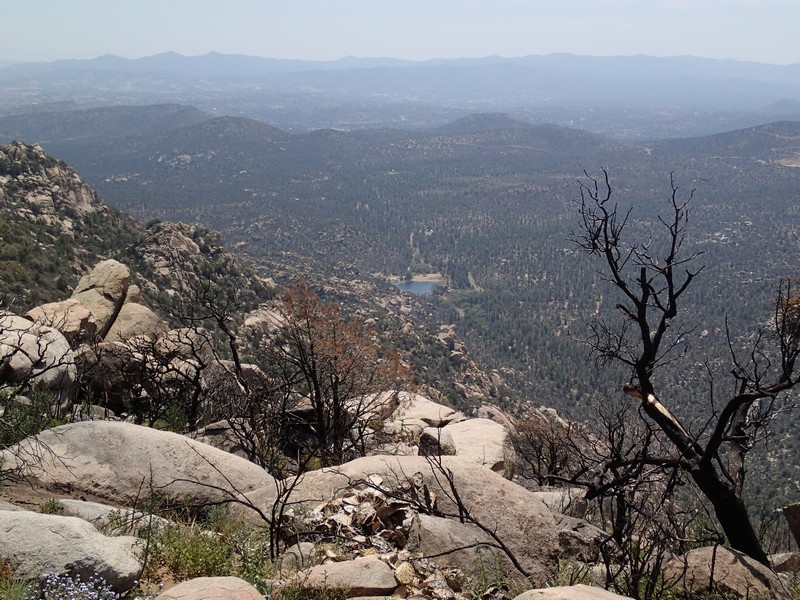
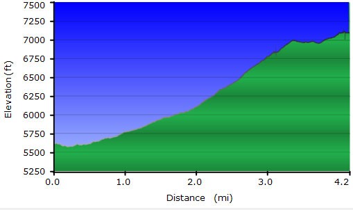
After 4.2 miles of hiking and a total elevation gain of 1400 ft, you will reach the Granite Mountain vista. Find a nice rock to enjoy your lunch and the surrounding views. You can easily see the city of Prescott from here, as well as a good view of Thumb butte and the Bradshaw mountains behind.
Return by the same route.
