
- Hikes in Arizona
- Grand Canyon / Marble Canyon
- Whitmore Trail
Whitmore Trail

Location
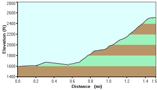
Hike details
Season
- April
- May
- September
- October
- June
- July
- August
Solitude
Difficulty
Permits
Hike the Whitmore trail in Grand Canyon national park, Arizona.
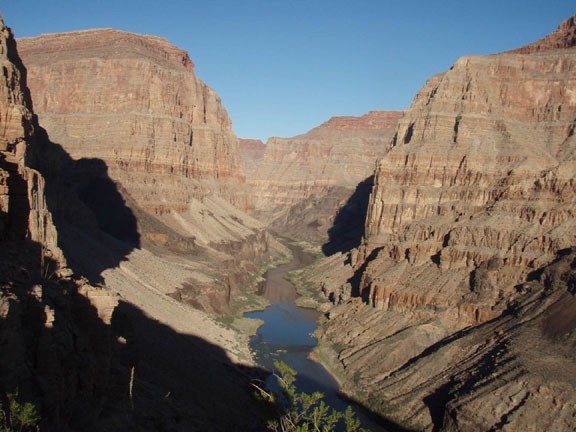
Ready for a change of pace? How about a hike that goes up the side of the Colorado River canyon instead of one that goes up one of it's narrow side canyons. The Whitmore trail has a long history, with the Bar 10 Ranch still offering assistance to river rafting companies today from this trail and their helicopter pad downstream. The ranch is 9 miles away from the rim wall, so you'll have the views at the top all to yourselves.
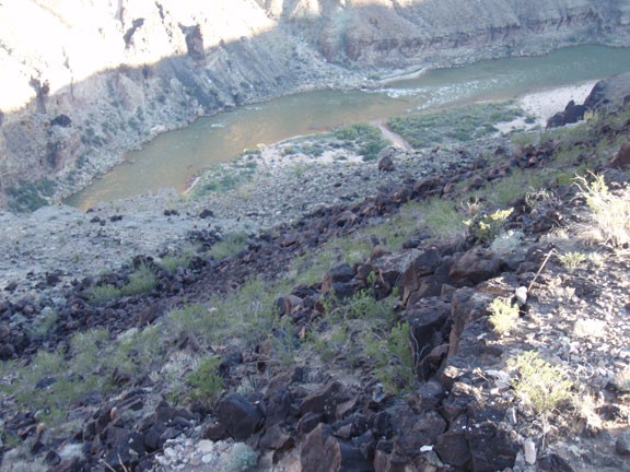
The tricky part is finding the trail. If you head straight back towards the wall from the beach, you'll see a well worn trail along the base of the canyon wall. Take this trail as it heads up over the tamarisk and back down to the river. Keep your eyes open here for some rock art on the open rock to your left. They are high on the wall, making them easy to miss. As the trail heads back down towards the water, keep an eye out on your left for the trail heading up the wall of the canyon. The trail is in excellent shape so you'll make good progress up the wall of the Grand Canyon.
Be sure to stop once in a while to enjoy the increasingly impressive views up canyon from the trail. Eventually, your climbing is rewarded with a Park Service boundary sign and views of the Grand Canyon as well as Whitmore canyon. If you explore around the top a bit, you can even see an old shack still used by the ranchers today.
