
- Hikes in Arizona
- Grand Canyon / Marble Canyon
- Deer Creek Falls and Narrows
Deer Creek Falls and Narrows
Location
Hike details
Season
- April
- September
- October
- June
- July
- August
Solitude
Difficulty
Permits
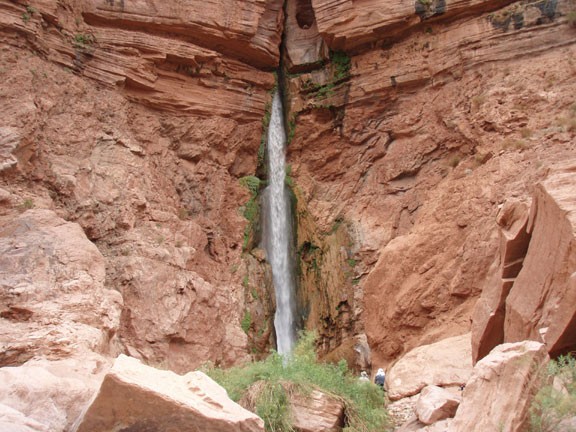
Hike to Deer Creek falls and Deer Creek Narrows in Grand Canyon National park, Arizona.
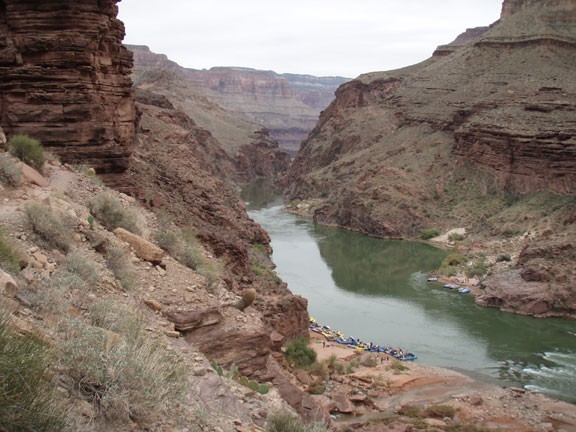
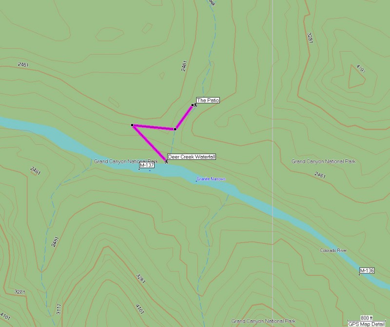
Deer creek falls is an unmistakable landmark noted while floating on this section of the canyon. With the abundance of campsites nearby and the available beaches to pick, stopping here is a popular choise for river rafting parties. You could easily spend some time enjoying Deer Creek falls, but a hike to the narrows above the falls really adds to the enjoyment of the area.
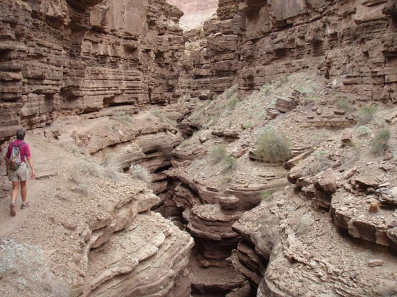
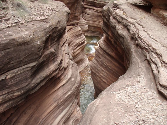
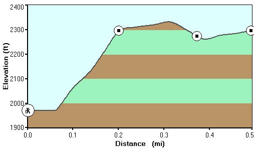
From the falls, there is a rocky trail on the left that gains elevation quickly. Be sure to check out the views up and down river as you walk higher. Soon the trail switches back and forth for a bit before requiring some scrambling to get to the same elevation as the mouth of the Deer Creek Narrows. Here there is a well defined trail, but there is some exposure to the creek running below, so it is best to go slow and watch your feet. This is the most enjoyable section of the hike anyway, so going slowly allows you the best views of the narrows below.
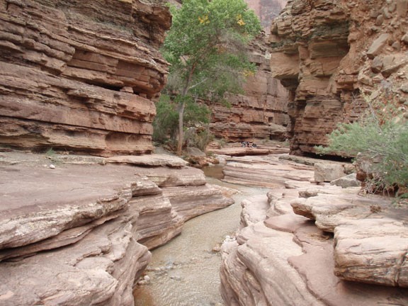
A short distance through the narrows gets you to a location known as the patio. There is a huge cottonwood growing here and it is easy to see why this is a popular stopping point. The mouth of the canyon opens here to the Deer Creek Camping area but at this point the narrow creek is still enjoyable. Some may want to play and swim at this location. Others will want to snap those pictures down canyon. Whichever you choose, this is your turn around point. Return the way you came.
You could continue hiking about 3/4 of a mile on well worn trails to the source of Deer Spring, but we ran out of time on our trip.
