
- Hikes in Arizona
- Grand Canyon / Marble Canyon
- Hermit trail to Santa Maria Spring
Hermit trail to Santa Maria Spring


Location
From Flagstaff, take HWY 180 north towards the Grand Canyon. Once you enter the park, you'll head towards the Grand Canyon Village. During the busy season, you will need to take the shuttle from Grand Canyon Village to the Hermit Rest trailhead.
Hike details
Season
- March
- April
- September
- October
- June
- July
- August
Solitude
Difficulty
Kids in good shape can make this hike with adult experience and supervision. Grandma can hike on it a little while, but then it's back to the nice Ranger talk at the rim about geology.
Permits
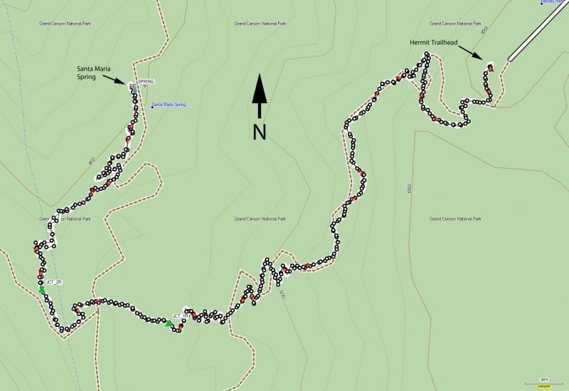
Day hike to Santa Maria spring via the Hermit trail in Grand Canyon National Park, Arizona.
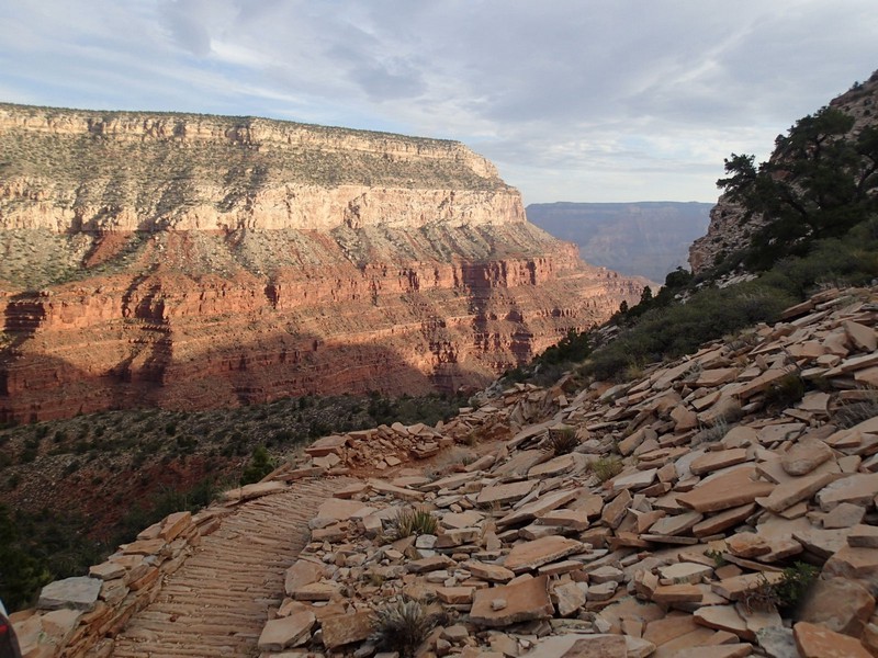
Less crowded and with the same spectacular views, the hermit trail is hidden away at the west edge of the popular South Rim of the Grand Canyon. To get to the trailhead, take the (free) shuttle from the Grand Canyon Village to the Hermit Rest stop. Allow 60 minutes for this, as the shuttle makes seven stops on the way for the gawking tourists. At Hermit Rest is a gift shop, restrooms, and water.
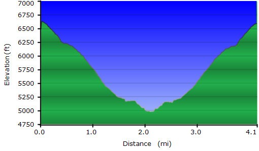
While the trail goes all the way to the Colorado River, stopping at the rest house at Santa Maria spring makes for a nice 1/2 day hike. Although this trail is not maintained, it is still in reasonably good shape. As the trail descends down the white sandstone region, enjoy the work put in by the Santa Fe railroad when they built this trail in 1910. After 1.2 miles of hiking, you reach the junction of Waldron trail, which is an alternate route to the rim of the canyon. Stay on the Hermit trail by keeping right here (JCT_1R on the map). After 1.5 miles of hiking, you reach the junction of Dripping Springs trailhead. Again, stay on the Hermit trailhead by keeping right (JCT_2R on the map).
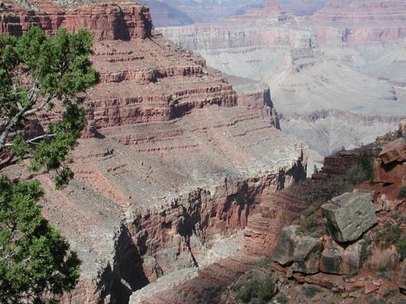
By now you are firmly in the red Hermit Shale region of the Canyon. You will enjoy the increasing view of Hermit Creek canyon as it opens up to the greater Grand Canyon. After 2 miles of hiking, you reach a small rest hut that sits next to Santa Maria Spring. The spring is a small trickle, but it does flow into a tin bathtub size container. Be sure to treat any water you take from this spring.
The rest house is a nice place to take a break, with shade and comfortable places to sit. It also marks the turnaround point of our hike.
If you are interested in going all the way to Hermit Campground, the total distance is 7.6 miles and 3800 ft elevation loss.
