
- Hikes in Arizona
- Grand Canyon / Marble Canyon
- Thunder River and Deer Creek
Thunder River and Deer Creek


Location
Take HWY 67 South from Jacobs Lake, AZ. Turn west (Right) on FR22 and zero your odometer. After 2.1 miles, go straight to stay on FR22. After 10.3 miles, turn right to stay on FR22. After 17.4 miles, turn left onto FR425. After 25.1 miles, turn left to stay on FR425. After 27.4 miles, turn right to take FR292. After 27.6 miles, turn right to stay on FR292. After 28.9 miles, go straight to take FR292A which will take you all the way to the start of the trailhead (odometer reading 30.5 miles when you reach the Bill Hall trailhead). The Forest Roads are are in decent shape and usually do not need 4 wheel drive to take. A high clearance vehicle would be helpful in spots. Since the opening of the North Rim of the Grand Canyon is not until mid May, depending on snows, HWY 67 may not be open until June. This road closes at the first heavy snowfall (usually November). Buy a good map before trying to find this trailhead.
Hike details
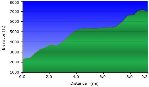
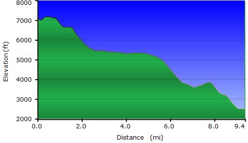
From Upper Tapeats to Colorado River, 2.5 miles
From Colorado River to Deer Creek via the river route, 3.5 miles
From Deer Creek back to the Bill Hall Trailhead, 10.1 miles.
Season
- May
- October
- June
- July
- August
Solitude
Difficulty
Leave the kids at home. Don't even mention this hike to Grandma... it would probably give her a heart attack just listening to the description
Permits
An epic hike on the North Rim of the Grand Canyon National Park to Thunder river and Deer Creek.
This hike describes a multi-day loop hike from the top of the North Rim, all the way down to the Colorado River, and back up a different route. For an excellent detailed description of this hike, please see Ron Adkinson's book on hiking the Grand Canyon in the Suggested Reading Section.
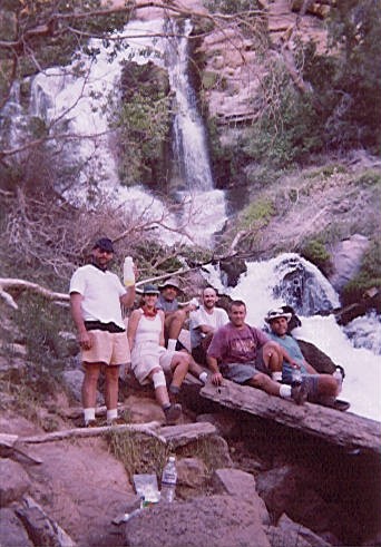
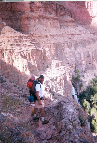
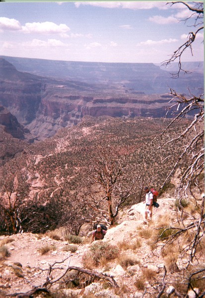
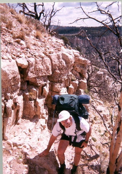
The hike begins at the Bill Hall Trailhead. Look for the Cairns marking the steep decent from Monument point. We missed these Cairns because we couldn't believe a trail descended from them... but it does. There's a fun down-climb here that you should probably shed your pack for. The Bill Hall trail meets up with the Thunder River Trail (JCT_1L on the map). The hike continues along the Esplanade range. There is no water on the Esplanade and this is where you will most likely want to camp on your final day soSTASH AT LEAST 1 GALLON of H2O per hiker! The hike descends again into Surprise Valley. From Surprise Valley, you meet up at the trail junction between Deer Creek Trail and the Thunder River Trail. Stay left (JCT_2L on the map) and use the Thunder River Trail to descend into Tapeats creek. As you begin your descent into Tapeats creek, you will hear Thunder River. Be sure to fill up your water at Thunder River and spend some time in the cool canyon. We camped at the Upper Tapeats Campground for the first night. (CAMP1 on the map)
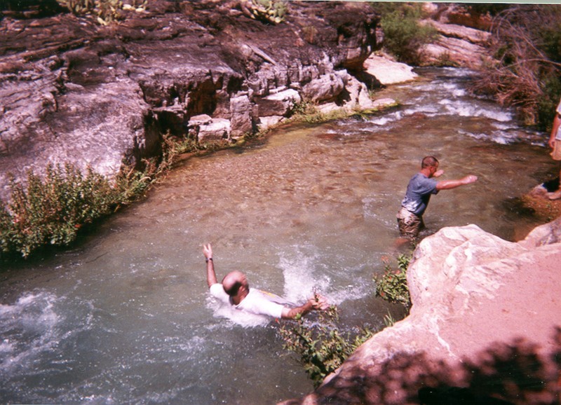
The next day we hiked down the Tapeats creek to the Colorado River on the West side of the creek. This hike gains and loses significant elevation, so it's much more strenuous than the 2.5 miles to the river suggests. It's very easy to miss the trail here as well. Fill up your water at the Colorado (treat the H2O) before continuing. At the Colorado, a trail skirts downstream of the river for a bit, walking along the beach, then turns uphill and heads away from the Colorado river and towards Deer Creek Valley. There is no shade on this route, so try hiking it early in the day or late in the evening if the temperatures are high. The trail eventually winds into Deer Creek Valley. We camped here on the second night. (CAMP2 on the map)
The following day, we hiked up to Deer Springs (the spring that feeds Deer Creek) and filled up all the H2O we could. Don't miss the creek crossing (CROSS CREEK HERE on the map) when you make the right turn to the spring. We then continued the killer climb up to our cached water on the Esplanade. There's not much shade in Surprise Valley and the Esplanade, so if you find your hiking either in the middle of the day, find some shade and wait it out until the sun dips down and temperatures drop. We eventually found our water cache and camped here the third night.
The following day was a quick ascent to the summit, parked cars, showers at the North Rim, and one amazing memory.
SPECIAL STUPID HIKER WARNING:
When we hiked this, we made several mistakes:
* We took along a hiker that did not have Grand Canyon hiking experience. They bought new shoes a few days before the hike, packed way too much crap, and slowed down the entire group. Experienced Grand Canyon hikers on this hike only!
* Some of us did not stash enough water at the Esplanade and were forced to continue the hike out to reach water. Stash at least 1 gallon per person!
* The weather was unseasonably hot and we drank much more water than we predicted.Bring enough water and check the weather!
* We got a very late start (10am) on the trail for the first two days and it really took it's toll on us as we ended up hiking in the heat of the day. Some of the rocks were hot to the touch, which made scrambling that much more painful. Hike early and late!
* We lost the trail between Deer Creek and Surprise valley and it cost us a good hour of hiking in the wrong direction that we could ill afford. Bring a topo map!
As expert hikers, we should know better. Don't make the same mistakes we did.
