
- Hikes in Arizona
- Tucson Area and Southern Arizona
- Sycamore Canyon
Sycamore Canyon


Location
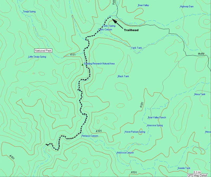
To get to the Trailhead: From the Tucson area, take I-19 South towards Nogales. At exit 12, turn right (West) towards Sycamore Creek on HWY-289. Drive 10 miles on this paved road and make a left turn towards Arivica. Take this graded dirt road 9 miles to the signed turn to Sycamore Creek. This road dead ends after 0.3 miles at the parking area.
Hike details
Season
- April
- May
- September
- October
- January
- February
- December
Solitude
Difficulty
Permits
Hike Sycamore canyon, Arizona.
From the parking area, follow the trail leading from the end of the road towards Sycamore Canyon. Sycamore Canyon is well shaded in many places with Oak and Sycamore, making this hike an enjoyable one. The other nice feature of this hike is that it is nestled in the Parajita Wilderness, which equates to hiking in a secluded setting. There may be trails to follow, but more often than not, they peter out and you need to do some rock hopping to make your way down the canyon.
The hike starts at the ruins of an 1880s ranch. The Hank and Yank ruins are named after these would be ranchers, who were chased away by native Americans. They left some ruins of their attempt behind, such as the adobe wall near the start of the trail.
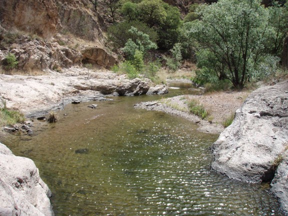
After the first mile of hiking, the pools start to appear. They get more picturesque in some of the narrows down canyon. There are a few pools that will require creativity to get around without getting wet, but all can be navigated successfully with some scrambling. If it's warm enough, you should consider a swim. The towering walls of the canyon are decorated with spires and hoodoos, which shrink down on occasion to create narrows. Progress down canyon alternates between game trails, rock hopping, and bushwhacking. Don't worry too much about getting lost, as the hike retains its canyon environment for the duration. There are a few side canyons that pop up once in a while but they are not difficult to distinguish from the main canyon. I recommend taking this canyon slowly and enjoying all the pools and narrows. After about 2 hours of hiking, we found a pool and relaxed with lunch, a swim, and a nap. It makes for a great day in the outdoors of Arizona.
The end of this hike is whenever you want to turn around... or the Mexico border 4.5 miles from the trailhead. I have not been this far, but the border is reportedly marked by a barbed wire fence and a sign.
