
- Hikes in Arizona
- Tucson Area and Southern Arizona
- White Canyon
White Canyon


Location
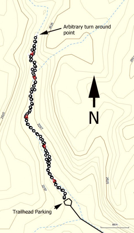
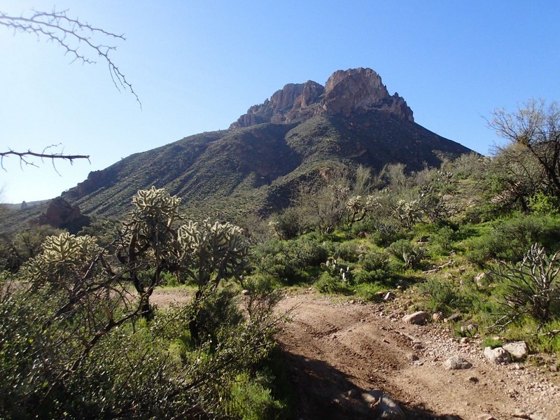
From the Phoenix area, take US-60 East to the town of Superior. Once in Superior, take HWY-177 South 9.6 miles to Battle Axe Road (on right). It's a 4.5 mile drive on a dirt road to the trailhead. A high clearance vehicle is highly recommended. After 1.6 miles, stay right at the fork at the coral. At 1.9 miles, stay right again at the fork. After 3.3 miles, there is a narrow spot in the road, just after a cattle guard. After 3.8 miles, stay right again (to the left is a pretty neat spring). At 4.4 miles, you'll reach a barb wire fence, after which is a steep downhill. This is a pretty serious hill, 4WD recommended. If you are worried about getting back up this hill, this would be a good place to park and walk the short distance to the trailhead parking. If you're confident in your vehicle and your driving abilities, head through the barb wire fence (close it behind you). After 4.5 miles, leave the main dirt road and turn right. Drive the short distance (staying left) to a small turn around. Park here and start walking along the trail next to the brown Wilderness trail marker to the trail register (about 100 yards from the parking area).
Hike details
Season
- March
- April
- September
- October
- June
- July
- August
Solitude
Difficulty
Permits
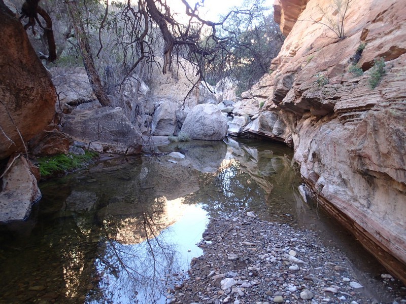
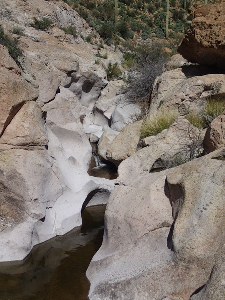
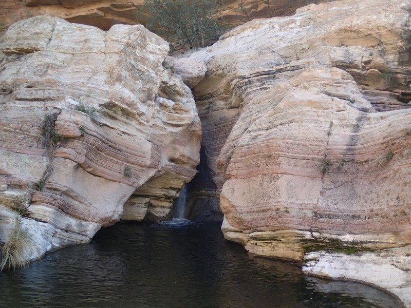
Hike up White canyon near Phoenix, Arizona.
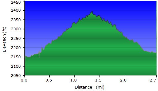
The White Canyon Wilderness is not well known among most Arizona hikers, which makes it an especially good place to find desert solitude. The best time to take this hike is in the Spring, hopefully after some rains. When we took this hike in February, it was a few days after some heavy rains and as a result, water was flowing throughout the canyon. From the small parking area, try to find a worn trail headed up canyon. After about a hundred yards, there is a trail register. You'll notice this trail does not get many visitors. You'll need good route finding skills for this hike to stay on the easiest path. Expect some minor bushwhacking and boulder hopping on this hike. If you were able to time this hike well, there are several lovely pools of water and even some waterfalls. Cairns will frequently point the fastest method up canyon, so keep a sharp eye out for them. The turn around point is arbitrary. We turned around when the cairns disappeared and the scrambling and bushwhacking became unpleasant.
