
- Hikes in Arizona
- Tucson Area and Southern Arizona
- Aravaipa Canyon
Aravaipa Canyon


Location
To get to the West trailhead: from the Phoenix area, take US-60 East toward Superior, AZ. At Superior, turn South on HWY-177 towards Winkleman. Continue South on HWY-77 for about 11 miles to signed Aravaipa Canyon Road on your left. The road turns to dirt and it's another 12 miles to the BLM trailhead. The well graded dirt road is usually in good shape, even for passenger cars. There is a pit toilet at the trailhead.
To get to the East trailhead: from the Phoenix area, take US-60 East to Globe. From Globe, take HWY-70 to the signed Klondyke road. Turn right and take this well graded dirt road 24 miles to Bonita Junction. Turn right and take the high clearance vehicle dirt road 17 miles to the trailhead.
Hike details
- Out and Back
- One way - Shuttle
Season
- April
- May
- September
- January
- February
- December
Solitude
Difficulty
Permits
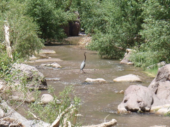
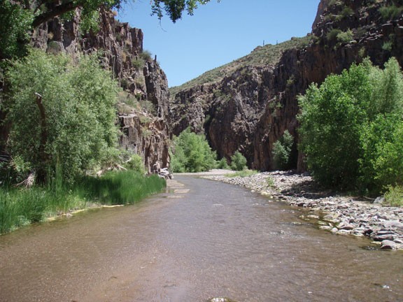
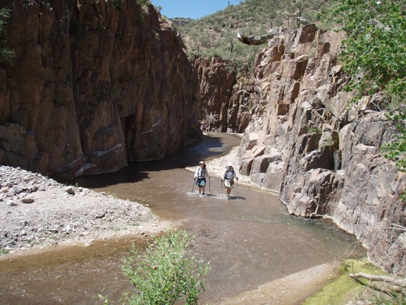
Hike up Aravaipa Canyon, Arizona.
Most of the hiking you will do on this hike will be in the creek. It's definitely a different kind of hike than most. There is no marked trail as you just follow the creek the entire hike. You will get wet and your progress will be slow. Don't be frustrated, relax and enjoy it. There's lots of vegetation and shade on this hike. As an added bonus, hiking in the creek is about 10 degrees cooler than hiking in the nearby desert.
I've never entered from the East trailhead. The hikes we've done have been day hikes from the West trailhead and just hiking as far as we felt like.
At the start of the hike (West trailhead) be aware of the private property on the left of the creek. Stay right and avoid private property so we can continue to enjoy access to this area. You'll be in Nature Conservatory owned land to start. After about a mile, you'll enter the wilderness.
Footwear is an important consideration on this hike. Boots will provide good ankle support, but will carry water and make the hiking more strenuous. Tevas will drain water, but are unstable in the water and pick up pebbles very easily. I found draining, closed toed water shoes plus a liner sock works well for me.
There's plenty of wildlife in the canyon. We saw several groups of Javelena as well as a Arizona Diamondback Rattlesnake (a little too close up for our comfort).
There's lots of side canyons to explore as well. For full enjoyment of this area, you might want to camp a night and spend some time exploring the side canyons during the day.
