
- Hikes in Arizona
- Tucson Area and Southern Arizona
- Picacho Peak
Picacho Peak


Location
From the Phoenix area, take I-10 South to the Picacho Peak Road Exit (Exit 219). Make a right turn at Picacho Peak Road and follow the road into the park. Follow the signs to the trailhead.
Hike details
Season
- March
- April
- June
- July
- August
All year (hike early in the day during the summer)
Solitude
Difficulty
30 yr old Recommendation: It's not a difficult climb and the views are good. The climbing with the cable hand holds are lots of fun. This is a medium difficulty hike.
Permits
Hike up Picacho Peak near Tucson, Arizona.
This trail is well marked and located between the Tucson and Phoenix areas. These two facts make it a very popular trail on weekends. There's a small fee to enter the Picacho Peak State Park (as of April 2009, the fee was $6).
This area is also the setting of the only Civil War battle fought in Arizona.
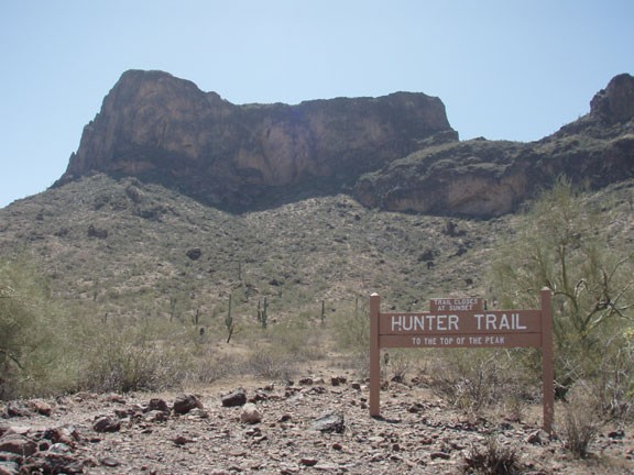
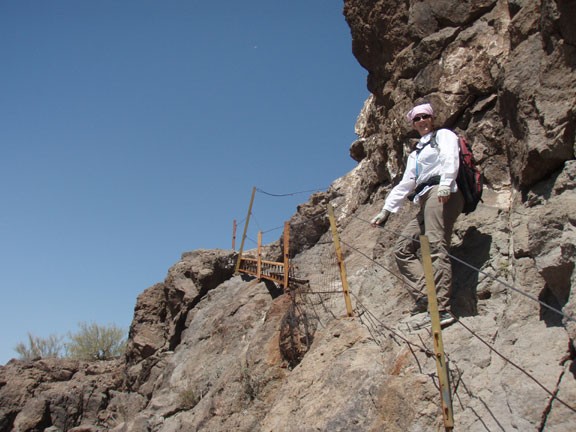
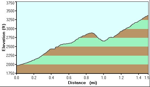
The trail we are interested in is the Hunter Trail. From the parking area, the trail quickly switchbacks up through the desert cacti to a saddle 900 ft above where you started. There are good views already, but the fun is just beginning.
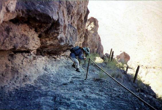
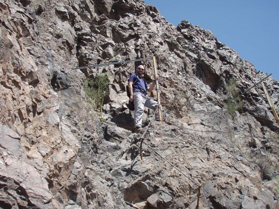
The trail descends steeply. Hikers are aided by cable hand holds for this stretch. Leather gloves may be helpful, but are not necessary. After the descent stops, the trail flattens out and meets up with the Sunset Vista Trail from the back side of the mountain. Continue on the Hunter Trail as it climbs steeply again. Cables are again provided for the hiker and this stretch of the trail turns out to be a great deal of fun. Views pop up everywhere.
Since there are a large number of people with different hiking abilities, remember your hiking etiquette. Yield to those people going uphill. Let faster hikers pass you. The cable routes can get a little snug, so try to time your ascent when there's no other hikers above you and vice versa.
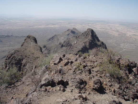
After this last climb you will reach another saddle. The trail to the right leads to the peak.
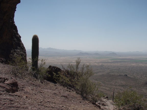
Once you reach the peak, take a look around and enjoy the view. Kitt peak, Santa Catalina, and Rincon mountains are all within view. If you are still restless, you might want to explore the other adjacent peak across the saddle at the top.
When you are finished snapping pictures and eating lunch, return the way you came.
