
- Hikes in Arizona
- Superstition and Mazatzal Wilderness
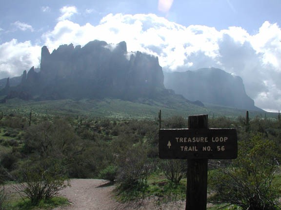
- Treasure Loop Trail
Treasure Loop Trail


Location
To get to the trailhead: From the Phoenix area, take US-60 East to the Idaho Road exit, turn left (North) on this exit. After Main Street, take HWY-88 which forks off to the right towards the lakes. After about 5 miles, turn into the Lost Dutchman State Park on the right side of the road. Park at the Saguaro Day use area (follow the signs in the park). The trailhead for the Treasure Loop trail starts here.
Hike details
Season
- January
- February
- March
- April
- October
- November
- December
Solitude
Difficulty
Permits
Hike the Treasure Loop trail in the Superstition wilderness of Arizona.
This is a nice introductory hike to the Superstition mountain wilderness area. The trail is well defined and every trail junction is well signed. The elevation gain is also gradual. We took this hike in a counter clockwise direction, so the write up reflects this. The Treasure Loop Trail #56 starts from the Saguaro day use area. The trail slowly gains elevation as it heads directly towards the Superstition Mountains. Typical desert plants of Saguaro, prickly pear, and Cholla are seen here. After a rain, the wildflowers quickly overrun this area and add color rarely seen by the desert.
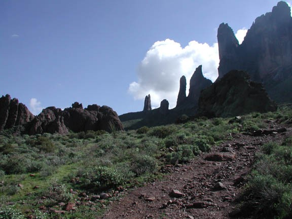
You will pass Jacob's Crosscut trail #58 (JCT 1ST on the map), continue on the Treasure Loop trail by going straight. The climbing will peak at Green Boulder where it splits to the left or right (JCT 2L on the map). Going right will take you to the Siphon Draw trail via the Prospectors View Trail. To stay on this loop hike, go left here. The hike runs parallel to the Superstition Mountains for a while, then starts to lose elevation. There is a wood bench and a sign at this point that marks the point at which you can take the secret spur trail to the Praying Hands.
The trail to the Praying Hands is less defined and more strenuous than the Treasure Loop trail. This trail does get you closer to the unique spire formations of the Praying Hands. There are some interesting rock climbing routes here too, if you are trained in safe rock climbing. This part of the trail is less crowded and presents an opportunity for some solitude and good views not seen from the main trail. If you do take this trail, a good spot to turn around is the saddle between the spires.
The real treat of this hike is the impressive up close views of the Superstition mountains and Apache Junction framed in the desert.
Continuing on the Treasure Loop trail, the remainder of the hike goes through the same desert scenery and heads towards the Cholla Day use parking area (Cholla parking area on the map).
From the Cholla parking area, it is a short walk to the Saguaro parking area to complete the loop.
