
- Hikes in Arizona
- Superstition and Mazatzal Wilderness
- Marion Spring
Marion Spring

Location
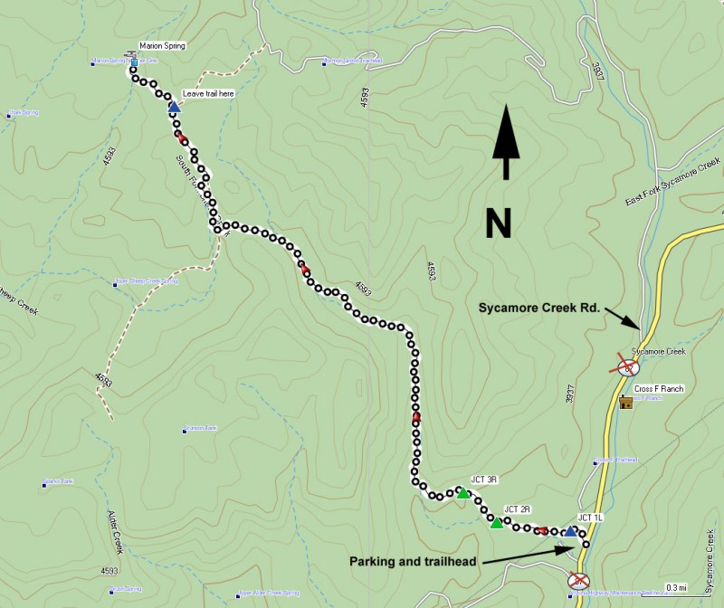
To get to the trailhead: From the Phoenix area, take HWY87 North, leaving the city limits. After passing the Sunflower turnoff, look for the Sycamore Creek Road turnoff (between mile markers 222 and 223). Turn let and take this paved road 2.8 miles where you will pass the Cross F ranch (private land, please be respectful). Another 0.6 miles will get you to the Arizona Trail signed parking area on the left side of the road. Cross the road from the parking area to get to the signed trailhead. One nice feature of this hike is that it is the only Mazatzal hike that is accessible from a paved road.
Hike details
Season
- January
- February
- March
- April
- October
- November
- December
Solitude
Difficulty
Permits
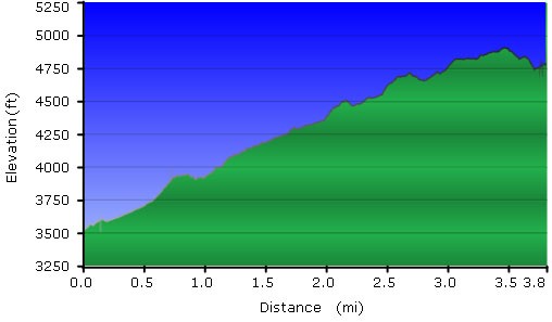
Hike to Marion spring in the Mazatzal wilderness of Arizona.
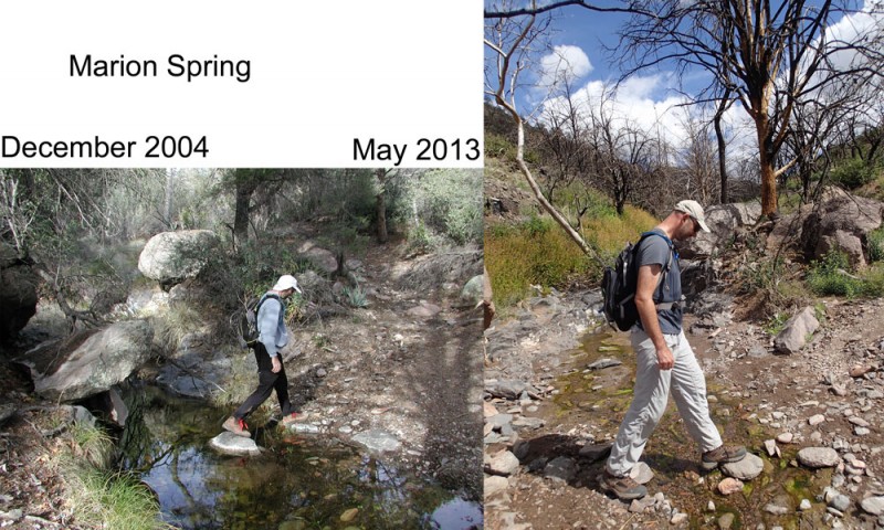
Things change... and not always for the better.
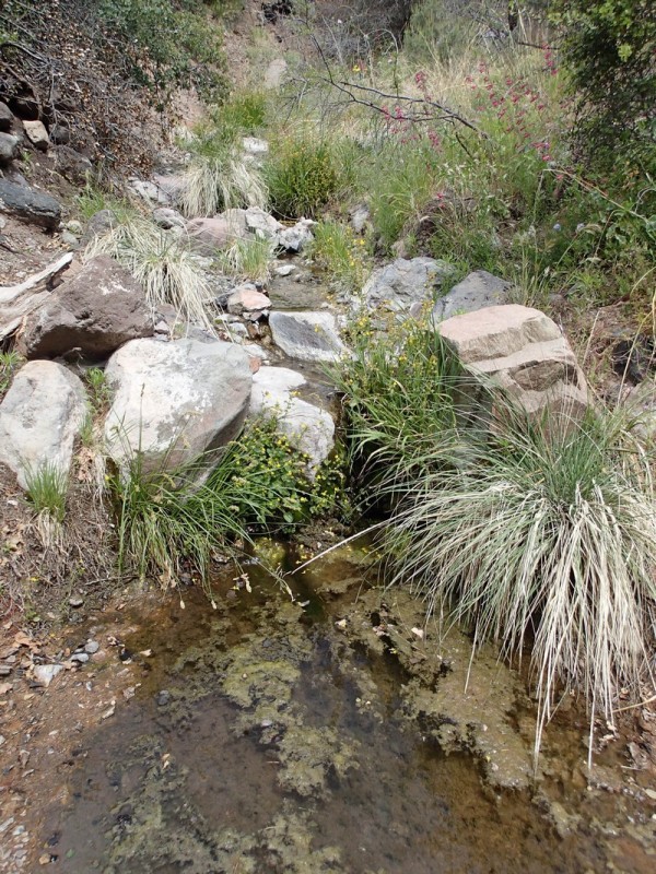
We took this hike originally back in 2004. The hike follows a creek for much of its length. Back in 2004, the creek was shaded with ash and sycamore trees, creating a lovely canopy of green.
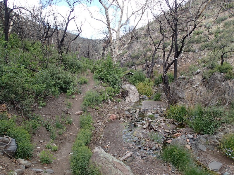
In 2012, the Sunflower fire decimated this area. We had no idea until recently (May 2013) just how badly this area was affected. The trees once covering this area are burned and dead. At least the creek was still flowing, but this hike is now but a shadow of what it once was. This area will take years to recover to it's former glory.
From the well signed trailhead, you will quickly reach a gate. After going through this gate, you will meet up with a crossing trail. Stay left here and remember this spot, as it would be easy to miss (JCT 1L on the map). Watch for cairns during this section and for the most likely trail as you follow these instructions. The trail heads west and a private house is visible across the creek to your left. You pass an old coral and the trail follows a barbed wire fence. Soon you will cross through a large opening in the barbed wire fence. Turn right here (marked by cairns) and follow the fence (JCT 2R on the map). The first time we did this hike, we missed this turn and found an alternate trailhead after about 15 minutes of hiking. We then had to double back and found our mistake.
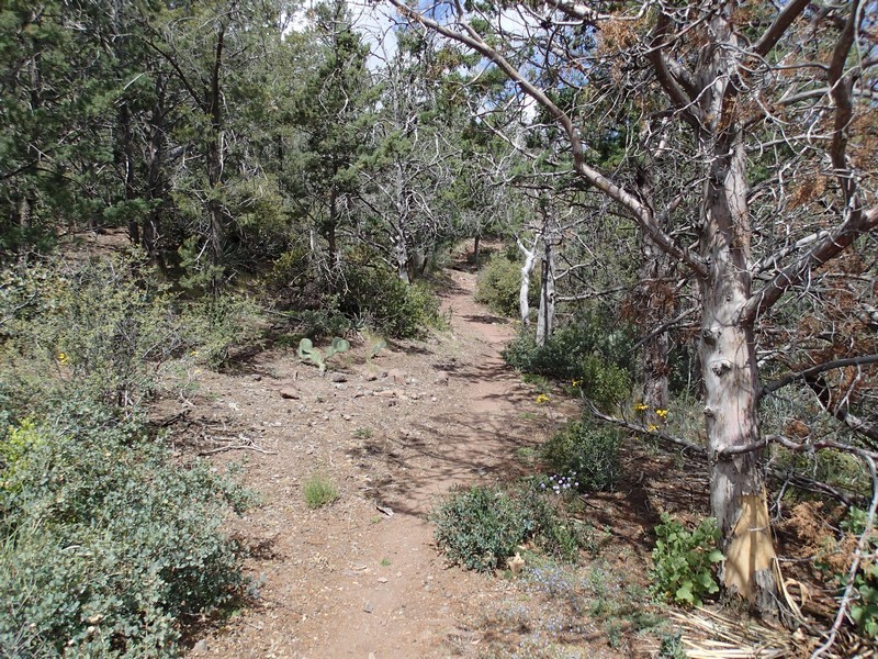
The trail heads North during this section. Soon, you will reach a trail junction that used to be signed, but is no longer. Perhaps the fire destroyed the sign. Now it is marked by rock cairns. Turn right here (JCT 3R on the map) to continue on the Little Saddle trail towards the Saddle Mountain trail. From this point, the trail well defined and climbs steadily. The Little Saddle trail follows up one of the tributaries of Sycamore Creek and is quite enjoyable. You can see the charred remains of the Ash and Sycamore trees that used to live in this canyon. When we hiked this in May, the creek was flowing peacefully.
After leaving the creek and hiking a total of 3.4 miles from the trail start, you will reach a saddle. To your left, you can see views of the wilderness area you've been hiking in. As you hike along this section, look at your map/GPS as you try to find the faint trail branching off to your left towards Marion spring (Leave Trail Here on map). This spur trail is not easy to find but once found is not difficult to follow. If you hit the Saddle Mountain trail junction, you've gone too far. From this point, it is another 0.25 miles to the wash that holds Marion Spring. There is some bushwhacking as you get close to the spring and depending on the time of year, you may need to bushwhack up the wash to see water and the spring.
When you've finished exploring, return the way you came.
