
- Hikes in Arizona
- Superstition and Mazatzal Wilderness
- Haunted Canyon (Tony Ranch)
Haunted Canyon (Tony Ranch)


Location
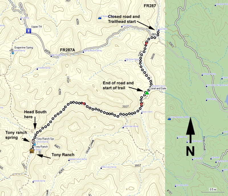
To get to the trailhead: from the Phoenix area, take US-60 East towards Globe. Just after Superior, take US60 another 12.7 miles to the well signed Pinto Valley Road (FR 287). You will be driving on roads that are constantly in use by the nearby mine, so please be careful and respectful so we can continue to enjoy access to this area of the Superstitions. Make a left turn here and follow the paved road. At the entrance to the mine, follow the PUBLIC ACCESS or HAUNTED CANYON signs to the Haunted Canyon Trailhead (#203). There are many spur roads here, but most end in a locked gate because they are used by the mine. At 2.8 miles from the US60 turnoff, turn left onto the well graded dirt road. After 6.8 miles of driving, the road becomes poorly maintained and you will need a high clearance vehicle to continue. At 6.9 miles, stay right at the fork. At 7.2 miles, you will need to make a left turn at the sign that reads 'Peak Well 26-29' to get to the lower trailhead. When we went, the road to the trailhead was closed due to high water in Pinto Creek. We parked at the sign and walked along the closed road. The trailhead is well marked and lies near a cattle pen. The trailhead is about 7.3 miles from HWY-60. Update (6-2-2011): A fellow hiker emailed me to let me know that the last mile of this road look to be permanently closed. To get to the trail, you'll need to follow the closed road to the signed trail near the cattle pen (thanks Chelsea!). Update (5-7-2013): The road was again closed, but the water level in Pinto creek was low. So this looks to be a permanent public road closure. It looks like mine vehicles still can access the road, but access would be very unpredictable. Plan on starting your hike here, as we did. There is limited parking on the right side of the road just before the locked gate blocking the road.
Hike details
Season
- January
- February
- March
- April
- October
- November
- December
Solitude
Difficulty
Permits
Hike to Tony Ranch via the Haunted Canyon trail in the Superstition Wilderness of Arizona.
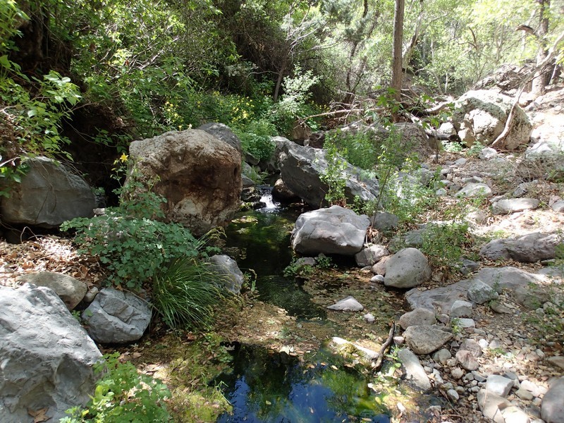
I'm continuously amazed at the amount of lush green trees in the Superstition mountain range where there is even seasonal water. There are plenty of Sycamore and Cottonwoods along this route. This is another fine hike to take during the fall while the leaves are changing. There may be grazing cattle here, some with sharp horns. Give the nice cows a wide birth.
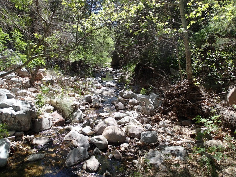
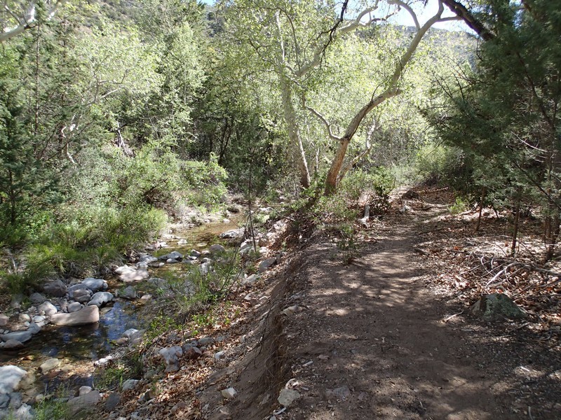
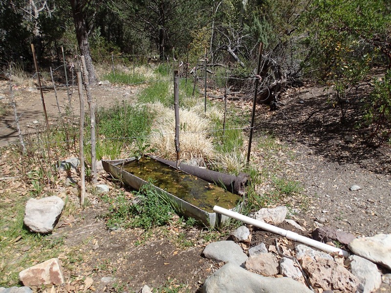
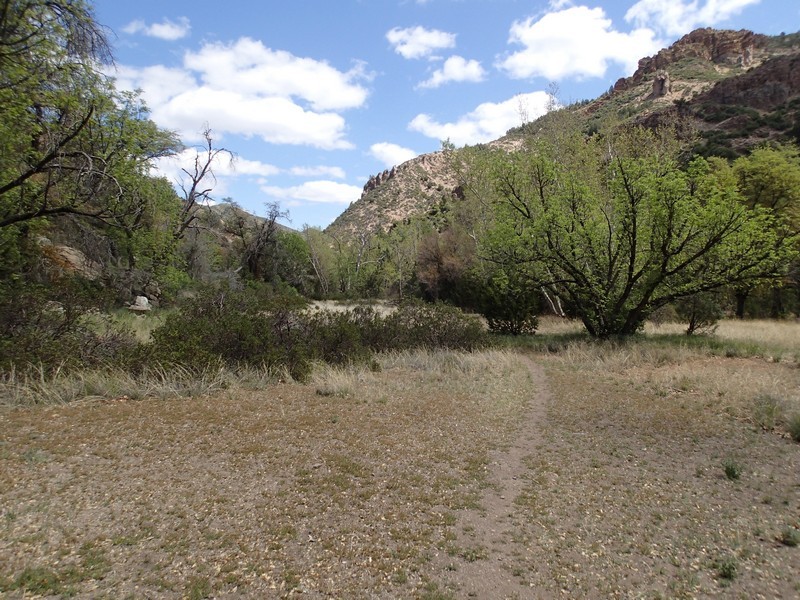
From the closed road, you'll walk the first 1.5 miles of this hike on a road closed to the general public. It is clear that the Mine still uses this road to access water pumps. The road is easy to follow and pleasant enough. After 1.5 miles, you'll reach a cattle pen and a signed trail marking. Head through the gate (closing it behind you) and start walking on a clearly defined trail. The trail follows the creek for nearly the entirety of this hike. Most of the time, the trail is right next to the creek. However, there is one section that heads up the slope of the creek (on the right) to avoid a particularly narrow section. This trail is well marked and worn, but a little overgrown. I'd recommend wearing hiking pants to stay comfortable and keep your legs from getting too scratched up. This area is strangely quiet and one can easily imagine why early settlers in this area believed there were ghosts in this canyon. The real treat of this trail is the solitude and the tall Sycamores throughout. The trail crosses the creek a few times, but keeping your feet dry should be no problem. The creek crossings are currently clearly marked with rock cairns.
After 5.6 miles of hiking, the creek forks. Trails are a bit confusing here and I didn't see a clearly definded trail junction to suggest that I head South (left fork), but I used my route finding and GPS to head the correct direction for Tony Ranch. If you were to take the right fork, the trail eventually reaches another trailhead access to FR287A (after some healthy climbing).
Staying left and heading South will bring you closer to Tony Ranch spring and Tony Ranch. There are several lovely campsites here if you are backpacking and it is easy to see why people settled here. There are also several trails in this area as a result of the numerous campsites, so use your route finding skills here.
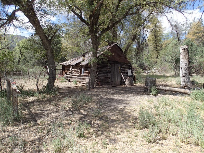
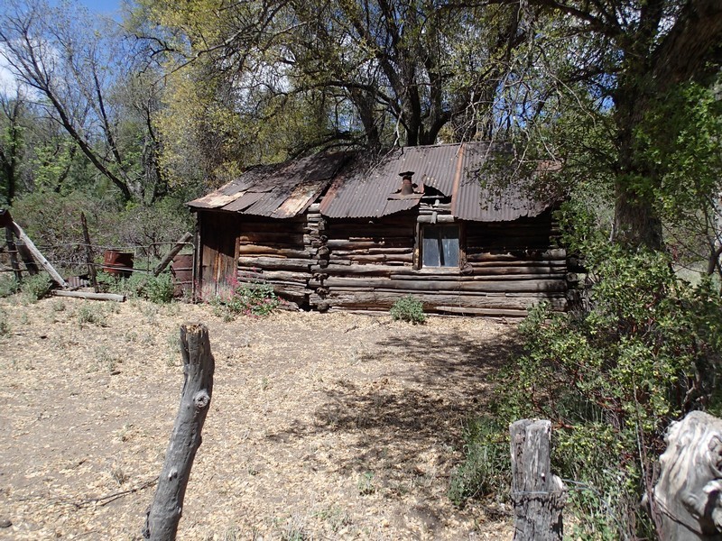
After 6.0 miles of hiking, you reach Tony Ranch Spring and a little further, the lone building marking Tony ranch. Nearby the ranch house is a corral and a large fire ring. Over the years, the ranch house had been maintained by hikers and equestrians. However, now the Superstition Area Land Trust (SALT) is responsible for the ranch house. By agreement with the US army corp of engineers, their current policy is that the Tony Ranch area is no longer open to visitors. I'm not sure exactly what this means, but I imagine it means not to enter the Ranch house, since it's old and unstable anyway. This is a good turn around point for this hike.
Return by the same route. Hopefully after finishing this hike, you'll agree with me that this area should be renamed "Hauntingly beautiful canyon".
