
- Hikes in Arizona
- Superstition and Mazatzal Wilderness
- Rogers Trough (Rogers Canyon Ruins)
Rogers Trough (Rogers Canyon Ruins)


Location
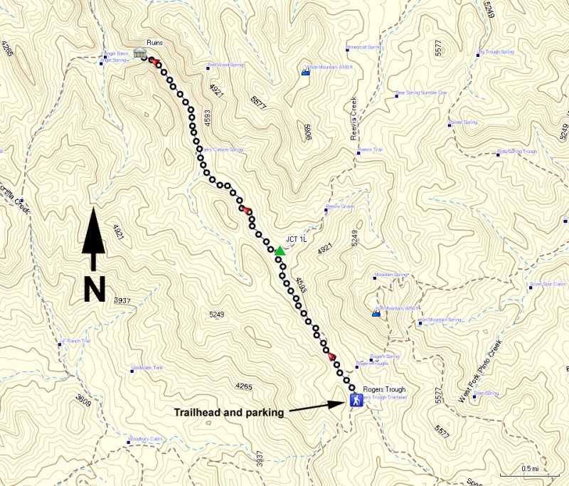
To get to the trailhead: from the Phoenix area, take US-60 East from Apache Junction about 16 miles to Florence Junction. Another 2 miles on US-60 gets you to Queen Valley Road. Follow Queen Valley road for 1.8 miles to FR357. Turn right on FR357 (signed as Hewitt Station Road) and go 3 miles. Make a left onto FR172 and drive 9.3 miles. Make a right onto FR172A and travel 3.9 miles to the trailhead. The last 3.9 miles would be safest with a high clearance vehicle with 4 wheel drive, although we have done it with a high clearance 2 wheel drive vehicle. Following the signs to the Arizona trail and Rogers Trough trailhead will help you stay on the right road.
Hike details
Season
- January
- February
- March
- April
- October
- November
- December
Solitude
Difficulty
Permits
Hike up the Rogers trough trail to the Rogers Canyon ruins in the Superstition Wilderness of Arizona.
Getting to this trailhead really is the toughest part. FR172A takes some off road skill and the vehicle to match. Once you pry your white knuckles from the dashboard, the trailhead is a welcome sight.
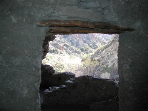
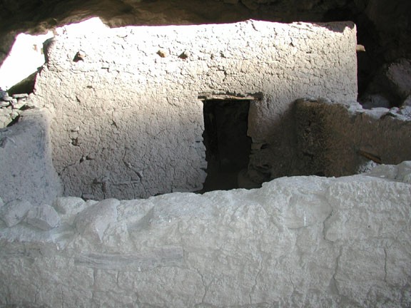
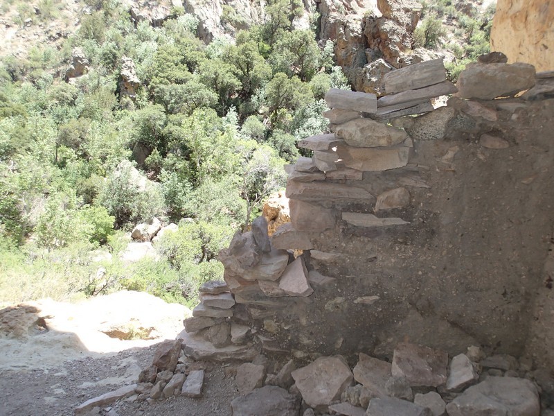
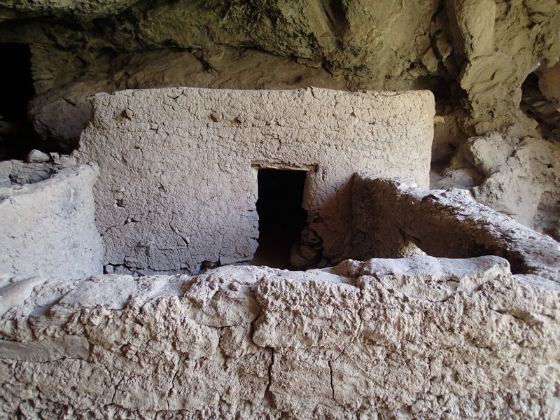
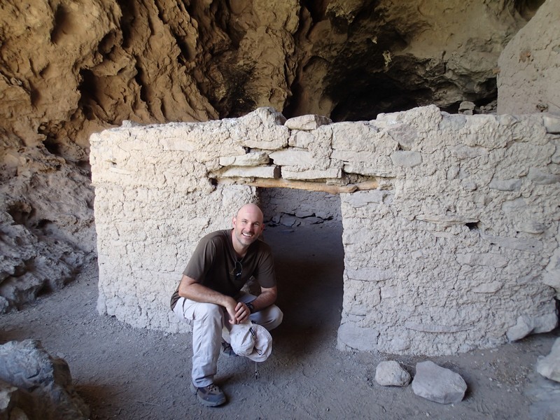
This hike descends steadily down a desert canyon, along a seasonal creek. Stay left at the first trail junction with the West Pinto trail a few hundred yards from the start. The trail itself is pretty easy to follow. We did this hike in the late fall, and the creek was flowing pretty well. After about 1.7 mile on Rogers Trough, the trail forks (JCT 1L on the map). To the right is the Reavis Ranch Trail, and to the left is Rogers Canyon Trail. Take the left fork and hike another 3.3 miles. When the trail starts to head west, look for the ruins in a cave on the North wall of the canyon. If you are not actively looking on the right side of the canyon, you could easily walk right by this ruin. You will have to do some scrambling to get to the cave, but the reward is worth it.
These ruins are remarkably well preserved, so PLEASE do your part in keeping them that way. Don't climb the walls, remove any objects, and treat the area with the respect it deserves.
When you're ready, return the way you came. You are going uphill now, so you'll be working a little harder. Don't worry, you won't be too anxious to repeat that 4 wheel drive back to home. At least you'll have the memories and the pictures.
