
- Hikes in Arizona
- Superstition and Mazatzal Wilderness
- Reavis Ranch (From Rogers trough trailhead)
Reavis Ranch (From Rogers trough trailhead)


Location
To get to the trailhead: from the Phoenix area, take US-60 East from Apache Junction about 16 miles to Florence Junction. Another 2 miles on US-60 gets you to Queen Valley Road. Follow Queen Valley road for 1.8 miles to FR357. Turn right on FR357 (signed as Hewitt Station Road) and go 3 miles. Make a left onto FR172 and drive 9.3 miles. Make a right onto FR172A and travel 3.9 miles to the trailhead. For the last 3.9 miles, a high clearance vehicle with 4 wheel drive would be best. However, we have done this road with a high clearance 2WD. Following the signs to the Arizona trail and Rogers Trough trailhead will help you stay on the right road.
Hike details
Season
- January
- February
- March
- April
- October
- November
- December
Solitude
Difficulty
Permits
Hike to Reavis Ranch via the Rogers Trough trail in the Superstition Wilderness, Arizona
There are several ways to get to Reavis ranch. This hike describes the route from the Rogers trough trailhead. For the route from the Reavis trailhead, click here.
Getting to this trailhead really is the toughest part. FR172A takes some off road skill and the vehicle to match. Once you pry your white knuckles from the dashboard, the trailhead is a welcome sight.
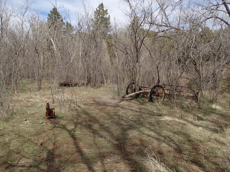
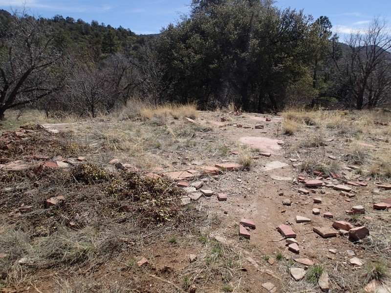
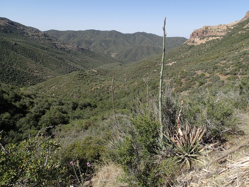
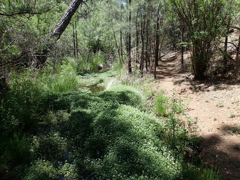
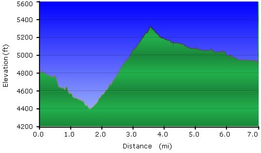
This hike starts by descending steadily down a desert canyon, along a seasonal creek. We have done this hike in the late fall (creek flowing well) and the late spring (creek mostly dry). Stay left at the first trail junction with the West Pinto trail a few hundred yards from the start. After about 1.7 miles on Rogers Trough, the trail forks (JCT 1R on the map). To the right is the Reavis Ranch Trail, and to the left is Rogers Canyon Trail. Take the right fork and start climbing, first gradually, then more aggressively. About 0.5 miles from the last trail junction there are a few cairns marking a spur trail on the left. If you follow this spur trail for 20 yards or so, you can see the final resting place of Elisha Reavis (Reavis Grave on Map). Soon after the grave, the hike begins it's earnest climbing. The hike travels through higher elevations in the Superstition wilderness, with the rewards being more wooded hiking than the typical desert terrain. Expect to see pine and cottonwoods as you near the site of the ranch. The former ranch site is wide open and flat, with the remains of old buildings and equipment here and there. Please leave any equipment or remains as you find them. This makes a nice spot for lunch. Take some time to explore around.
When you're ready, return the way you came.
