
- Hikes in Arizona
- Superstition and Mazatzal Wilderness
- Fish Creek (Lower)
Fish Creek (Lower)
Location
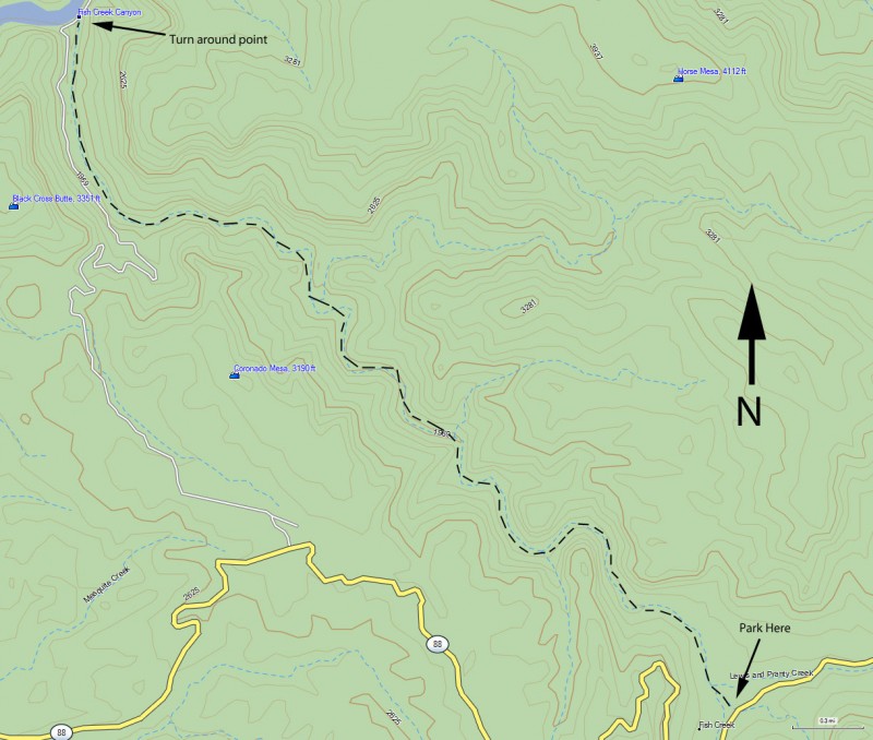
From the Phoenix area, take HWY 88 North East out of Apache Junction towards Apache Lake. Eventually, HWY 88 turns into dirt. This road is OK for cars if you drive slowly, but it is slow going in spots, with some definite elevation. After about 25 miles, you will cross over the fish creek bridge. Go another 0.7 miles and park in the pullout to the left.
Hike details
Season
- January
- February
- March
- April
- October
- November
- December
Solitude
Difficulty
Kid approved. Sorry Grandma, better you wait at home for us.
Permits
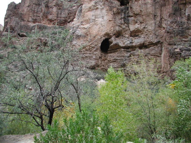
Hiking down Fish creek (lower) near Phoenix, Arizona.
First the good news about this hike. It's close to the Phoenix area, it's got great views, water, and shade. The best part is there is great solitude on this hike... rare for a hike so close to Phoenix.
The bad news is you need to do a fair bit of bushwhacking on this hike. Wear long pants and a long sleeved shirt. You'll be waking in a creek bed most of the time too, so bring sturdy footwear.
The hike starts from the parking area off of HWY88. Follow the dry creek downstream. There isn't a trail, but it would be difficult to get lost. This canyon has tall cliff walls, caves, trees, and even water in parts. Although it is tough to look around while bushwhacking, try your best in this canyon, as there is much to see and appreciate. After about 3.5 miles, you'll hit some narrows (keep left at the fork where the canyon splits). It's best to start thinking about turning around soon. Definitely turn around if you see power lines coming in to the canyon on your left. There is a road here, but it would be a long walk back to where you parked. When you've had enough, return the way you came.
This is also a rewarding hike if you are looking for fall leaves changing and don't want to take the 2 hour drive to Flagstaff. There is plenty of vegetation in this canyon.
