
- Hikes in Arizona
- Phoenix Area and Central Arizona
- Madera Peak
Madera Peak

Location
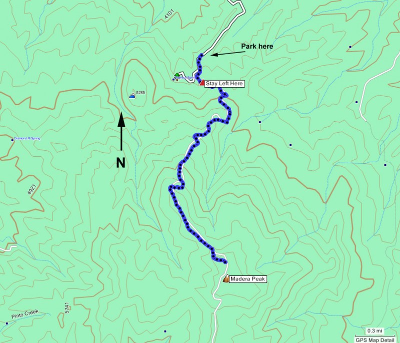
To get to the trailhead: from the Phoenix area, take US-60 East toward Globe/Miami. Once you reach the town outskirts of Miami, drive into town. Within the first mile you will see a stoplight for Adonis Street. Turn right onto Adonis Street. Keep going straight on Adonis Street past Prospect Avenue. Adonis Street will soon appear to dead end, but if you look over your left shoulder, you will see the road continue. Make a hairpin turn to the left and continue up. You will soon reach a five road intersection. You want to continue straight on the only road that is not signed (so don't take Sunset Street). You will know you are on the correct road if you continue on your upward direction. The road will turn to dirt after passing Maquey Street. The dirt road is in very good shape and passenger cars are no problem. Continue up the dirt road (FR906, also known as Cherry Flats Road). There are two main forks on this road before you reach the trailhead. Turn right at both forks. Again, you will know you took the correct fork if you continue going up. After 4.1 miles from US-60 you will reach another fork in the road with two signs. One sign reads "Warnica Springs Group Reservation Area". The other sign is located on the left fork and reads "primitive road-unsuited for public use". Park your car at the small pullout to the right of this fork. Start hiking up the left fork (the one with the "primitive road" sign). This road services the transmission towers at the top of Madera Peak, so it may or may not be closed. Hiking is OK, so if the gate is closed it is OK to go through the gate.
Hike details
Season
- January
- February
- March
- April
- September
- October
- November
- December
- July
- August
Solitude
Difficulty
Permits
Hike to Madera peak near Phoenix, Arizona.
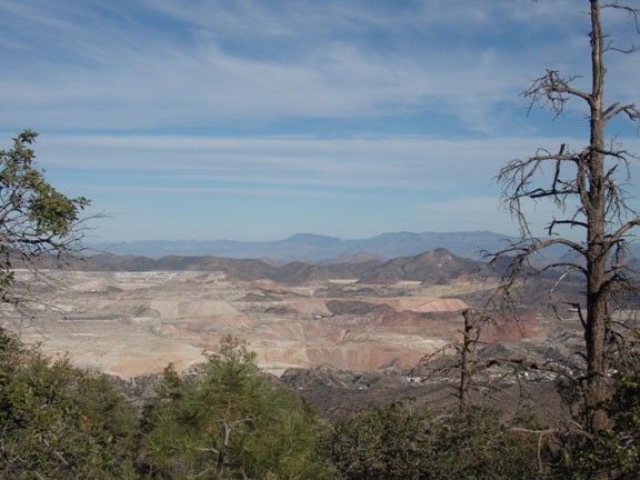
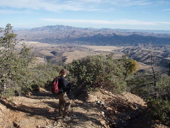
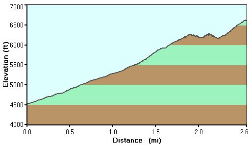
Sometimes, you're just in the mood for a steep climb. The climb to Madera peak (elevation 6647 ft) certainly fits such a mood and rewards you with good views of the towns of Miami and Globe as well as the surrounding area.
From the primitive road (FR580) start climbing. You'll reach a fork after the first 0.25 miles of hiking, stay left. From here on up, the route finding is easy. Just continue to follow the road up.
The vegetation starts out as chaparral, but as you climb higher, you move through manzanita and finally at the top is a pine forest. There is not much shade on this trail, so it is well suited for the cooler times of the year.
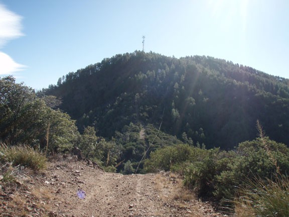
Be sure to enjoy the increasingly impressive views of the surrounding area as you climb. After a few false summits, you'll reach the top. There is a transmission tower on the way up that you may think is the top, but it isn't! Keep on the road past the tower and continue another 0.1 miles, turning left at the fork, to get to the actual top. The pine trees here serve to block the views a bit, but it is still a satisfying conclusion to your hard work.
After enjoying the views, catch your breath and head back down the same way.
